How common are tornadoes in SLO County? Here’s how many times twisters have hit the area
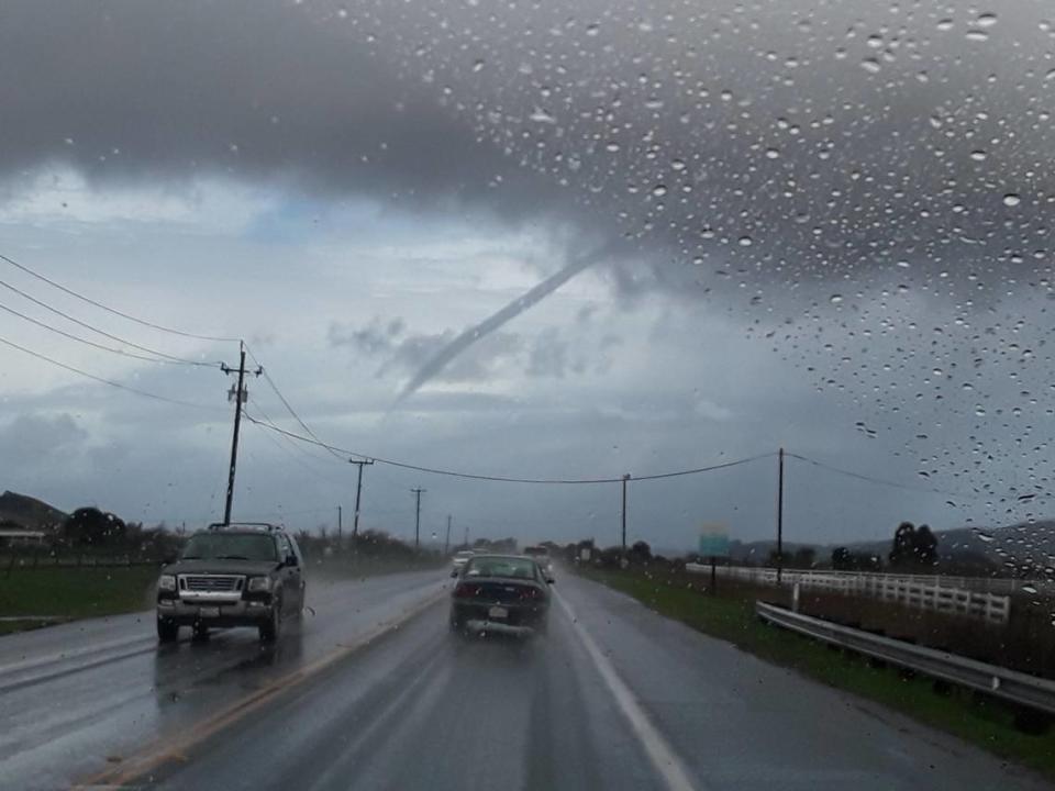
It’s official: Two rare tornadoes touched down in San Luis Obispo County this week.
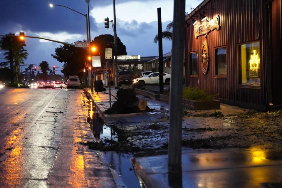
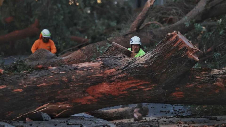
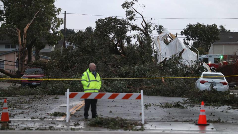
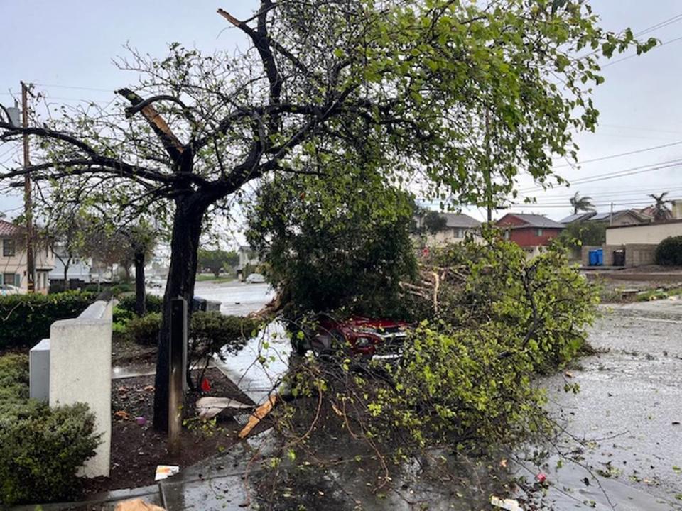
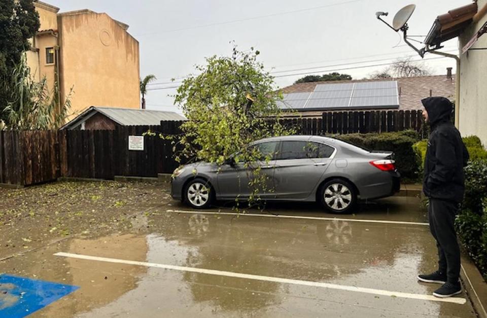
Powerful winds whipped through the area on Wednesday, toppling trees, downing power lines and damaging buildings. Thousands of PG&E customers lost power.
On Thursday, the National Weather Service conducted a damage survey in Grover Beach “to determine if the damage in this area was due to a tornado, or severe straight-line winds.”
The weather service determined that a tornado briefly touched down in the South County and “tracked through Grover Beach” before dissipating.
Another weak tornado hit just east of Los Osos, the weather service said, and cut a swath of destruction “in proximity to Los Osos Valley Road.”
How common are tornadoes in SLO County?
“They’re not common but they’re more common than people think,” local retired PG&E meteorologist John Lindsey said.
Here’s what to know about the weather phenomenon:
What is a tornado?
The National Weather Service defines a tornado as “a violently rotating column of air touching the ground, usually attached to the base of a thunderstorm.”
“Tornadoes can cause fatalities and devastate a neighborhood in seconds,” the agency said, with winds reaching 300 mph.
Tornadoes are possible anywhere in the United States and can occur at any time of day and on any day of the year, the National Weather Service said.
However, they’re most common in the central plains east of the Rocky Mountains and west of the Appalachians, and usually occur in the late afternoon and evening during the spring and summer, according to the weather service.
What causes tornadoes?
According to Lindsey, tornadoes are a form of funnel clouds — rotating columns of condensed water droplets.
When funnel clouds develop over the ocean, they’re called waterspouts, he explained in a 2018 Weather Watch column in The Tribune.
As soon as they hit the ground, however, they are classified as tornadoes.
So what causes funnel clouds?
“First of all, you need an unstable atmosphere with warm and/or humid air at the surface and cold air aloft,” Lindsey wrote. “As the air rises into the sky, it cools to the point that water vapor condenses to form visible clouds and releases tremendous amounts of latent heat.”
This keeps the air rising inside the cloud, producing updrafts that can trigger thunderstorms and cause wind shear. That means the air is traveling in a different direction and speed at dissimilar heights, Lindsey explained.
The result? A spinning cylinder of air familiar to anyone who’s seen “The Wizard of Oz.”
How are tornadoes rated?
Introduced by T. Theodore Fujita in 1971, the Fujita Scale is used to assess damage produced by tornadoes and then estimate associated wind speeds, according to the weather service.
Meteorologists and wind engineers eventually updated the original F-scale, and those changes were implemented in 2007.
The Enhanced Fujita Scale ranges from EF-0 — meaning a weak tornado with winds of up to 72 mph — to EF-5, a violent tornado with winds of up to 318 mph.
The “vast majority” of tornadoes have scale ratings ranging from EF-0 to EF-3, the Weather Service said.
Both of Wednesday’s tornadoes were rated EF-1 on the scale, which means they resulted in moderate damage with winds of up to 110 mph.
How often do tornadoes happen in California?
A total of 478 tornadoes have been recorded in California between January 1950 and October 2023, according to the Redding Record Searchlight’s analysis of National Oceanic and Atmospheric Administration data.
Those resulted in injuries to 92 people as well as about $134.7 million in property damage and about $1.5 million in crop damage, the Record Searchlight found.
Lindsey, the meteorologist, said most of the state’s tornadoes occur south of Point Conception or in the San Joaquin and Sacramento valleys.
Nearly all of the tornadoes reported in California have been rated low on the EF-scale, Lindsey said, but that doesn’t mean the twisters are harmless.
“Even a weak tornado can cause a fair amount of damage,” Lindsey said.
What about SLO County?
The Record Searchlight’s interactive map tracking the history of twisters in California shows just three small tornadoes in or near SLO County during that time period.
All three tornadoes had ratings of EF-0, according to the map.
Here’s when they happened:
May 5, 1998: A small tornado developed over the city of San Luis Obispo, damaging four homes and knocking out power to several hundred customers, the Record Searchlight wrote.
Nov. 29, 2001: A weak tornado struck in northeast Santa Maria, causing minor damage to three homes, according to the Record Searchlight.
Feb. 2, 2004: A waterspout that developed offshore of Oceano Dunes, came onshore as a weak tornado and hit a California State Parks ranger in his truck, the Record Searchlight reported. He wasn’t injured.
Wednesday’s tornado was the first recorded tornado in the county in 20 years, the San Luis Obispo County Office of Emergency Services said Thursday.
However, Lindsey said a band of thunderstorms may have produced a weak tornado at Camp San Luis Obispo on April 2, 2014.
Doppler weather radar at Vandenberg Air Force Base indicated severe weather over Cayucos moving southeast through the Chorro Valley toward San Luis Obispo, he said, and numerous Cayucos residents reported seeing hailstones measuring 1 inch in diameter.
Over decades of forecasting weather along the Central Coast, Lindsey said he’s noticed “a pattern of post-frontal thunderstorms” in the late winter and spring moving off the Pacific Ocean through the Los Osos and Chorro valleys toward San Luis Obispo that resulted in tornado-related activity.
That’s roughly the same area where Doppler radar indicated so-called “tornadic activity” on Wednesday afternoon, Lindsey said.
In a post on X, Lindsey said a “classic signature of tornadic activity” developed off the coast of Los Osos and Morro Bay around 3:30 p.m. Wednesday and another developed off the coast of Diablo Canyon Power Plant around 4 p.m.
Waterspout off Buckley Road in San Luis Obispo just now!!!
Video taken by Jorge Mariano—thank you for a GREAT capture!! ️ @NWS @weatherchannel @ReedTimmerAccu pic.twitter.com/rkzhYrCx2M— Trisha Butcher (@TrishaButcher1) February 6, 2024
Could tornadoes become more common on the Central Coast?
Lindsey said a shifting climate could mean that twisters become more common off the Central Coast.
“We’re seeing storms become more and more intense,” he said. “As the atmosphere warms, I’m afraid we’re see more occurrences of tornadic activity along our coastline.”

