Ophelia wreaks havoc, causes washout in mid-Atlantic and Northeast


Ophelia unleashed flooding and dangerous seas as it slammed into North Carolina on Saturday and then continued to trek north and northeastward through the mid-Atlantic over the weekend, losing wind intensity and becoming a tropical rainstorm over land. The system's heavy rain doused areas up and down the Eastern Seaboard, including along the I-95 corridor, and even caused a rainy and dreary weekend westward across the central Appalachians.
In New York City, travel advisories were issued on Sunday due to the "long-duration rainfall event," and people living in basement apartments in flood-prone areas were warned by officials to be prepared to move to higher ground.
Strong winds cut power to tens of thousands of customers across North Carolina, Virginia, Pennsylvania, and New Jersey at the height of the storm over the weekend. Wind gusts as high as 80 miles per hour were measured in Wrightsville Beach, North Carolina.
 |
Hazardous conditions developed along the coast even well ahead of the storm's landfall when Ophelia crashed onshore near Emerald Isle, North Carolina, around 6:15 a.m. EDT Saturday. It was a strong tropical storm with maximum sustained winds of 70 mph at landfall. Several people had to be rescued due to dangerous seas stirred by Ophelia even as it approached land.
As the storm inched north once inland, dangerous episodes of flash flooding developed. Greenville, North Carolina, located in the eastern part of the state, was enduring a "major flash flood event" on Saturday afternoon, according to storm chaser Aaron Rigsby, who added that several vehicles had been carried "a sizeable distance." Entire parking lots filled with cars were flooded, he reported.
Several residents were left stranded and had to be rescued from floodwaters in the area.
As of Monday morning, Tropical Rainstorm Ophelia was spinning off the coast of New Jersey with sustained winds of 15-20 mph. Although the center of circulation had become less defined, a solid shield of rain on the storms' northern flank continued to drench portions of the mid-Atlantic and southern New England, with New York City in the core of rainy and dreary weather.
The storm slowed its forward motion to a crawl over the weekend and into early week, prolonging the duration of soaking rain affecting millions across the mid-Atlantic and Northeast.
Dangerous seas led to problems as the Coast Guard had to rescue five people from a boat anchored near the North Carolina coast last Friday night, The Associated Press reported.
Rigbsy was on the scene after rough seas from Ophelia sank a boat with the owner inside in Newport News, Virginia, early Saturday morning. The man told Rigsby he woke up and was suddenly in the water, his boat appearing to have hit the dock so many times that it sank.
"Thankfully seas calmed for rescue crews to extract him," Rigsby said.
Storm surge flooding also inundated some communities last Friday evening well in advance of the storm's strike along the coast. Rigsby reported knee-high water in many homes along the waterfront in New Bern, North Carolina.
The power of Ophelia had already proved to be a formidable force in parts of the Outer Banks. Highway 12 at Mirlo Beach, North Carolina, located along the Outer Banks, was covered with sand and water by last Friday afternoon.
 |
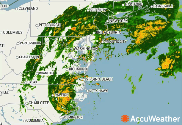
A look at Tropical Storm Ophelia on radar after landfall Saturday morning. |
"We're already seeing hazardous conditions," Drew Pearson told AccuWeather in an interview on Friday. Pearson is the Director of Emergency Management in Dare County, North Carolina, the part of the state that experienced some of the worst of Ophelia's impacts.
Farther to the north, AccuWeather National Reporter Bill Wadell filmed streets flooded by storm surge in Bethany Beach, Delaware, around dawn on Saturday.
Several streets are now flooded in Bethany Beach, #Delaware
Some of the barriers are being knocked over in the wind. #turnarounddontdrown #Ophelia #DEwx pic.twitter.com/VGD4hh8opW— Bill Wadell (@BillWadell) September 23, 2023
Rough surf was visible in Rehoboth Beach, Delaware, as Ophelia was bearing down farther south along the North Carolina coast, Wadell reported. Crews were out keeping an eye on dunes for any weak points, he added.
Ophelia's storm surge proved damaging in some communities. Rigsby captured footage of major damage in Washington, North Carolina, on Saturday afternoon, where storm surge and wind had left their mark. Trees could be seen downed on the ground and water remained on the road in a residential area.
Last Friday marked the final day of astronomical summer before the changing of the seasons, but instead of enjoying warm, sunny conditions, people from South Carolina to Delaware made last-minute provisions to brace for the rapidly developing storm.
States of emergency were declared in North Carolina, Virginia and Maryland in advance of Ophelia.
Ophelia also resulted in disruptions to travel and weekend events. The Nationals baseball team postponed a game scheduled for Saturday in Washington, D.C., until Sunday, and ferry services were suspended in North Carolina, the AP reported.
Some people braved the wind, crashing waves and rain to head out to the beach as conditions deteriorated on Friday.
"I just had to have one beach fix before I nestled in for the winter," one visitor told Wadell at a beach in Maryland.
Other visitors told Wadell about their impressions of Ophelia after the storm hit on Saturday.
"Mother nature is impressive," Melina Gillis, a Fenwick Island, Delaware, resident, said.
She noted concerns about more flooding from what she had already witnessed along the coast, pointing to the condition of sand dunes in parts of the region.
"It's definitely impressive seeing the force she has, and this isn't even a hurricane," Tom Gillis, a Fenwick Island, Delaware, resident, told Wadell.
Additional reporting by AccuWeather's Bill Wadell, and storm chaser Aaron Rigsby.
Want next-level safety, ad-free? Unlock advanced, hyperlocal severe weather alerts when you subscribe to Premium+ on the AccuWeather app. AccuWeather Alerts™ are prompted by our expert meteorologists who monitor and analyze dangerous weather risks 24/7 to keep you and your family safer.
