Connecticut will get more snow this weekend. When will it start and how long will it last?
Another winter storm is on the horizon, likely to bring frigid temperatures and snowfall across New England.
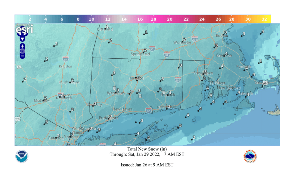
The National Weather Service currently predicts snowfall in Eastern Connecticut to begin Friday evening. Winds will start off calm before building into Friday night as snow begins in earnest. Two to 4 inches of snow are expected overnight, with temperatures reaching a low of 19 degrees.
Expect additional snowfall Saturday morning along with blustery winds and low temperatures. Light snowfall should continue throughout the day, petering off Saturday night.
Depending on how the storm shifts, parts of New London and Windham counties could see over a foot of snow. If the storm heads west, however, we're likely to receive a lighter snowfall.
More: Legacies of lost Norwich community centers highlight challenges facing city's youth
"There is increasing potential for a low pressure storm system to bring heavy snowfall and high winds to portions of the area Friday night into Saturday night," says the National Weather Service.
"Uncertainties remain with the track and intensity of the storm system and its resulting potential impacts."
All signals are pointing toward a major nor'easter near the coast on Saturday. A blizzard is possible somewhere in New England with strong winds and heavy snow totals. How much in CT specifically? Too soon to tell but it could be a big one. #nbcct pic.twitter.com/CxXMNTXWd3
— Ryan Hanrahan (@ryanhanrahan) January 24, 2022
People living on the coast should watch for possible flooding. Commuters should expect delays and parking bans across the state.
This article originally appeared on The Bulletin: What we know about the weekend blizzard predicted for Connecticut

