Could SLO County get snow this week during light rainstorms? Here’s the latest forecast
San Luis Obispo County appears to be on course to weather some rain once again as clouds bring darker skies and even snow to higher elevations this week.
According to a post on X by the National Weather Service, a weak storm system brought light rain to Southwest California starting Monday evening and early Tuesday. That’s expected to be followed by a stronger, colder storm starting Friday, the agency said.
Areas near foothills and mountains could receive 0.25 to 0.5 inches of light rain Tuesday, according to the NWS.
The region will likely see moderate to heavy rains starting Friday through Sunday, with gusty southwestern winds and “significant snow” at resort elevations.
Within San Luis Obispo County, conditions are likely to stay clear through the middle of the week, with temperatures falling through the weekend and rain starting Friday.
A weak storm system will bring mainly light rain to the area tonight into early Tue with very light snow at higher elevations. A stronger, cold storm on the way Fri-Sun with mod-heavy rain and significant snow at higher elevations. #CAwx pic.twitter.com/2MGRNtnhd3
— NWS Los Angeles (@NWSLosAngeles) February 27, 2024
SLO County to receive fog, rain this weekend
San Luis Obispo will likely see temperatures peak Tuesday and Wednesday with highs of 67 and 68 degrees, respectively, before temperatures cool to around 61 degrees Thursday and Friday, according to the NWS forecast.
That lines up with the patchy fog predicted to arrive Wednesday evening, which will persist until Thursday afternoon, when skies will clear somewhat.
However, Thursday evening will bring a 30% chance of rain, which is expected to continue through Saturday evening. On Saturday, temperatures are expected to drop to their lowest point this week, with a high of only 56 degrees.
Sunday will see skies clear and temperatures rise to 58 degrees.
On opposite ends of the county, Pismo Beach and Paso Robles are expected to experience similar conditions, albeit with temperatures around two to five degrees lower than San Luis Obispo, according to the NWS.
On Saturday, the high for Paso Robles is expected to be about 52 degrees and the high for Pismo Beach is 55 degrees, according to the NWS’s graphical forecast.
Where in California will snow during weekend storm?
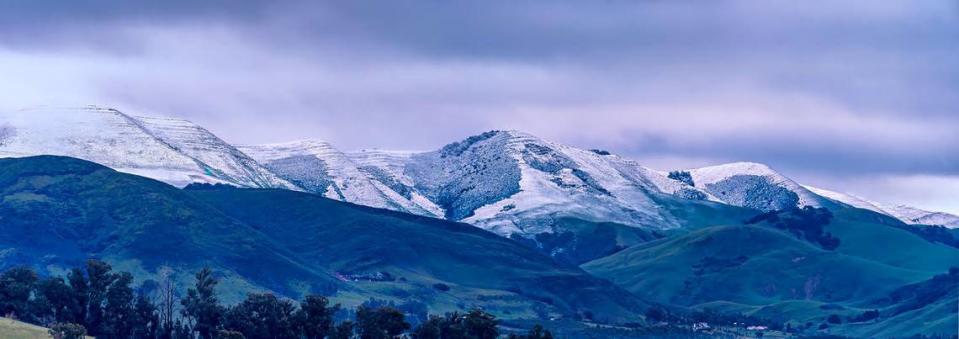
In his weekly forecast, San Luis Obispo County meteorologist John Lindsey said freezing levels during the weekend storm could drop as low as 3,000 feet.
This would mean many Central Coast mountain peaks could get a layer of snow, he said.
The are will likely see only a dusting of snow compared to Northern California, according to the NWS.
The storm will initially hit Northern California on Thursday morning with moderate rain and snow north of Interstate 80, according to a timeline shared by the weather service’s Sacramento office.
Moderate to heavy rain and mountain snow will follow that afternoon, along with wind gusts of 30 to 50 mph in the Sacramento region and 60 mph over the Sierra Nevada.
Snow levels will be at 4,500 to 5,000 feet, the weather service said.
Friday will bring more strong wind gusts as well as moderate to heavy rain and heavy to very heavy snow, the agency said, with snow levels dropping to 2,000 to 4,000 feet.
That’s followed by moderate to heavy snow and gusty winds on Saturday, with snow levels at 1,500 to 3,000 feet.
On Sunday, the weather service said, the storm will start to let up.
The agency is predicting moderate rain and snow on Sunday morning with lingering mountain snow showers in the afternoon. Snow levels will hover around 1,000 to 1,500 feet, and frost is possible.
Monday will dawn dry and cold with possible frost.
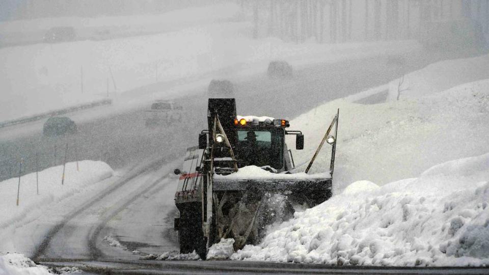
Winter storm watch issued for Lake Tahoe area
On Monday afternoon, the National Weather Service issued a blizzard warning for the greater Lake Tahoe area, including the cities of Stateline, South Lake Tahoe, Glenbrook, Markleeville, Truckee, Incline Village and Tahoe City.
The warning will be in effect late Wednesday night through Sunday morning.
During that time period, the weather service is predicting snow accumulations of 2 to 4 feet for Lake Tahoe communities, with 4 to 8 feet of snowfall at spots above 7,000 feet.
Winds will gust up to 60 mph in lower elevations and more than 100 mph over Sierra mountain ridges, the weather service said.
“Travel could be impossible due to blizzard conditions,” the agency said. “Very strong winds could cause extensive damage to trees and power lines.”
How much snow could fall in Sierra Nevada?
In a post on X, the UC Berkeley Central Sierra Snow Lab said it’s expecting 6 to 9 feet of snow to fall in the area, most of it on Friday into Saturday morning.
The field research station is at Donner Pass in the Sierra Nevada.
Five to 12 feet of snow are expected at elevations above 5,000 feet, the weather service said via X.
What do you want to know about life in Sacramento? Ask our service journalism team your top-of-mind questions in the module below or email servicejournalists@sacbee.com.

