New crime map shows where police respond to calls in Des Moines metro
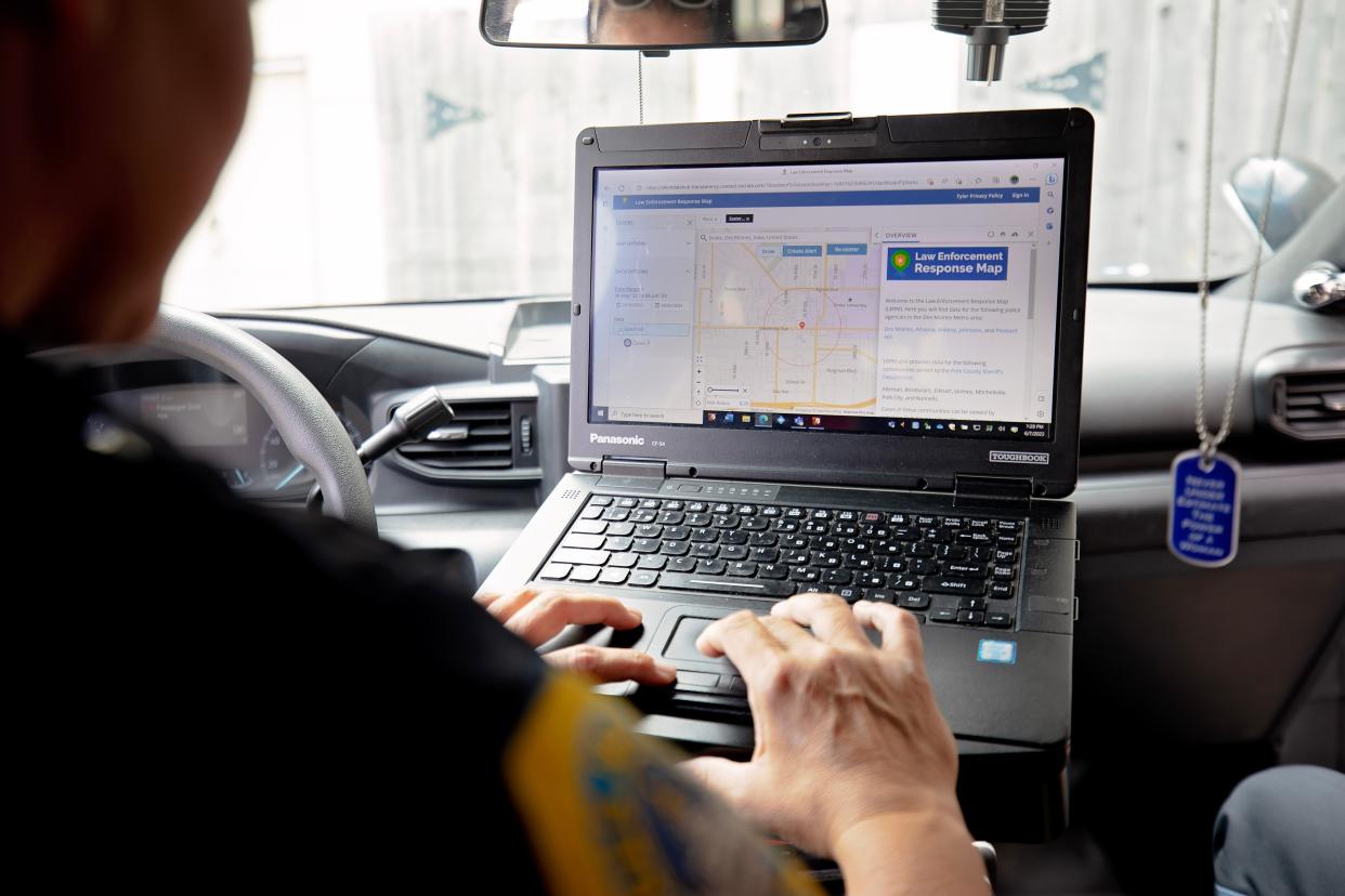
The Des Moines Police Department is rolling out an interactive incident response map this week — a new transparency tool that will show where and when local police respond to calls.
Police Chief Dana Wingert said the Law Enforcement Response Map will provide the public credible and timely information about the calls police departments across the metro area are dispatched to. Des Moines police alone respond to about 300,000 service calls per year.
Built from scratch by the department's crime analysts and information technology specialists, the map replaces Des Moines’ CrimeView system, which shut down last year when its support platform was discontinued. It's also part of a larger records management and analysis suite that was added in April 2022 to help the department spot trends, conduct follow-up investigations and deploy the needed resources, Wingert said.
More: Des Moines is a top 20 place to live. Why is it slipping in the ranks?
"We set this as a priority because we attend all the neighborhood association meetings, as do our elected officials, and you can't just walk in there empty-handed," he said.
Wingert said the new mapping system goes "way above and beyond" the data previously available, and will keep community members in the know about what's happening in their neighborhoods.
"This will allow the citizens to do some of their own crime analysis if you will," he said. "People love information and they love having it at their fingertips. This is something you can get from your laptop at home or you can get it from your cellphone."
What does the crime map show?
The data represented on the map is funneled from computer-aided dispatch, a system dispatchers and 911 operators use to prioritize and record service calls.
Community members and visitors will be able to filter law enforcement response information by agency, neighborhood, incident type, and date, according to the city. In addition to crime mapping, it also will provide a record of non-criminal crisis responses.
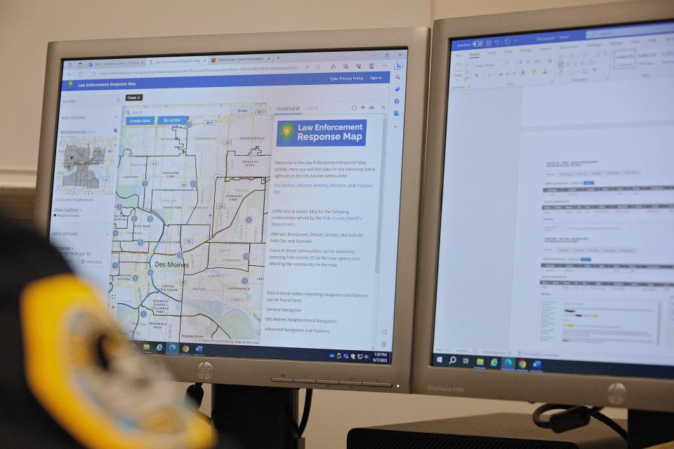
The map, with information beginning in April 2022, covers areas served by several metro police departments, as well as the Polk County Sheriff's Office. The information on the map is updated every 15 to 20 minutes. Incidents shown range from robbery to aggravated assault.
Map users will be able to click on a data point on the map to see the case number, the time and date the incident was reported and a brief description of the crime.
More: Man convicted in Des Moines drag racing crash that killed 4-year-old boy on Fleur Drive
"It can certainly give you everything you want about your neighborhood or a specific area or our city to do the things you want to do in the community," Wingert said. "If you're thinking about moving, if you're thinking about opening a business, thinking about changing schools, you can look at all that information in that neighborhood."
Users also can create an account to save custom searches and get alerts when incidents pop up.
What does the crime map leave out?
The map does not include information such as traffic tickets or crashes.
And while residents can type in an address to look up calls, the data does not show the exact location. Instead, the data points are plotted within a six-block radius of where incidents took place.
Wingert said there's also information on the back end that the police department will not share with the public, including the identities of crime victims who could be in danger and specifics about ongoing investigations and sensitive crimes such as those related to child abuse, drugs ands sexual assault.
"That kind of information first and foremost, regardless of what information we have on this program that we share with the public, our number one goal is to keep the public safe," he said.
Sharon Zanders-Ackiss, racial justice and equity director for Iowa Citizens for Community Improvement, told the Des Moines Register the data on crime is "beneficial." She said it's something she has been working on with neighborhood leaders since the 1990s and is glad the police department is catching up.
Still, Zanders-Ackiss said she thinks the lack of traffic data is a serious deficit. Data on when and where traffic stops are taking place, as well as who is stopping drivers, is important to determine how prevalent racial profiling is in the city, she said.
Iowa CCI consistently has called for more accountability and transparency within the police department.
Which Des Moines metro communities are participating?
Beyond Des Moines police, the map will include data from metro agencies that have shared record management systems, including the:
Altoona Police Department.
Ankeny Police Department.
Johnston Police Department.
Pleasant Hill Police Department.
Polk County Sheriff’s Office.
It also shows some communities served by the sheriff's office, including:
Alleman.
Bondurant.
Elkhart.
Grimes.
Mitchellville.
Polk City.
Runnells.
The map does not include data for metro agencies that are served by Westcom Emergency Communications, such as West Des Moines, Norwalk and Waukee.
When does the crime map launch?
Des Moines will be the first agency to publicly launch the map on June 15. The map will be available at dsm.city/LERM.
Virginia Barreda is the Des Moines city government reporter for the Register. She can be reached at vbarreda@dmreg.com. Follow her on Twitter at@vbarreda2.
This article originally appeared on Des Moines Register: New Des Moines metro crime map shows locations of police calls

