Will Dallas-Fort Worth area see more frost this week? Here’s what’s coming for North Texas
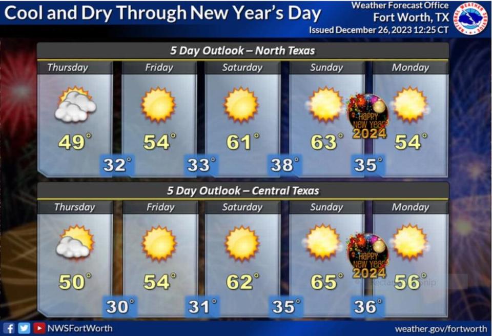
Expect colder conditions across North and Central Texas as the sun sets tonight and into Wednesday with another cold front rolling in, according to the National Weather Service forecast.
“A reinforcing shot of cool air will arrive this evening with tonight`s temperatures ranging from the lower to mid 30s,” wrote Fort Worth meteorologist Juan Hernandez on the NWS website.
It will feel even colder all day Wednesday as 10 to 25 mph winds bring down wind chill values into the 30s and 40s all day, the NWS report states. Actual daytime highs will be in the low 50s.
⚡ More trending stories:
→5 things to know about 'The Iron Claw' movie.
→What to know about Fort Worth garbage collection during the holidays.
→ Watch video of a Buc-cee's recreated entirely in gingerbread.
“Even with full sunshine overhead, there will still be a bit of chill in the air, therefore, make sure to bundle up,” Hernandez said.
Many across the Dallas-Fort Worth region felt the bite of cold air this morning with temperatures in the 20s and 30s, with frost seen across many parts of North Texas. The 10 to 20 mph southerly winds made it feel colder than what the thermometers showed.
It will be dry the rest of the week and into the weekend with a warming trend that will being daytime highs in the 50s to low 60s by New Year’s Eve.