Damage from violent clashes in Sudan visible from space (satellite photos)
Satellite imagery has provided insight into the damage caused by fighting between rival military factions in Sudan.
Battles broke out across the African nation on Saturday (April 15), as a power struggle between the army and paramilitary Rapid Support Forces (RSF) spilled over into violence.
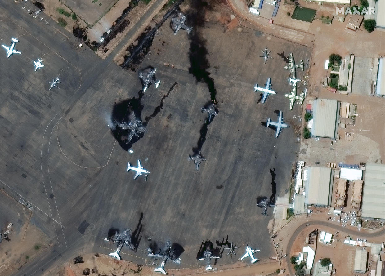
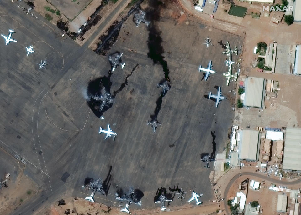
Images from satellites operated by Maxar Technologies published on Monday (April 17) and Tuesday (April 18) show damaged and destroyed planes at Khartoum International Airport and at Merowe Airbase around 200 miles (330 kilometers) north of the capital.
New #satellite imagery (April 18, 2023) reveals more evidence of the ongoing fighting between rival military factions in #Sudan. At #Merowe Airbase (~330 km north of #Khartoum) you can see damaged and destroyed fighter aircraft and one of the airbase buildings on fire. pic.twitter.com/T9MdaQmTRkApril 18, 2023
A mapping of hostilities published by the New York Times indicates that fighting has broken out at several locations across the country, from Port Sudan on the coast of the Red Sea to the western desert region of Darfur.
Attempts at a 24-hour cease-fire reportedly failed as fighting continued into Wednesday.
Follow us @Spacedotcom, or on Facebook and Instagram.

