Dangerous heatwave blankets the Mississippi Coast this week. How hot will it get?
It’s the very beginning of summer and the Gulfport-Biloxi metro is already bracing for temperatures in the triple digits this week.
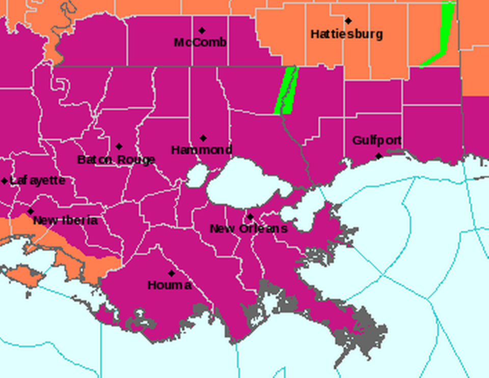
The National Weather Service in New Orleans has issued an excessive heat warning for Hancock, Harrison and Jackson counties on the Mississippi Coast. The warning goes into effect at 10 a.m. Tuesday, June 27, and lasts until 8 p.m.
Cities including Gulfport, Biloxi, Bay St. Louis, Pascagoula, Ocean Springs, Slidell and New Orleans are included in the advisory.
It feels like 106 degrees Monday afternoon at Keesler Air Force Base, and the heat index across the Coast is expected to reach 110 or slightly higher on Tuesday as “extreme heat and humidity” blanket South Mississippi.
The hot weather isn’t going anywhere soon — the heatwave will remain stagnant over much of the South and central regions of the U.S. and it will be “oppressively” hot, the NWS said in a recent forecast.
High temperatures later in the week are expected to top 100 degrees in some areas on the Coast, including Vancleave.
The NWS says the hot weather is dangerous and could lead to heat strokes, particularly for those working outside or performing outdoor activities.
Protect yourself from the heat by staying indoors as much as possible, drinking plenty of water and avoiding direct sunlight at peak hours. Keep pets and children indoors and don’t leave them inside cars.