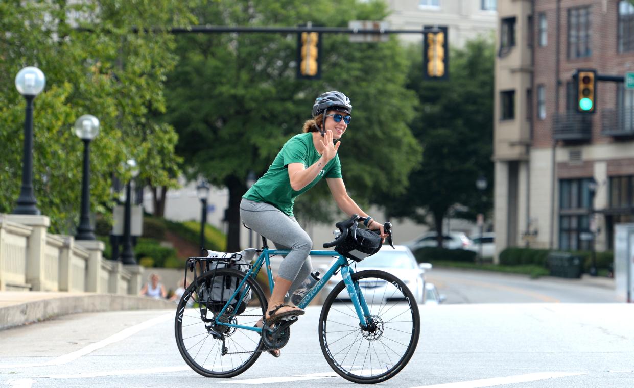
Data gathering app could make roads safer for Greenville area cyclists
Only about 20 percent of bicycle accidents are initially reported to law enforcement across the country and South Carolina ranks as one of the most dangerous states for cyclists.
Facing these facts, Bike Walk Greenville is encouraging cyclists and others in the city to use an application developed by a data scientist at the University of California-Santa Barbara to help expand the data to improve safety and guide infrastructure improvements in the Upstate.
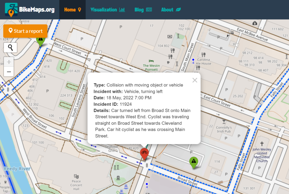
BikeMaps, created by UCSB data scientist Trisalyn Nelson, is a community engagement tool that allows bicyclists to map out and identify data on bicycle collisions, hazards and other safety amenities anonymously. BikeMaps can be accessed at BikeMaps.org on computer and phone.
The site shows real-time data on bike collisions and near-misses from cities around the United States and the world.
South Carolina ranked No. 5 as the most dangerous state for bicyclists, according to a study by Dolman Law, a personal injury firm. The state roughly had 3.5 cycling-related deaths per 100,000 deaths. That includes 178 total bicyclist fatalities between 2010 and 2019, according to the study. Throughout the 10-year study, the number of bicyclist deaths increased each year.
"When city planners are sitting down and thinking where should we start, where are our priorities areas, it's not as clear because they don't have all the local expertise," Nelson said. "BikeMaps curates and collects all local expertise on what is safe and unsafe for bicyclists in cities."
"Even if planning departments captured all the crash data, they would still be missing a lot of what is happening to cyclists on the roads," Nelson said.
BikeMaps will work with Bike Walk Greenville to create hot spot maps that will show the worst places for biking in the city.
City Council member Wil Brasington said the city is always in dialogue with community groups like BikeWalk Greenville that advocate for pedestrian and bicycle safety.
"The City of Greenville definitively benefits from the instances where these groups share local and global data," Brasington said.
Nelson said BikeMaps can help the city figure out the dangerous places and decide what investments are required to improve infrastructure.
Carl Anderson, a board member of BikeWalk Greenville, said BikeMaps will help them in the long run to document events they can take to planners and let them know where exactly the problems are.
BikeMaps can show collisions, near misses, hazards, bike thefts and new infrastructure.
Nelson said it is particularly difficult to notify law enforcement of close calls. BikeMaps gives cyclists a chance to record and share that information.
Bike Walk Greenville executive Director Frank Mansbach said community engagement can drive change and predict and prevent crashes.
Although too soon to pick out trends in the data, Anderson said he has noticed a lot of the incidents reported were near areas with a heavy traffic flow. But it's too early to correlate the heavy traffic with a safety concern.
Like a lot of cyclists, Timothy Simpson has had a few close calls with drivers who weren't paying attention. He recorded one of those incidents on BikeMaps.
"I had an incident in March where I had a driver intentionally try to run me over. I was biking home and I see lights behind me and I'm very visible wearing biking clothing. The car comes over the train tracks and spots me and blazes his horn then runs me off the road," Simpson said.
He said he reported it to the police but nothing was done about it.
"I don't take that route anymore," he said.
Anderson said there have been reports on Swamp Rabbit Trail, but there is a tremendous amount of traffic on the trails.
Related: The most dangerous intersections on the Swamp Rabbit Trail: What to do, what's being done
There have been two cycling deaths at Swamp Rabbit Trail crossings since it opened in 2009.
Carli Brewer Soukup died on the trail in June 2021 when she was riding her bicycle across Sulphur Springs Road and was struck by a vehicle.
More: Highway Patrol: Bicyclist killed in crash with vehicle near Swamp Rabbit Trail victim of hit and run
In June of 2019, Ellis Bailey was riding his bicycle when he was struck by a vehicle as he crossed the intersection of Watkins Bridge Road near Furman University.
"Hopefully this can be used by not only other Greenville bicyclists groups but the general public," Anderson said.
Simpson said Greenville needs to have more multi-modal infrastructure like sidewalks, bike lanes and multi-use pathways like on the Swamp Rabbit Trail.
"These options make it easier for people who aren't in cars to get around," Simpson said.
Tamia Boyd is a Michigan native who covers breaking news in Greenville. Email her at tboyd@gannett.com, and follow her on Twitter @tamiamb.
This article originally appeared on Greenville News: BikeMaps app could reduce cycling accidents, deaths in Greenville

