Defiant winter doubles down as frigid air looms over the Prairies
Relatively mild conditions blanketing the Prairies will give way in a hurry next week as a blast of Arctic air delivers a brutal reminder that it’s still the middle of winter.
For many, this will be the coldest air we’ve seen since the extreme cold that gripped the region back in December.
Communities across the Prairies will see high temperatures struggling to break out of the -20s by the middle of next week, which is a significant turnaround from the above-seasonal conditions we’ve seen in recent weeks.
MUST SEE: Wild ride to the winter finish line in Canada, find out your fate
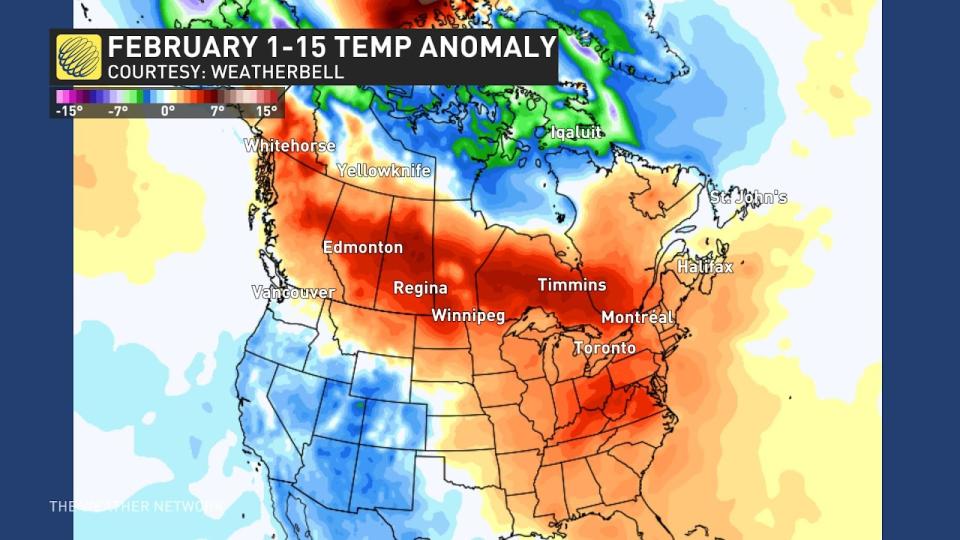
A series of upper-level ridges parked over the middle of North America have led to pretty mild conditions over the Prairies for more than a month now.
Temperatures have come in significantly above normal for just about everyone on the Prairies so far this month.
A typical February in Edmonton would see about 20 mornings with a low temperature below -10°C. Edmonton has only seen 8 such mornings so far this month.
It’s a similar story in Calgary, where we’ve only seen 4 mornings with low temperatures dipping below -10°C, down from February’s usual count of 14.
That trend won’t last much longer.
A trough swinging south across the middle of the country will allow frigid Arctic air to flood south over the Prairies by next week. The coldest air will spill across the region on Tuesday and stick around for several days before letting up a bit.
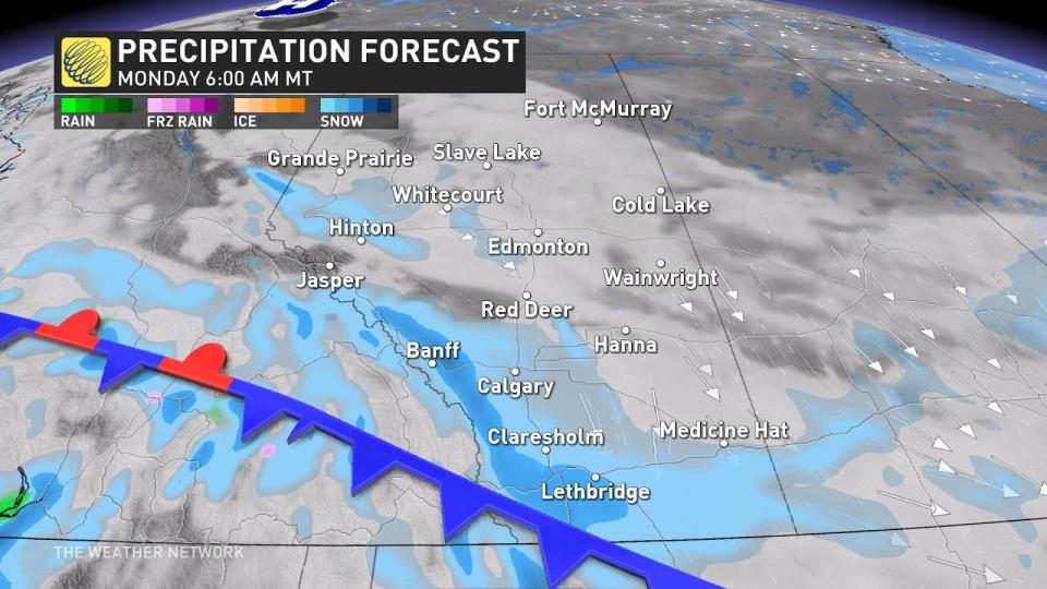
Heavy snow will develop along the southern Alberta foothills on Monday morning as the cold front passes through, potentially hampering travel throughout the region as this push of Arctic air forces its way into the region.
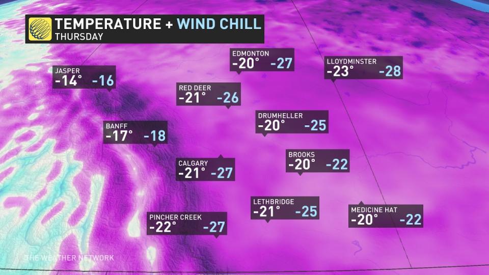
The deep chill pushing into Alberta will keep temperatures in Calgary and Edmonton firmly lodged in the double digits beginning Monday night and lasting through Saturday morning.
DON’T MISS: Jet streams can bring Canada wild winters and steamy summers
Regina and Saskatoon will see the coldest air arriving on Monday night and Tuesday. Each city will deal with several days of high temperatures in the -20s, with Saskatoon only predicted to hit -25°C on Wednesday.
Winnipeg will face Wednesday and Thursday with daytime highs only climbing to about -22°C, with overnight lows predicted to reach -28°C multiple times through the week.
While these certainly aren’t the coldest temperatures we’ve seen, it’s going to feel especially raw given that it’s been so mild on the Prairies in recent weeks.
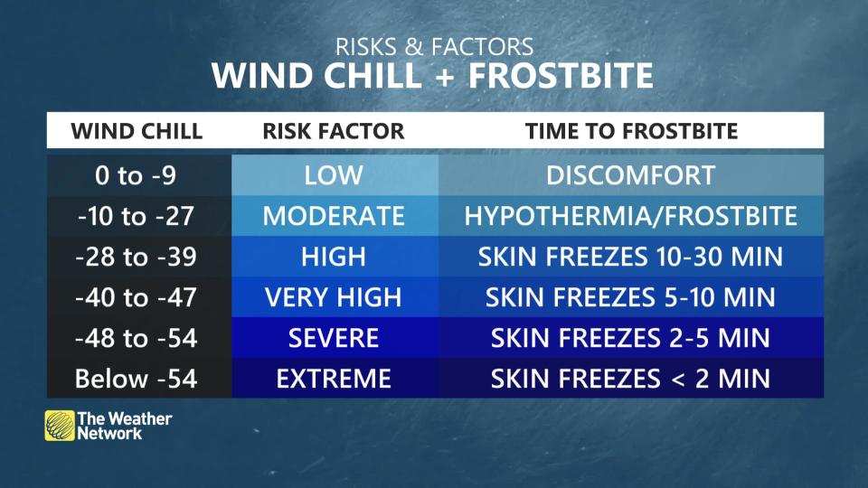
Winds certainly won’t help matters, either. Wind chill values will dip into the -30s and approach -40 for the duration of the coldest air next week, which will increase the risk for frostbite and hypothermia. Exposed skin can develop frostbite in as little as 10 minutes with wind chill values approaching -40.
This spell of cold air isn’t scurrying off anytime soon. Below-seasonal temperatures will stick around for much of the Prairies through the end of the month.
Thumbnail image courtesy of Ian Furst via Wikimedia Commons.
Stay with The Weather Network for the latest on conditions across the Prairies.

