New details, images show effort to protect homes from Liberty Fire
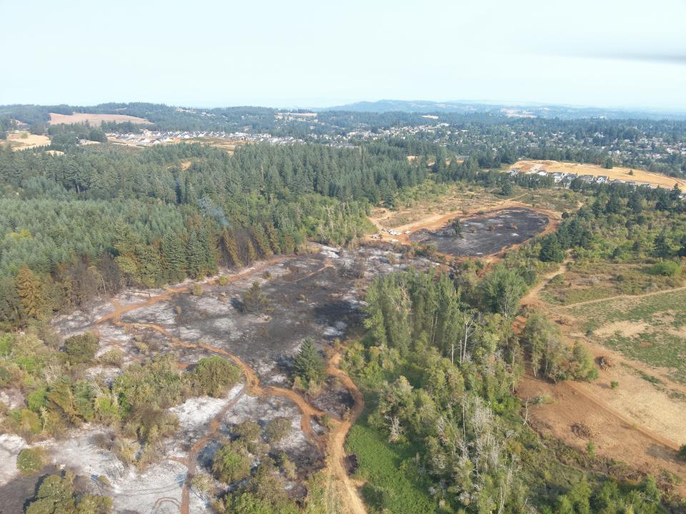
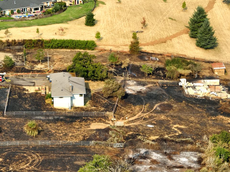
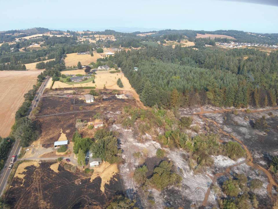
Dramatic aerial photographs captured by a Salem Police drone show how dangerously close the Liberty Fire came to sweeping through a thicket of tall fir trees, wiping out homes and jumping Jory Hill Road S.
The grass fire turned wildfire whipped through the tinder-dry hills just south of Salem on Aug. 23, spurring evacuation orders for more than 600 residents.
More: Wildfires have burned in South Salem 3 years in a row, raising fears among residents
The efforts of firefighters on the ground and in the air helped limit the spread to 50 acres and the damage to two outbuildings. No one was injured or lost their home.
Local and state fire agencies dispatched more than 100 personnel and 30 apparatus to battle the blaze, including four aircraft.
The Oregon State Fire Marshal's office said it ordered two Single-Engine Air Tankers (SEATs), one fixed-tank helicopter and an attack fixed-wing plane that supported operations and handled air traffic control during the wildfire.
The SEATs, equipped with the Fire Boss water scooping system, used water from the nearby Willamette River to douse the flames and contain the fire before it threatened more homes and property to the west and south.
A Fire Boss can scoop more than 800 gallons of water into its amphibious floats in about 15 seconds, and the plane's maneuvering ability, speedy climb rates and compact size make it ideal for attacking fire in wildland-urban interface areas such as the hills of South Salem.
A spokesperson for the Oregon Department of Forestry said each Fire Boss plane — on a 75-day exclusive contract to the department and based at Columbia Gorge Regional Airport in Dallesport, Washington — made 15 drops on the Liberty Fire.
Through an agreement created in 2021, the State Fire Marshal's Office said it pays for the cost when fires threaten homes and communities, as was the case on Aug. 23.
The drone photos, obtained by the Statesman Journal through a public records request, show the margins of the Liberty Fire and provide details not easily seen from the ground.
Sgt. Jacob Pratt, a drone pilot for Salem Police Department, flew over the impacted area the evening of the fire and the following morning to map the footprint and pinpoint hotspots. The drone's camera equipment includes thermal imaging.
Expansive views were captured in images from every direction, revealing a carpet of scorched black on the ground and showing how the fire surrounded two homes on Jory Hill Road and crept along the edge of a dense forested area.
The official cause of the fire has not been released.
Capi Lynn is a senior reporter for the Statesman Journal. Send comments, questions and tips to her at clynn@statesmanjournal.com or 503-399-6710.
This article originally appeared on Salem Statesman Journal: Oregon wildfire came close to burning Salem homes, images show

