Travel not recommended as heavy snow slams B.C.'s South Coast
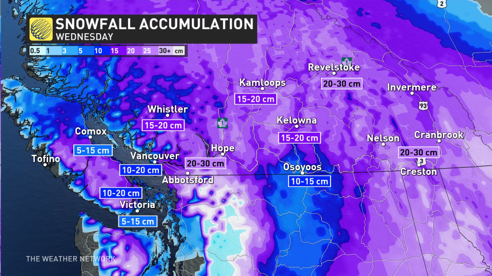
A major snowstorm hitting B.C.'s South Coast could drop anywhere from 5-30 cm of snow across the region Wednesday. Dangerous travel is likely throughout the day, with drivers being urged to adapt to the changing and deteriorating conditions, or to simply, just stay home.
Most schools opted to close for the day, and more shelter spaces and warming centres were being made available amid the snow and frigid temperatures.
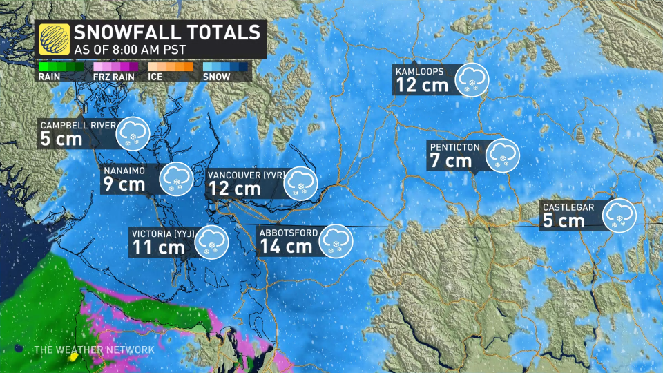
By 8 a.m. PST, between 5-15 cm of snow had already been recorded, with Vancouver airport reporting 12 cm, and Victoria airport reporting 11 cm.
Snowfall warnings are in place for a good portion of southern B.C.
DRIVERS BEWARE: Check current road conditions if you have to travel
Wednesday
Moisture from the Pacific system will interact with Arctic air already in place over the B.C. South Coast, helping to keep the region on the wintry side of this major storm system. Cold air stuck, and has won, over in the Lower Mainland, allowing for snow to accumulate quickly and make a mess of the roadways early Wednesday.
Areas immediately along the coast could still have some marine influence, which could bring mixing or even some melting of the snow on contact.
PHOTOS: Heavy snow hits western Canada
For Victoria and surrounding communities, there is lower confidence in the amount of snow that will fall, and also how much mixing can move into the region with it being a bit further south and closer to the centre of the low.
Along the east side of Vancouver Island, snow is expected for all, even down to sea level.
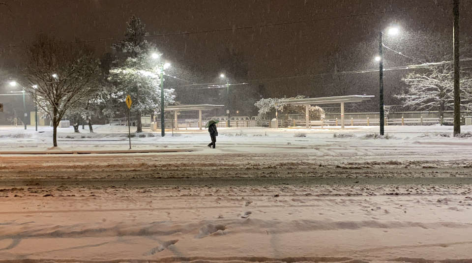
As of 5 a.m. PST, Vancouver (CYVR) was reporting 8 cm on the ground. (Photo taken in Vancouver by The Weather Network's Mia Gordon)
Accumulations will vary greatly from the shorelines in Victoria up to the airport.
The system will start as snow in Victoria and then coastal sections could transition to mixing, which would limit snowfall amounts. These areas could see accumulations in the 5-15 cm range.
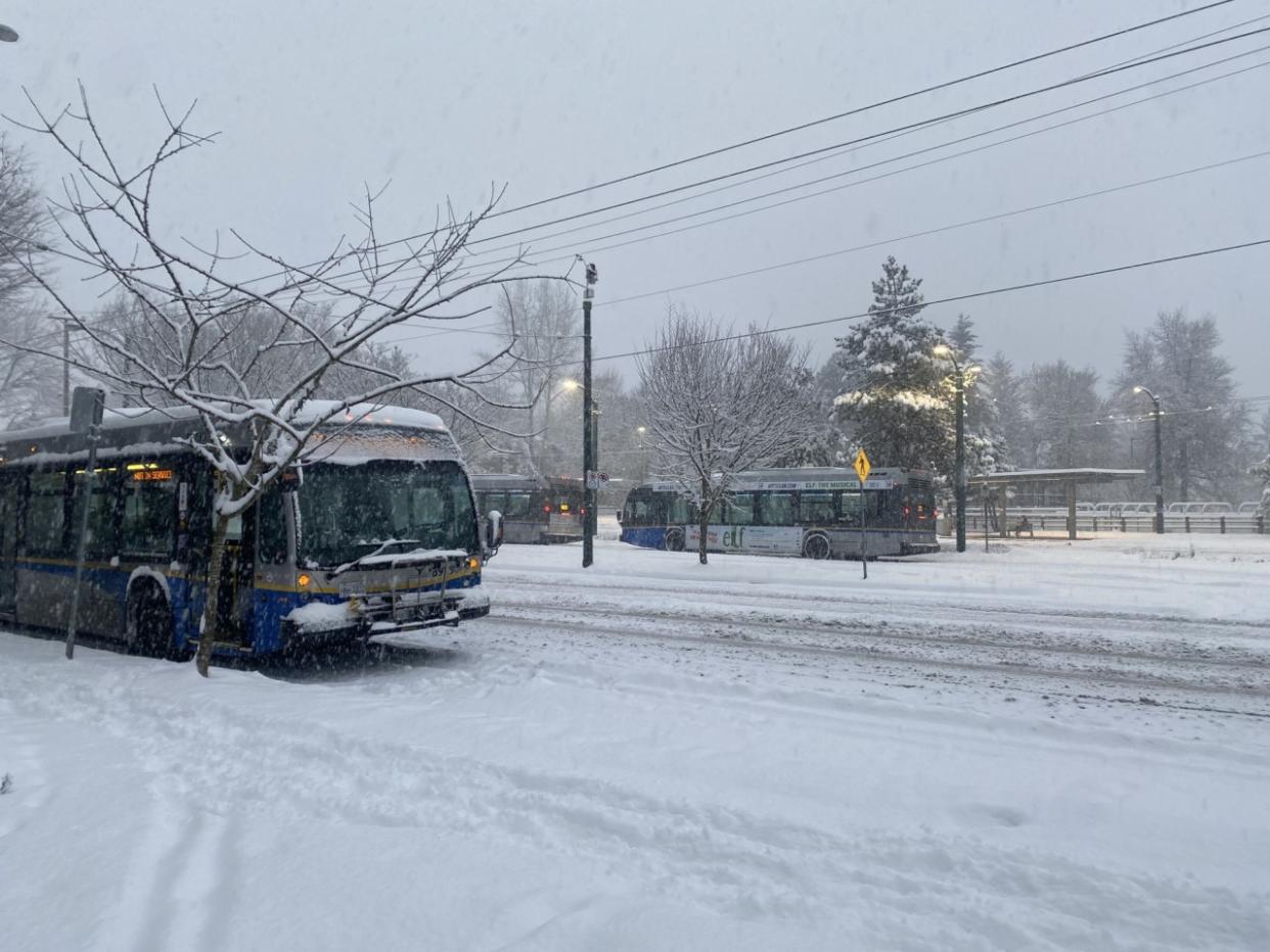
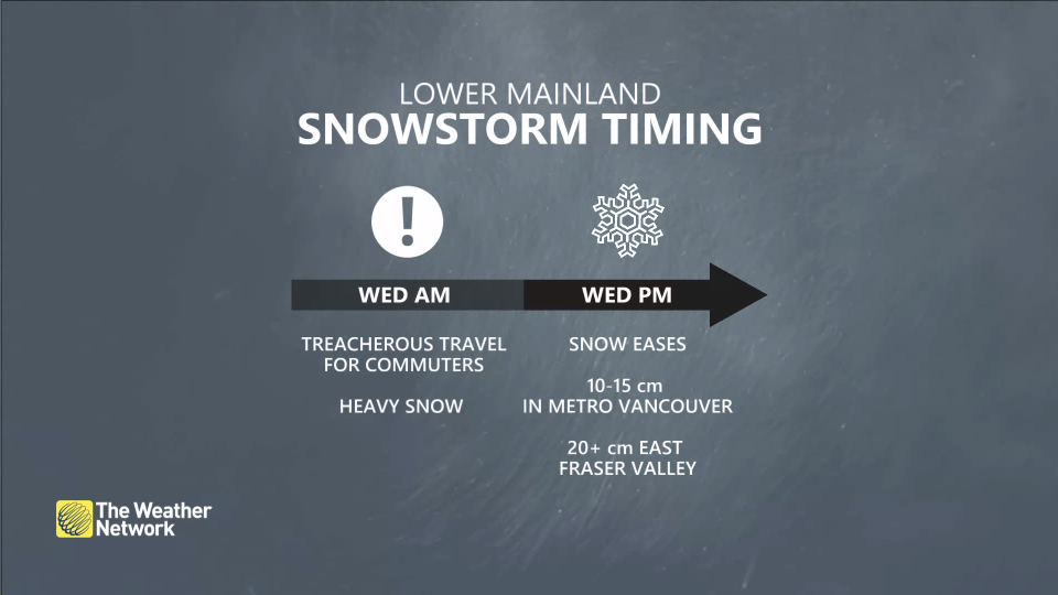
Travel is expected to be difficult on Wednesday with the snow and slippery conditions. The same will be said for the Lower Mainland, with the heavy snowfall expected to wreak havoc on Wednesday commute times.
RELATED: Beware of King Tides
Areas north of the Fraser River are likely to stay as all snowfall, making for treacherous travel. Northern and central B.C. will also see snow with the northern front.
Between 10-20 cm of snow is expected across the Interior by the time the snow ends Wednesday evening. Although the Interior is more accustomed to the snow, it will still create poor driving conditions, especially Wednesday afternoon.
Travel is not advised on Wednesday. For up-to-date road conditions around the province, visit DriveBC.ca.
WATCH: Vancouver Island hour-by-hour snowstorm forecast
Thursday: More snow ahead
Another system is on tap for Thursday into Friday, which could bring more snow to the region. There's also the threat for freezing rain, especially for areas just inland from the coast and into the Fraser Valley.
Eventually, warmer temperatures will win, and rain will take over.
An active and unsettled pattern will continue into the weekend and through most of next week. Mild Pacific air will take over through the end of January, with snow levels rising to 1000-1500+ metres, resulting in snow and rain for South Coast ski areas.
Stay with The Weather Network for more updates and information on your forecast in B.C.

