Did your county exist when Arkansas became a state?

FAYETTEVILLE, Ark. (KNWA/KFTA) — The county map of the Natural State looked very different when Arkansas became a state in 1836.
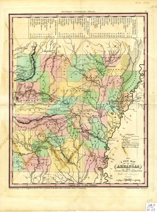
Based on a county map from 1836, only 36 of the 75 current counties existed.
Arkansas Territory
When Arkansas became a territory in 1819, just five counties existed. Four of those counties extended into what is now Oklahoma.
Lawrence County
Pulaski County
Clark County
Hempstead County
Arkansas County
As the population grew, the five counties were divided into smaller counties.
Miller County
Five Arkansas employers among best in America, according to Forbes
Miller County was technically established before and after Arkansas became a state. The county was first established in 1820 and included portions of present-day Miller County and 11 Texas counties, according to the Encyclopedia of Arkansas.
However, the county was abolished in 1838, two years after Texas declared its independence from Mexico. CALS says the county was problematic because Mexico claimed much of eastern Texas then.
The county was reestablished in 1874 with Texarkana as the county seat.
Here are the counties established before and after Arkansas became a state.
Before June 15, 1836 | Arkansas, Carroll, Chicot, Clark, Conway, Crawford, Crittenden, Greene, Hempstead, Hot Spring, Independence, Izard, Jackson, Jefferson, Johnson, Lafayette, Lawrence, Marion, Miller, Mississippi, Monroe, Phillips, Pike, Pope, Pulaski, Randolph, Saline, Scott, Sevier, St. Francis, Union, Van Buren, Washington, White |
After June 15, 1836 | Ashley, Baxter, Benton, Boone, Bradley, Calhoun, Clay, Cleveland, Columbia, Craighead, Cross, Dallas, Desha, Drew, Faulkner, Franklin, Fulton, Garland, Grant, Howard, Lee, Lincoln, Logan, Lonoke, Madison, Miller, Montgomery, Nevada, Newton, Ouachita, Perry, Poinsett, Polk, Prairie, Searcy, Sebastian, Sharp, Stone, Woodruff |
For more information on each county, click here.
For the latest news, weather, sports, and streaming video, head to KNWA FOX24.

