Hilary's strange trip over the heart of L.A. — even Dodger Stadium
For days, forecasters tried to determine the path of Hilary as it morphed from a Category 4 hurricane in the Pacific Ocean to an exceedingly rare tropical storm that entered Southern California.
But the trail of Hilary took an interesting turn Sunday — veering a bit more eastward than expected. That likely explains why parts of San Diego County were spared some of the more concerning possible impacts.
What was particularly interesting Sunday night was how Hilary's eye then made a sudden zag to the west — from the Inland Empire to the heart of Los Angeles.
The center of the storm went from being east of Murrieta in Riverside County at 5 p.m. to above Compton around 8 p.m., according to the National Hurricane Center.
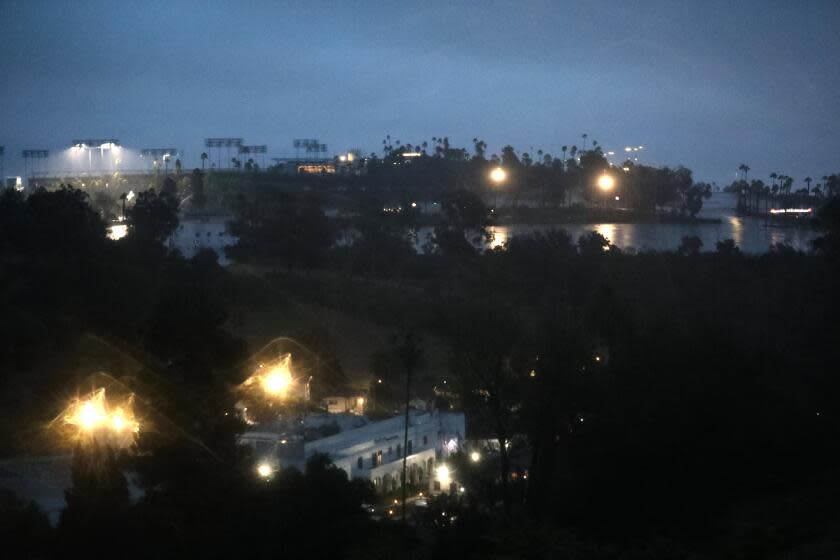
At around 8:15 p.m., the center of the storm was circulating directly over Dodger Stadium, according to Daniel Swain, a UCLA climate scientist. The National Hurricane Center, by 11 p.m., put the eye of Hilary back where it was originally expected to go, into the Owens Valley along the U.S. Highway 395 corridor.
It was an unexpected move of the center of the storm, one of many unusual moments for the first tropical storm to hit Southern California in decades.
The move of the eye of the storm to L.A. County, as determined by the National Hurricane Center, coincided with Hilary becoming less organized as a tropical storm.
In some ways, where the eye of the storm was on Sunday night mattered less than before, according to meteorologist Todd Hall of the National Weather Service office in Oxnard, as Hilary weakened.
There were some other surprises, a testament to the limits of how precise forecasters can be when dealing with a tropical storm.
For some moments Sunday evening, eastern Ventura County and western L.A. County saw dangerous flooding — an area that had been quite far from what was thought to be the center of the storm at that time. The weather station at Leo Carrillo State Beach, just west of Malibu, saw an eye-popping 1.2 inches of rain in a single hour.
What makes Hilary's movements so unusual compared to a hurricane hitting the Gulf Coast is that Southern California has many mountain ranges.
"When Hilary came ashore, it interacted with the mountain barriers," and an area of low pressure developed right along the Ventura County coast, separate from the main circulation of Hilary, said National Weather Service meteorologist Joe Sirard. As a result, there was high-intensity rainfall in that area of Ventura and L.A. counties.
"As tropical storms move ashore, especially when they hit a mountainous terrain, the circulation kind of gets torn apart and disorganized," Sirard said.
Without a doubt, some areas of Southern California were hit hard, especially the Coachella Valley, forcing lengthy closures of Interstate 10 in the Palm Springs area, and in the Eastern Sierra shutting a 120-mile stretch of the 395, the main road connecting Mammoth Mountain to the Southern California metro area.
There have been reports of people stuck on roofs in Cathedral City, where roads remained awash in a thick layer of mud and water Monday, and elderly residents needing help. Communities in the San Bernardino National Forest have been cut off by major debris flows. Floodwaters poured into Eisenhower Medical Center in Rancho Mirage.
It will take some time for the full extent of the storm's historic impacts to be tallied. Workers were evacuated ahead of Hilary's arrival from Death Valley National Park, which got 2.2 inches of rain within a day — breaking the all-time wettest day record. Death Valley on average gets roughly 2 inches of rain a year.
But there are other places that saw less devastation. Parts of coastal San Diego, Orange and Los Angeles counties saw high amounts of rain for a single day — especially considering that it's August, in the middle of the dry season — but not unprecedented for what might have occurred during a strong winter storm.
In fact, rainfall forecasts were generally within expectation in a number of areas. San Diego was forecast to receive roughly 2 inches of rain; it received 1.82. Downtown L.A. was forecast to receive around 2 inches of rain; it received about 3 inches.
Palm Springs was forecast to get 4 to 5 inches of rain — as much rain as it on average gets in a year — and has received more than 3 inches.
But some highly populated areas of San Diego County, which was thought to be an area of potential concern due to its proximity to the projected eye of Hilary, were likely sheltered from more significant winds due to the storm's move eastward as it passed by.
The actual path of the storm "put it kind of more over the foothills, in the mountains," said Brandt Maxwell, meteorologist with the National Weather Service's San Diego office.
La Jolla, on San Diego's coast, had one reading of a 51 mph gust — which is substantial — but places further inland, where many people live, the winds were more like 20 to 30 mph, with a few higher gusts, Maxwell said.
Some areas of L.A. County received highly unusual amounts of rain. Many rainfall records were broken for any single day in August. And Hilary's rainfall dump even resulted in the breaking of records at a number of weather stations for the entire month of August.
Of course, there are many areas of Southern California that didn't see catastrophic damage. But the weather service never made that kind of prediction.
"Not everywhere, not every square meter of L.A. County was flooded," Sirard said. But there were nonetheless a number of areas of L.A. County that did see damaging floodwaters, including a commercial stretch of Melrose Avenue in Los Angeles. The Los Angeles Fire Department received reports of 22 minor mudflows; Highway 138 in the Antelope Valley was closed Sunday by running water and debris flows; and flooding on the 5 Freeway in Sun Valley severely limited access to northbound lanes early Monday.
Read more: Magnitude 5.1 earthquake strikes Ojai area, rattling nerves as Hilary pounds Southland
Swain said conditions of the storm just didn't produce those some of the more extreme rainfall rates that were forecast as an outside possibility, which he said helped minimize flooding damage.
Instead of 3 to 4 inches an hour, most areas saw rates closer to 1 to 2 inches — more manageable. However, Swain still called the amount of rain that fell unprecedented.
"Numerous locations in Southern California saw their wettest August day on record … and many locations set new records for the wettest day in summer," Swain said.
Another factor that helped is that the rainfall fell at more steady rates, instead of the brief bursts of the same amount of rainfall that would've worsened flooding concerns.
“Even though the same amount of water fell overall in many cases, it didn’t fall as quickly as had been feared," Swain said, avoiding those "catastrophic" flooding concerns.
He said he expects there was some extreme flooding in some more remote areas, noting there has been little reported from Death Valley, as it was evacuated.
“The hardest hit areas are often the most inaccessible ones," Swain said.
Times staff writers Brittny Mejia, Louis Sahagún, Hannah Wiley and Ruben Vives contributed to this report.
Sign up for Essential California, your daily guide to news, views and life in the Golden State.
This story originally appeared in Los Angeles Times.

