Difficult travel as heavy autumn snow hits northern Ontario, risk of 20 cm
Winter driving will be put to the test across northern Ontario Friday, as an early season storm brings a mix of frozen precipitation to the region.
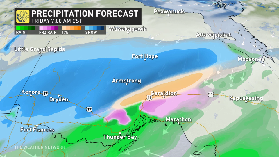
Temperature differences across the storm will bring rain, freezing rain, ice pellets, and heavy snow, likely leading to periods of travel issues throughout the day on Friday.
RELATED: Why the first snowfall of the season can catch drivers by surprise
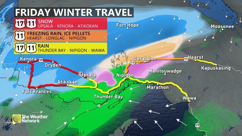
Snowfall warnings cover Dryden, Armstrong, and Fort Hope, while freezing rain warnings were issued for the northern shores of Lake Superior. Precipitation should remain as rain for lower elevation areas.
Difficult day of winter travel through Friday
The same system responsible for heavy snow in southern Manitoba will slide over the provincial border and bring hazardous driving conditions to northern Ontario through Friday.
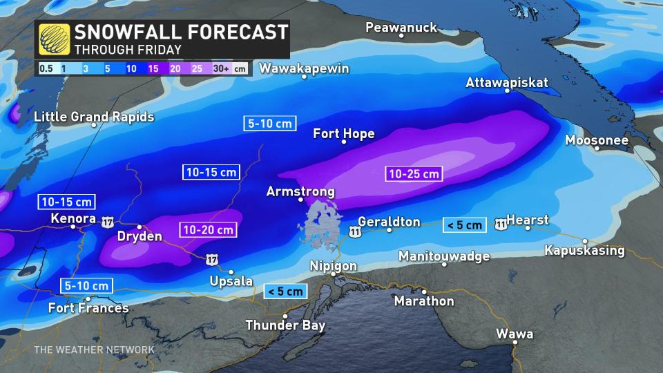
We’ll see snowfall rates pick up as the heart of this low-pressure system pushes into the region. Peak snowfall rates of 2 to 4 cm per hour are expected at times.
Temperatures will stay cold enough for precipitation to stay mostly snow north of the Trans-Canada Highway, with general totals of 10-20 cm expected from Dryden to Armstrong.
PLAN AHEAD: Warm or wintry? Halloween weekend holds a mixed bag for Canada
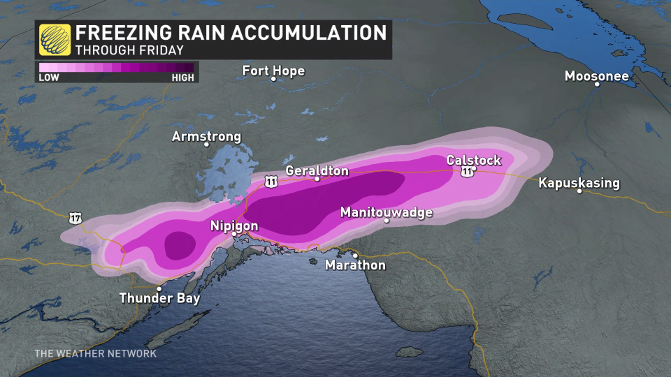
Accumulations are much trickier closer to the Trans-Canada as a touch of warmer air aloft will force a transition to ice pellets and freezing rain for a time through Friday.
The greatest risk for ice accretion from freezing rain will fall along and south of the Trans-Canada, bringing a potential glaze of ice to Geraldton, Calstock, Nipigon, and Manitouwadge.
Winds blowing off Lake Superior should be just warm enough to keep precipitation plain old liquid rain around Thunder Bay.
Motorists planning to travel in these impacted regions are urged to exercise caution as driving may be treacherous at times.
This is all quite the contrast from the southern half of the province, where overnight lows may even be warm enough to break some October records this week.
MUST SEE: Some overnight lows in southern Ontario may be warm enough to set records
This late October warm-up in southern Ontario won't last forever though, as chilly air arrives in time for Halloween and below-seasonal temperatures are expected to dominate through the first week of November.
Keep checking back to The Weather Network for more forecast information and updates on your weather in Ontario.

