Disruptive Thanksgiving-week storm affecting much of the East as holiday travel rush begins
A storm system pushing across the eastern US ahead of Thanksgiving is delivering widespread impacts on Tuesday, threatening to disrupt holiday travel with severe thunderstorms, drenching rain and snow.
Live Updates: See the latest on delays and disruptions as Thanksgiving travel gets underway
At least two dozen states across the East, including major travel hubs from Atlanta to New York City, will contend with adverse weather during two of the busiest travel days of the year.
The conditions may cause travel headaches during what is expected to be the busiest Thanksgiving travel period in years, leading to disruptions at airports in large hubs such as Atlanta, New York City, Boston and Washington, DC.
But there is still room for optimism. The storm’s impacts are forecast to subside Wednesday as it tracks off the East Coast, leaving much of the central and eastern US to enjoy a dry Thanksgiving day.
Track the storm with more maps here.
Tuesday’s significant storm threat
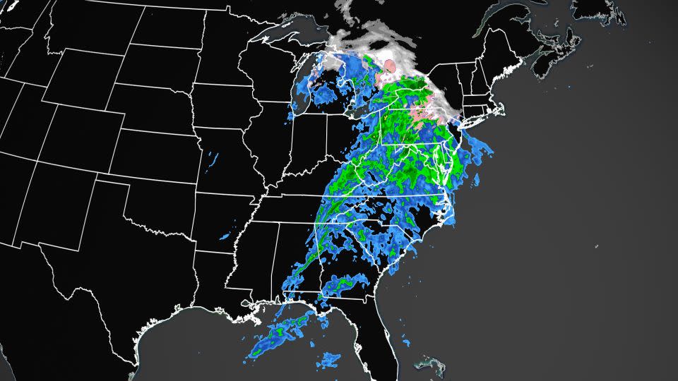
Rain will be heavy at times from southern Alabama to New York as the wide-reaching storm tracks east and expands to the north throughout Tuesday.
Widespread rainfall totals of 1 to 3 inches are possible. Some areas, including Virginia’s Blue Ridge Mountains, could receive over 4 inches.
The risk for severe thunderstorms will shift east Tuesday evening and encompass portions of Georgia, the Carolinas and Virginia into early Wednesday morning. Damaging wind gusts are the main concern, but a brief tornado cannot be ruled out.
The storm is also worsening fire weather in the drought- and wildfire-plagued Appalachians. Winds from the storm increased late Monday in the region and prevented steady, beneficial rain from reaching the ground. This caused one fire to flare up and force evacuations in a remote area of Tennessee near Great Smoky Mountains National Park.
A wintry mix of rain, sleet and snow will spread across northern New York, Vermont and New Hampshire Tuesday evening. This same wintry mix already made some roadways slick across portions of Pennsylvania and southern New York early Tuesday.
High-elevation areas of the Adirondacks and the Green and White mountains are most likely to see accumulating snow Tuesday night.
As the sun rises in the northeast Wednesday, roads may be slick or snowy in parts of Vermont, New York and New Hampshire due to overnight snowfall.
Steady rain and breezy conditions will linger early Wednesday morning across the greater New York City metro but the storm’s impact will taper off significantly by mid-morning as it moves off the East Coast, dumping its final remnants on parts of New England. Snow will accumulate in Maine on Wednesday as a wintry mix continues across Vermont and New Hampshire.
Thanksgiving Day will be much cooler and largely dry across the central and eastern US as chilly Canadian air settles into place in the wake of the storm. A storm will begin to build over the northern Rockies on Thursday and strengthen on Friday bringing snow to portions of the Rockies, including Denver and Salt Lake City.
CNN’s Andy Rose contributed to this report.
For more CNN news and newsletters create an account at CNN.com

