Distant Major Hurricane Dora kicks up winds, stirs dangers in Hawaii
Major Hurricane Dora continued to impact Hawaii into Thursday, bringing rough surf and strong winds to the islands despite passing hundreds of miles to the south in the open Pacific Ocean, according to AccuWeather forecasters.
The strong winds were contributing to the rapid growth and spread of wildfires on Hawaii's Big Island and Maui that have destroyed structures, led to evacuations and forced some people to escape the flames by jumping into the ocean. As of Thursday, at least 36 people have died and over 2,000 people have been evacuated to shelters according to local authorities.
 |
Major Hurricane Dora, as seen on AccuWeather Enhanced RealVue™ Satellite, as of early Wednesday morning, Aug. 9, local time. |
Dora, still a powerful Category 3 hurricane on the Saffir-Simpson Hurricane Wind Scale (SSHWS) with maximum sustained winds of 120 mph as of Thursday afternoon local time, was packing even stronger maximum sustained winds of 145 mph, with gusts upwards of 170 mph, as of early Thursday morning, local time. This made Dora the strongest hurricane of the season thus far in the central Pacific basin, and third strongest in the entire Pacific Ocean, behind only Typhoons Mawar and Khanun.
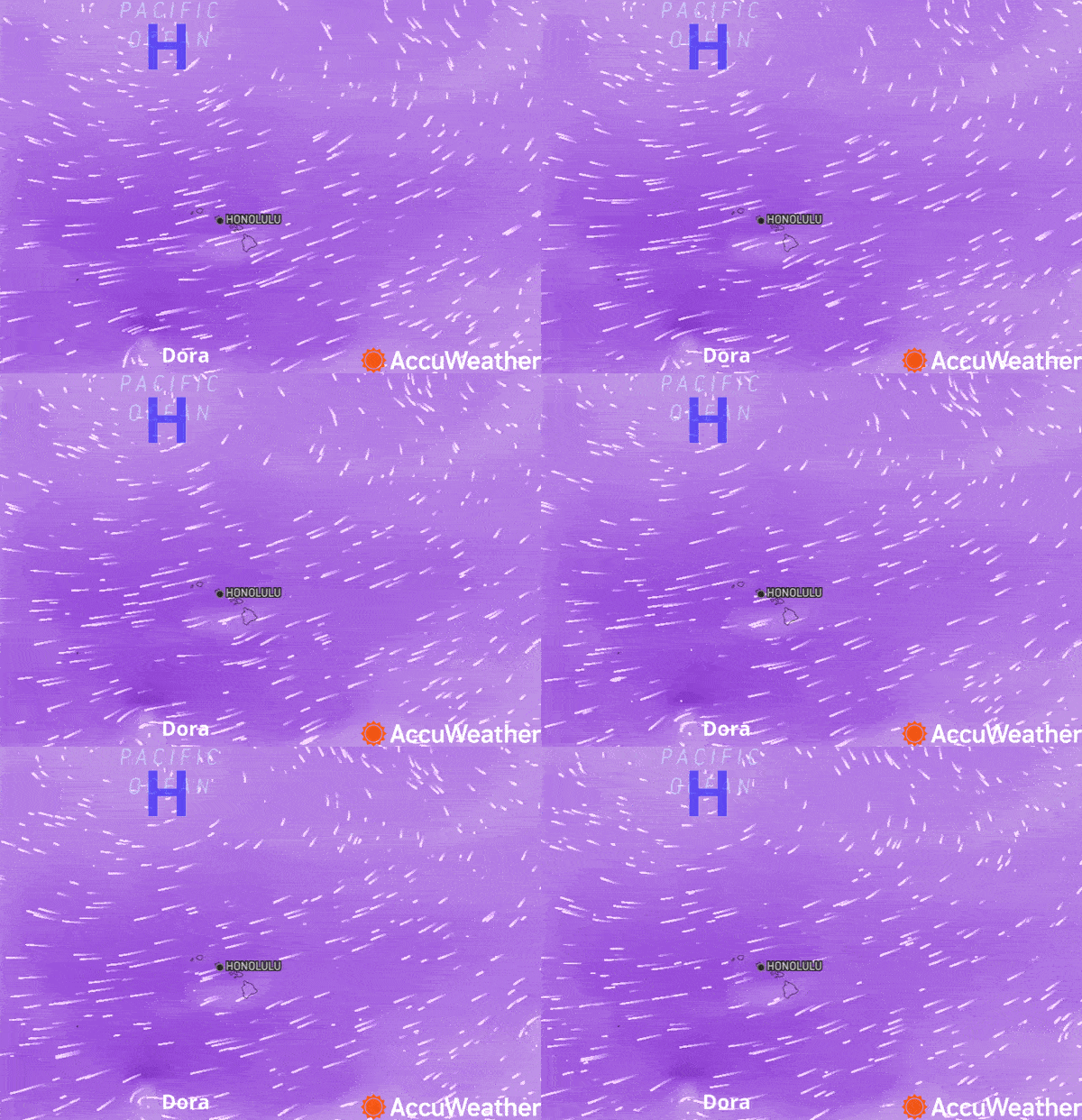
In terms of wind impacts on Hawaii, Dora -- an intense area of low pressure -- has been working in concert with a strong area of high pressure to the north, says AccuWeather.
"The difference in pressure between the area of high pressure to the north of the islands, and Dora going by to the south, is leading to very strong winds across the state," said AccuWeather Senior Meteorologist Dan Pydynowski. Air is rushing from the high pressure area to Dora.
 |
AccuWeather's Wind Flow map shows a high-pressure system and Dora creating a pressure gradient, driving higher winds in Hawaii on Wednesday, Aug. 9, 2023. |
High wind warnings and wind advisories were hoisted by the National Weather Service into Wednesday. At Honolulu International Airport, a peak wind gust of 49 mph was measured Tuesday, with even higher gusts in the more mountainous areas. By late Wednesday evening, all wind advisories, warnings and red flag warnings had been cancelled as wind gusts eased back.
The threats posed by Dora are not limited to just the land.
"In addition to the strong winds and high fire threat, rough surf, high waves and rip currents will also continue to pummel the islands," said Pydynowski. "This will especially be the case along south-facing beaches."
 |
Swimmers and surfers will face dangerous water conditions, even as Dora moves farther away, as swells from tropical systems can travel thousands of miles.
Hurricane Dora's strength has been quite remarkable and noticeable in satellite images captured from space. The compact and powerful storm - hurricane-force winds extended only 30 miles out from its center as of Wednesday -- has a well-defined eye with notable showers and thunderstorms wrapping around its center.
Current forecasts from AccuWeather call for Dora to maintain major hurricane status, or at least a Category 3 on the SSHWS, into Thursday. Dora is predicted to lose wind intensity as it continues to move farther away into the weekend when it will likely become a tropical storm.
 |
A close-up of major Hurricane Dora, as seen on AccuWeather Enhanced RealVue™ Satellite, early Wednesday morning, Aug. 9, 2023. |
As the difference in barometric pressure decreases between the high to the north and Dora to the southwest, stiff winds will ease over Hawaii and that should assist with firefighting efforts late this week and this weekend. However, the northeast trade winds will continue.
After developing in the Eastern Pacific tropical basin on July 31, Dora crossed into the Central Pacific basin on Aug. 9. It is very likely that the cyclone will survive into a third basin, the Western Pacific, by later this weekend or early next week when it crosses the international date line, located along longitude 180 degrees east.
This is a rare feat, but it may be more likely due to current global atmospheric and oceanic conditions.
"Such long-track storms are far more common during El Niño years," said AccuWeather Lead International Meteorologist Jason Nicholls.
In 1994, Hurricane John, which later became known Typhoon John as it moved into the West Pacific, followed a path similar to Dora, and held the record for the longest-lasting tropical cyclone until Cyclone Freddy broke that record earlier this year in February and March as it crossed the Indian Ocean.
Dora would arrive in the western Pacific on the heels of Khanun, which made landfall on the Korean Peninsula Thursday morning, local time, and also behind Lan, which is expected to impact Japan by early next week.
Want next-level safety, ad-free? Unlock advanced, hyperlocal severe weather alerts when you subscribe to Premium+ on the AccuWeather app. AccuWeather Alerts™ are prompted by our expert meteorologists who monitor and analyze dangerous weather risks 24/7 to keep you and your family safer.


