Double hurricane threat as Tropical Storms Laura and Marco advance towards US Gulf Coast
Two tropical storms are advancing across the Caribbean posing potentially historic threats to the US Gulf Coast, with both projected to reach the coast at or close to hurricane force.
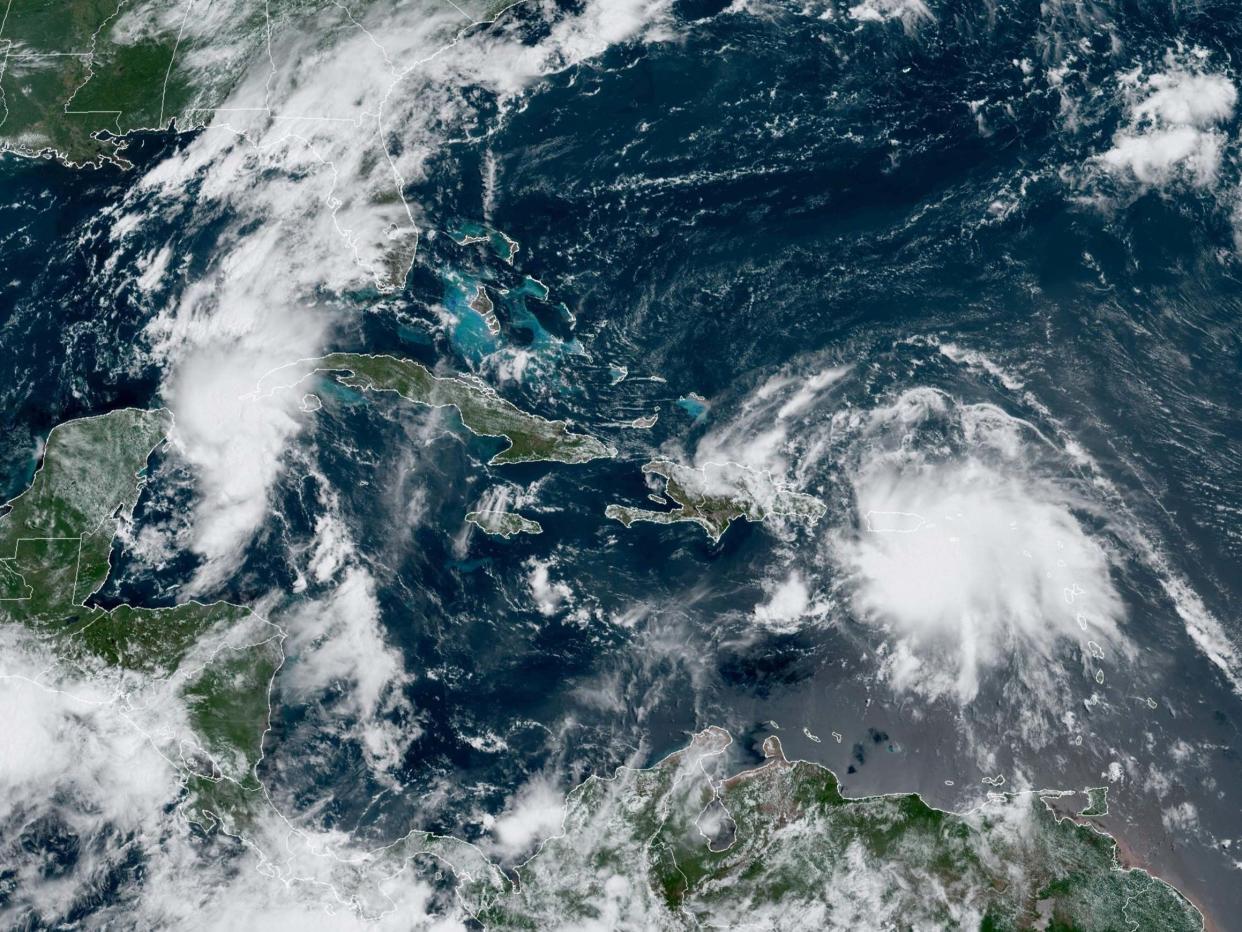
The current projected track for Tropical Storms Laura and Marco by the US National Hurricane Center puts both storms together in the Gulf on Tuesday, with Marco set to hit near the Texas-Louisiana border and Laura set to make landfall a little less than a day later.
Phil Klotzbach, a hurricane researcher at Colorado State University, said two hurricanes had never appeared in the Gulf of Mexico at the same time, according to records going back to at least 1900, and the last time two tropical storms were in the Gulf together was in 1959.
Mr Klotzbach added that the last time two storms made landfall in the US within 24 hours of each other was in 1933.
On Saturday morning, Laura began flinging rain across Puerto Rico and the Virgin Islands, with the Dominican Republic, Haiti and parts of Cuba expected to be drenched during the day as it moves westwards.
Wanda Vazquez, Puerto Rico’s governor, declared a state of emergency and warned the flooding could be worse than what Tropical Storm Isaias unleashed three weeks ago because the ground was now saturated.
“No one should be out on the streets,” Ms Vazquez said.
Officials said they were most concerned about the thousands of people in Puerto Rico who were still living under blue tarps after 2017's Hurricane Maria and the hundreds of families living along Puerto Rico's southern coast in homes damaged by a string of strong earthquakes this year.
Meanwhile, Marco was strengthening with maximum sustained winds of 65 mph (100 kph) and was expected to become a hurricane later in the day.
The Hurricane Center said it expected the storms to stay far enough apart to prevent direct interaction as the region braces for the peak of the Atlantic hurricane season, which is forecast to be unusually active.
Both storms were expected to bring 3 to 6 inches (8 to 15 cm) of rain to areas they were passing over or near, threatening widespread flooding across a vast region.
“A lot of people are going to be impacted by rainfall and storm surge in the Gulf of Mexico,” Joel Cline, the tropical programme coordinator for the National Weather Service, said.
“Since you simply don't know, you really need to make precautions.”
It is still not clear whether Laura will weaken as it passes over Puerto Rico and the mountains of Haiti, the Dominican Republic and Cuba before it enters warm Gulf waters which are conducive to growth.
On Friday, Louisiana’s governor John Bel Edwards declared a state of emergency citing both storm systems.
“It is too soon to know exactly where, when or how these dual storms will affect Louisiana, but now is the time for our people to prepare for these storms,” Mr Edwards said in a statement.
Officials in the Florida Keys, which Laura could pass over on its route into the Gulf, declared a local state of emergency on Friday and issued a mandatory evacuation order for anyone living on boats, in mobile homes and in campers.
Additional reporting by AP
Read more
Hurricane Isaias makes landfall in North Carolina bringing 85mph winds

