Dreary, windy conditions in B.C. will lead to abnormal October warmth
It was a blustery Tuesday for parts of B.C. with a low-pressure system continuing to impact the coast.
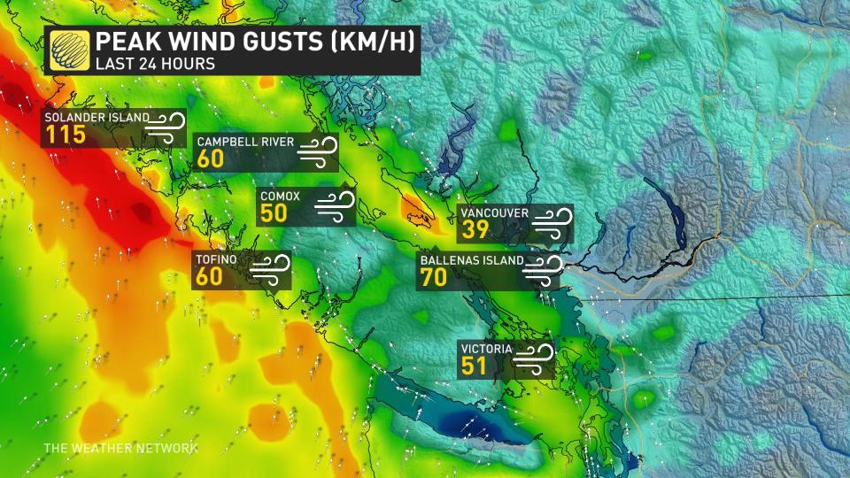
Peak winds exceeded 100 km/h for the northwestern tip of Vancouver Island. Solander Island reported a 115 km/h gust while Sartine Island checked in at 107 km/h. Farther south, gusts topped out at around 60-70 km/h, limiting the number of reported power outages.
Visit our Complete Guide to Fall 2023 for an in-depth look at the Fall Forecast, tips to plan for it and much more!
Lightning strikes were even reported along the coast of western Vancouver Island as the instability reached the coast Tuesday afternoon.
More rain and wind is expected before the low moves out, making way for an unusual shot of warmth coming in late week with some sunshine.
Tuesday night
Areas: Coastal B.C.
Timing: Showers and breezy conditions continue into Wednesday, before the low shifts south Wednesday evening.
Weather: Conditions are starting to improve as a low-pressure system stalls across western Vancouver Island, but some additional rainfall is still on the way.
RELATED: Why the aroma affiliated with a rainfall is so appealing
Wednesday and beyond
Weather: Rain showers continue into the day Wednesday and then tapering off overnight with cloud cover clearing, as well. Conditions will be steadily improving across northern Vancouver Island and the Sunshine Coast, but pesky showers will continue across southern Vancouver Island and the Lower Mainland. Winds will be noticeably lighter, bringing a northerly wind to much of the region.
Additional rainfall is up to 20-30 mm on western Vancouver Island, with Victoria and Vancouver both seeing less than a further 5 mm, as the moisture is intercepted across the mountains and the atmosphere starting to dry out.
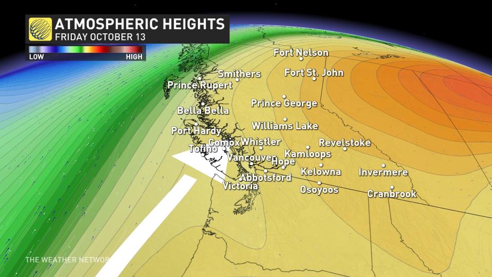
Long range, a coastal ridge builds for Thursday and Friday, giving fair and abnormally warm temperatures for mid-October.
SEE ALSO: B.C. doubled its old wildfire record. Experts say we can take action now
Temperatures peak on Friday, spilling into the low 20s, away from the water. Abbotsford will see a nice bump up to 22°C or 23°C.
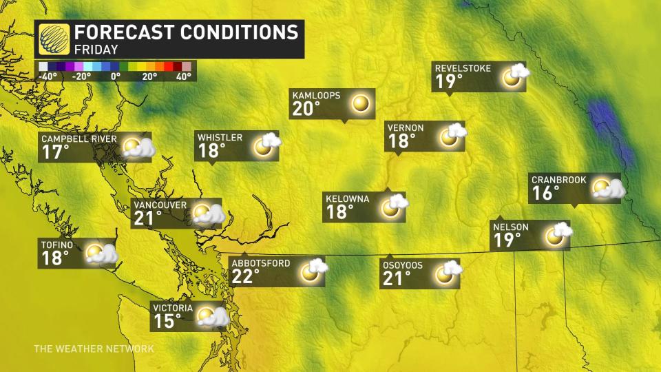
It’s not the latest in the year we’ve recorded temperatures in the 20s, either. In fact, just last year we hit 20.2°C on Oct. 16. The latest 20°C on record at the airport is on Oct. 21, 1965.
Stay tuned to The Weather Network for more forecast updates in British Columbia.

