How do you get there from here? A driver's guide to getting from Fall River to Providence
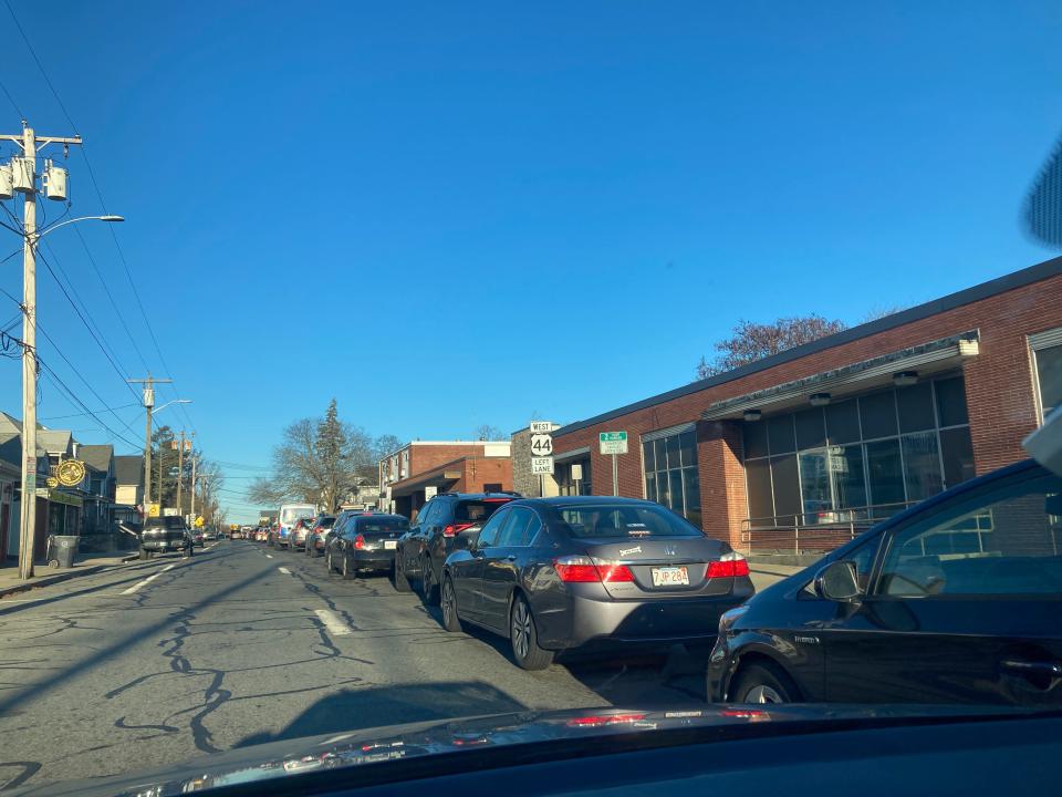
Days after Providence’s Washington Bridge westbound lanes were closed on an emergency order, the reality is sinking in for many drivers and commuters that we’re looking at several months of frustration.
For people in Greater Fall River, Providence offers similar benefits to a major metropolitan city like Boston like public transportation, major hospitals, colleges and more, but closer and often more convenient — until now. The hours-long detours that have turned the city’s highways into parking lots may limit our access to Providence for a while, or even effectively cut off access entirely.
For people who need to get into the city, how do you get there from here? Here’s a guide:
'A lot of road rage': Greater Fall River drivers share commutes from hell into Providence
What's the best driving route from Fall River to Providence?
The main thing to understand is that, with tens of thousands of people still needing to commute every day, there is no magical “best” route westbound into Providence nobody else has thought of. The best route might actually be avoiding the trip altogether if possible.
But drivers got some relief on Friday with the opening of a two-lane westbound bypass on the Washington Bridge, several weeks ahead of schedule. This could provide some relief for Greater Fall River drivers, but is still likely to make for a tough haul.
For those seeking alternate routes, here’s the best of the worst. The time estimates used here are Google Maps predicted 7:30 a.m. travel times, but keep in mind GPS has been hilariously inaccurate due to the evolving situation.
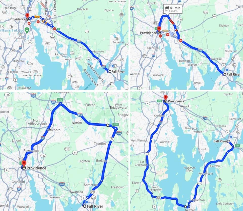
East Providence to Henderson Bridge: The state’s initial detour sends drivers coming from the east through the streets of East Providence to cross the Seekonk River. This option is more direct than most, but the Henderson Bridge is not intended to handle a huge amount of traffic and empties into the narrow lanes of Providence’s East Side. Distance: 18 miles. Estimated time: 30 to 45 minutes.
Seekonk to Pawtucket: One option that avoids the clogged Henderson Bridge is driving through Seekonk to Rumford on Route 114 and entering Pawtucket, then back south to Providence. Distance: 24 miles. Estimated time: 35 to 60 minutes.
Major roads only: If you don’t mind looking at long, boring stretches of highway, one option involves taking Route 24 to I-495 west, then I-95 south into Providence. Distance: 52 miles. Estimated time: 55 to 75 minutes.
The scenic route: Head south to Tiverton and onto Aquidneck Island. Travel through Newport to Jamestown, then on to North Kingstown. From there, head north on Route 4 until you reach I-95 North and ride it all the way into Providence. It's long, but pretty. Distance: 52 miles. Estimated time: between 60 and 90 minutes.
Just for laughs: The Washington Bridge closure is a nightmare, but the memes are pretty funny
What's the best driving route from Fall River to T.F. Green Airport?
This is one scenario where the scenic route might be the best. Going through Newport and Jamestown then back north is a 47-mile drive — but since T.F. Green Airport is in Warwick, you don’t even enter Providence at all. Estimated time: 50 to 75 minutes.
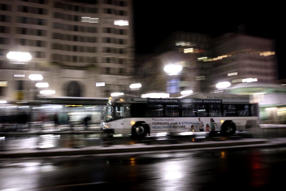
Is there bus service from Fall River to Providence?
Yes, and it's a great way to let someone else deal with traffic while you read, take a nap, twiddle your thumbs, or do anything other than look at brake lights.
RIPTA's Route 24L services the Tiverton Park and Ride on Fish Road, downtown Fall River, and the Somerset Park and Ride. Route 61X starts at the Tiverton Park and Ride and goes north along the East Bay to Providence. According to RIPTA, riders of both routes should expect delays, and there are detours from the usual route once inside Providence. Fares are $2.
Peter Pan Bus Lines also serves Fall River to downtown Providence and the bus terminal. A notice on Peter Pan’s website indicates buses could face a delay of an hour. The fare is $14.
You asked, we answered: Reader questions about the Washington Bridge
Can I take a boat from Fall River to Providence?
Not quite. RIDOT is planning to establish a temporary passenger ferry service from Bristol to Providence's India Point shortly. The duration of the trip is unknown, and no date for the start of service has been nailed down. That's the closest ferry service to Fall River.
Of course, if you have your own boat, have at it — go heed the call of the sea.
Can I get from Fall River to Providence by bicycle?
Yes, and it might actually be faster than driving there. You'd need to ride from Fall River to the East Bay Bike Path in Warren, then take the path north. The bike path crossing the Washington Bridge into Providence is on the eastbound side and still open. Google Maps estimates the ride at 2 hours.
Less adventurous riders could also eliminate most of that by racking the bike, driving to East Providence, and picking up the bike path from there. Start at a parking lot along the path on Veterans Memorial Highway, and Google Maps estimates a ride into downtown would take a brisk 22 minutes.
Dan Medeiros can be reached at dmedeiros@heraldnews.com. Support local journalism by purchasing a digital or print subscription to The Herald News today.
This article originally appeared on The Herald News: Providence commuting from Fall River: Best driving, bus, bike routes

