Drone footage reveals the terrifying aftermath of Hurricane Sally
Drone footage of the aftermath of Hurricane Sally shows the extent of the flooding and damage caused by the category 2 storm system.
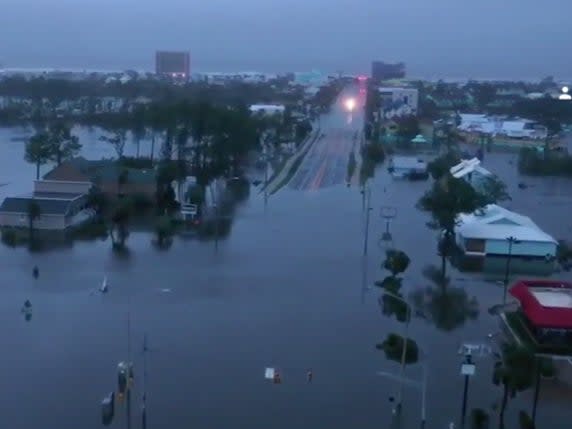
Sally made landfall in Gulf Shores, Alabama, between 4am and 8am on Wednesday, with sustained wind speeds of 100mph.
The footage shows debris in flooded streets, collapsed walls, and damaged roofs.
One 10-storey apartment building has lost much of one wall, exposing at least five units to the ferocity of the storm. Rubble is strewn below.
More than half a million customers are without power across Alabama and western Florida.
The flooding is described as catastrophic, as the slow moving system travels inland to the northeast at just 5mph, continuing to dump rain.
Sally has been likened to Hurricane Harvey which swamped Houston, Texas in 2017.
Further east from Gulf Shores, a five foot storm surge was recorded in Pensacola, Florida, flooding much of downtown.
Pensacola, Florida These two pictures were taken from the same building. One was before Hurricane Sally, the other during the height of the storm. Wind gusts topped out at around 90 mph here this morning (9/16/20). Photo cred: Aaron Fields. #FLwx #Sally pic.twitter.com/WfFk14ZHiu
— Amber Wheeler (@AmberWheelerWX) September 16, 2020
Those who did not evacuate have been warned to shelter in place until floodwaters recede due to the danger of downed power lines and displaced wildlife such as alligators, vermin and fire ants.
Read more
If you’re wondering why people in the path of Hurricane Sally won’t evacuate, here’s the reason
Hurricane Sally: Images of destruction across Alabama and Florida panhandle
