Early April precipitation is expected to be below normal where it is most needed in Northern California

April showers may be more scarce than normal north of Point Conception in California, according to an outlook produced by the National Oceanic and Atmospheric Administration.
This area where the probability of precipitation is below normal includes virtually all of Northern California and the crucial northern Sierra Nevada, where the state's largest reservoirs are located.
While snow cover has increased thanks to a series of March storms, the Northern Sierra 8-Station Index stands at 56% of normal for the season. As of March 24, another 29.25 inches would be needed to reach the season normal of 54.52 inches. But the area normally gets just 9.42 inches from March 24 through June 30. So a daunting 310% of normal precipitation would be required to make up the deficit, according to Jan Null of Golden Gate Weather Services.
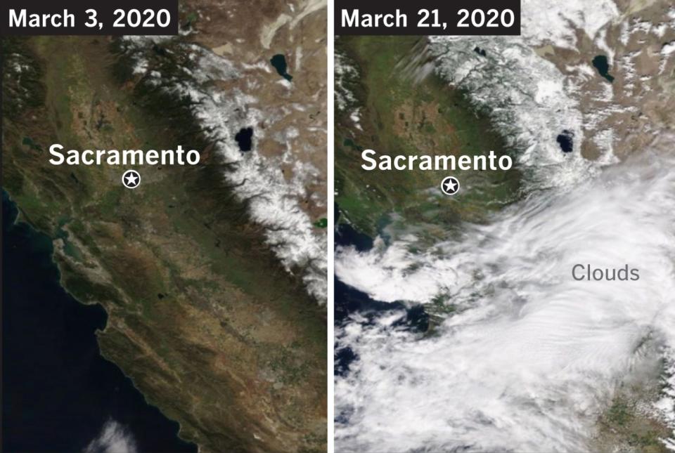
The March storms that plowed through the state have provided some good news. Satellite photos released by the National Weather Service office in Sacramento compare the snow cover in the northern Sierra Nevada on March 3 and on March 21. In the March 21 photo, the mountains are draped in more robust snow cover than they were about three weeks earlier.
The state's major reservoirs are near or above historical averages for this time of year, and the added moisture from the storms may have helped to postpone an extra early start of the fire season.
But Northern California got a late start on its precipitation this year, and despite the recent rains, the picture remains bleak. Deficits — the amount needed to reach seasonal norms — start small in Southern California and increase as you go north.
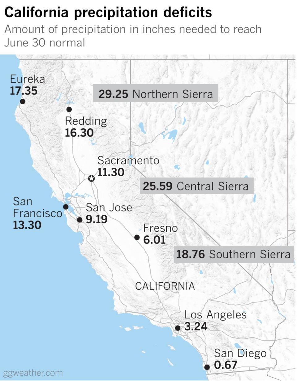
San Diego, with 9.67 inches of rain, is at 107% of normal for its July 1 through June 30 rainfall year, so it's ahead of the game. But Los Angeles, for example, with 11.69 inches, has only 88% of normal rainfall, and would need 3.24 inches to reach its seasonal norm of 14.93 inches. However, from March 24 through June 30, L.A. normally gets only 1.64 inches. So it would need to get 198% of normal to make up the deficit.
The deficits grow as you move north in the state. San Francisco, which has received just 50% of normal rainfall for the season, has a deficit of 13.30 inches. But until the end of the season on June 30 the City by the Bay normally gets an additional 2.89 inches. So it would need a whopping 460% of normal rain between March 24 and June 30 to come up to par. San Jose is in worse shape. It would need 481% of normal rain before the season ends.
The April outlook is making it look increasingly unlikely that Northern California will be able to catch up to where it should be.

