El Niño will likely change Wisconsin's weather. Here's how.
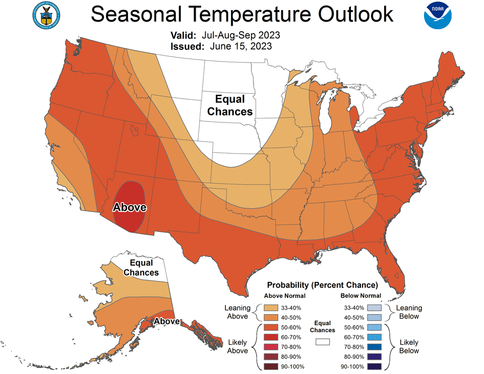
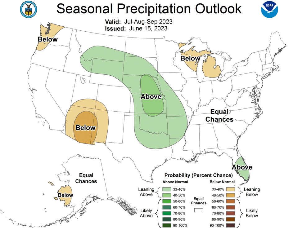
Wisconsinites could see a warmer than average winter as El Niño is expected to gradually strengthen into the winter, according to the National Oceanic and Atmospheric Administration.
There's a greater than 90% chance El Niño will continue through the winter as of July 13, according to NOAA. Here's how it could impact you:
What is El Niño?
During an El Niño, the ocean warms to above-average sea surface temperatures in the central and eastern Pacific Ocean. It is the opposite of a La Niña when the sea surface temperatures are cooler than normal.
El Niño occurs because the polar jet stream shifts north and limits cold air coming from the north. The weather pattern usually causes above average temperatures to the northern parts of the country and below average temperatures to parts of the southern U.S.
How long does a typical El Niño episode last?
Episodes of El Niño usually last nine to 12 months, but can also last for years. El Niño events typically occur every two to seven years on average, but don't occur on a regular schedule, according to NOAA.
Does this mean Wisconsin will have a warmer winter this year?
Wisconsinites can generally expect warmer conditions during the winter, said meteorologist Cameron Miller at the National Weather Service office in Sullivan.
These conditions are for the winter season average and there will still be days during the season with below normal temperatures and a lot of precipitation, according to NWS.
How does this El Niño compare to others?
Currently, this El Niño is on track to be one of the strongest on record dating back to 1950, according to the National Weather Service.
What happened during the last strong El Niño?
During the last strong El Niño in 1997-98, temperatures were six to 8 degrees above averages and precipitation was up two inches above average and snowfall was very close to average, according to the National Weather Service.
This article originally appeared on Milwaukee Journal Sentinel: El Nino 2023 likely to cause warmer Wisconsin winter, experts say
