Enormous storms, gravity waves–this is your amazing planet today

A pair of powerful storms spiraling on either side of Canada. Gravity waves spilling over one of the most isolated cities on Earth. A vast ocean of clouds wrapping around the hills that loom over an endless expanse of farmland, isolating sunbathed crests above a sea of gloom.
This was a busy year for active weather here in Canada and around the world. Our living, breathing atmosphere is busy as ever as the calendar rolls over to 2024.
Here’s a look at our gorgeous planet from above—the ultimate group photo of Canada and our entire hemisphere in the closing hours of December 31, 2023.
DON'T MISS: From fires to floods: Canada's 2023 was a fury of record-breaking weather
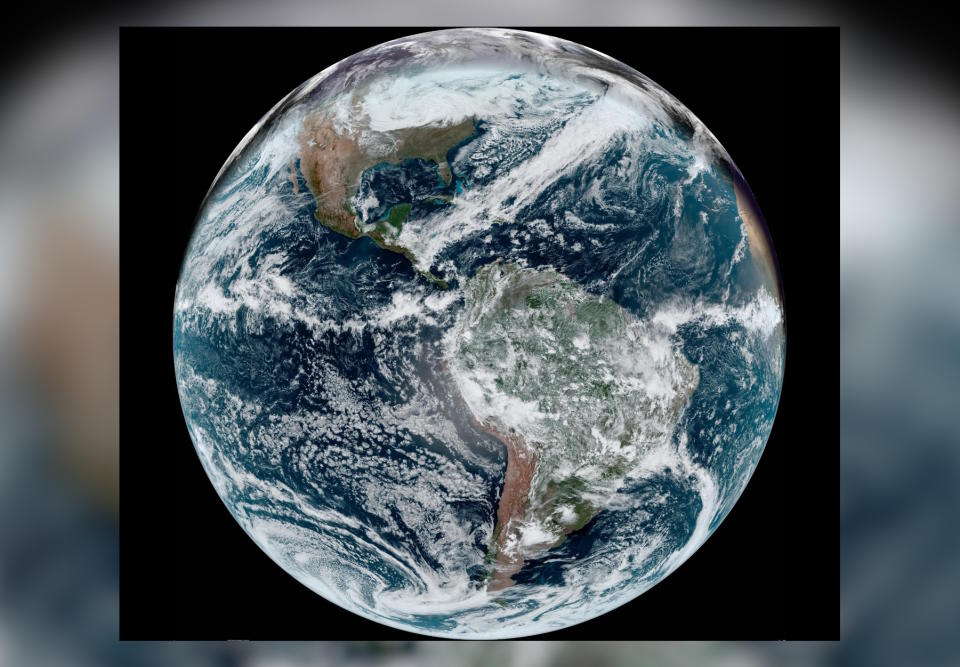
A full disk image of the Americas on December 31, 2023. (NOAA)
Floating in place nearly 36,000 km above the equator, the satellite GOES-East will have taken about 52,560 full-disk images of our planet by the final minutes of 2023.
Keeping watch over most of the western hemisphere, GOES-East and GOES-West are responsible for most of the satellite imagery we see on a daily basis. These workhorses captured millions of high-resolution closeups that witnessed tremendous supercells, scale-topping hurricanes, and almost every storm you experienced in this turbulent year.
This snapshot of our planet on New Year’s Eve reveals a stunning low-pressure system with an influence that stretches for thousands of kilometres from the tip of Greenland all the way down to Central America. That’s the same storm responsible for bringing freezing rain and ice to Atlantic Canada this weekend.
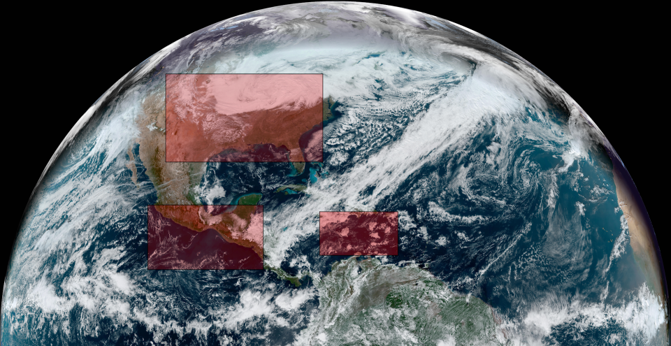
A satellite view of the northern hemisphere on December 31, 2023. (NOAA)
SEE ALSO: 2023 was the year of massive hail across North America
Zoom in, though, and you can see dozens of fascinating features that dot our everyday skies.
Take a look at the clipper system over the Great Lakes, for example. Low-hanging clouds lurking behind the storm cast a grey pall over the northern U.S. for the final day of the year.
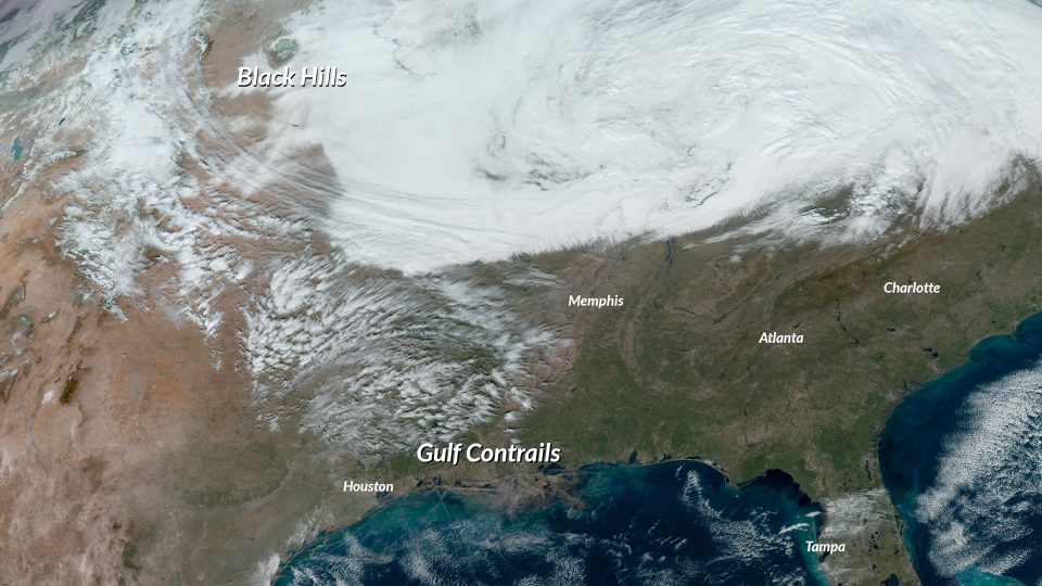
A satellite image of the U.S. on December 31, 2023. (NOAA)
But look a little closer and you can see the lush peaks of the Black Hills rising high over the gloomy clouds hugging the ground. The Black Hills of western South Dakota are home to some of the highest peaks in the United States east of the Rockies.
Just south of there is a grand streak of high-level clouds zipping across the centre of the U.S. These shredded cirrus clouds actually trace the outline of the jet stream feeding the clipper system its energy. The cirrus embedded in that fast-moving jet stream are trucking along at more than 150 km/h.
CHECK IT OUT: Millions to begin 2024 amid a historic, years-long snow drought
A sharp cutoff divides this snowy clipper system from crystal-clear skies over the southern half of the United States. Some of the only clouds in this clear sky are condensation trails, or contrails, formed by high-flying aircraft over the northern Gulf of Mexico. Higher humidity allowed the contrails to linger as cirrus clouds off the Louisiana coast.
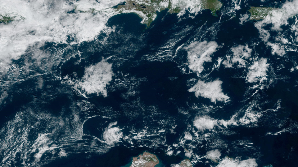
A visible satellite image of the Caribbean on December 31, 2023. (NOAA)
Look farther south and there’s hardly a trace of winter to be found. Daily showers and thunderstorms gurgle all year in the warm and humid air parked over the Caribbean Sea. A few of those bubbly showers on New Year's Eve popped up over the open waters.
When those showers fizzled out, the rush of cold air hitting the sultry air at the surface caused rope clouds to develop. Acting like mini cold fronts, these outflow winds scooped the humid air into a sharp cloud radiating away like a ripple on a pond.
A visible satellite image of the eastern Pacific on December 31, 2023. (NOAA)
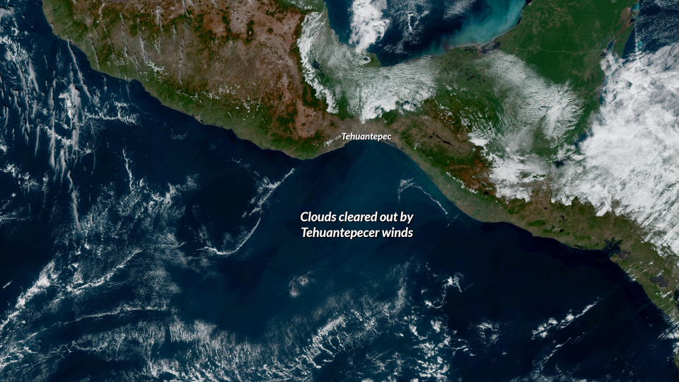
MUST SEE: Canada’s cold air brings Mexico some of Earth’s most violent winds
Travel a bit to the west and you’ll see the blustery Tehuantepecer winds churning over southern Mexico.
Cold winds speed up as they push between a tiny gap in the mountains here, leading to persistent gusty winds in the Pacific called the Tehuantepecer. We can see the extent of these gusty winds by the clearing left behind by those crisp gusts shoving the puffy fair-weather clouds aside.
Things are even interesting in one of the roughest and most remote places on the planet.
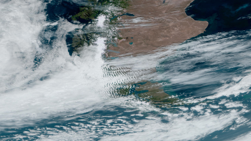
A visible satellite of southern South America on December 31, 2023. (NOAA)
Westerly winds blowing over South America’s Tierra del Fuego have to rise over the region’s rugged mountains before crashing over the other side of the continent. Gravity waves can form downwind from mountains as winds ripple away from the terrain like a disturbance in a creek.
Clouds often form at the crest of each ripple as rising air cools and condenses out its moisture, leaving behind an awesome display of gravity waves that can stretch for hundreds of kilometres.
Whether it's half a world away or right out your window, our skies are always full of incredible sights. Never forget to look up.
Header satellite image courtesy of NOAA.

