These epic fall hikes are within driving distance of Ohio
If you're like me, it's hard to stay indoors during the fall. Just let me pitch a tent under a canopy of reds, yellows and oranges and leave me there to be surrounded by the colors, the sweet-burnt scent, and the crisp air until November, please. Then ship me off somewhere the trees are still aflame with their fall foliage splendor.
Persistent favorites pumpkin spice, cozy sweaters and pumpkin patches all have their rightful place in autumn. But it's hiking for me when it comes to the best way to immerse into the simplest but most spectacular essence of the season: the oh-so-fleeting display of color. Autumn drives are wonderful, but a stroll through the woods forces you to slow your pace, look around, breathe, and take everything in, completely unplugged, engaging all five senses (taste if you have a warm drink bottled in a Thermos).
And perhaps, just for this season, "hike" should not be the word of choice, but instead "saunter." As John Muir famously said: "Now these mountains are our Holy Land, and we ought to saunter through them reverently, not 'hike' through them.”
And so here's a collection of some of the most epic hikes (saunters, whatever you'd like to call them), within driving distance of Ohio: A mix of single trails worth an entire trip, as well as entire parks and National Parks, where it's often too hard to choose just one favorite trail.
If you want to plan your trekking during optimal fall color, use this handy map.
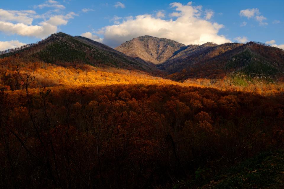
Linville Gorge Wilderness
North Carolina
From Akron 7 hours, 55 minutes
From Columbus: 7 hours, 20 minutes
From Cincinnati: 6 hours, 35 minutes
Linville Gorge Wilderness is so strikingly beautiful, it has been dubbed "The Grand Canyon of the East."
The stunning features of the Gorge were formed by the Linville River, which has cut 12 miles of the mountains 2,000 feet deep in areas, resulting in breathtaking views from Jonas Ridge and Linville Mountain, which rise 3,400 feet in elevation.
Start your adventure on a just-over-two-mile hike on Linville Falls Trail, or the 1.75-mile Linville Falls Plunge Basin Trail, which gets you up close and personal to the falls, before exploring the many trails in the Wilderness.
For views the whole hike: The exposed trail of Shortoff Mountain means spectacular vistas of Linville Gorge and Lake James for much of the trail's 5.5 mile (out and back) length. Most of the approximate 1,300-foot elevation gain is at the beginning of the climb. The trail levels out mostly for the last quarter or so, as it stretches along the summit and provides ample panoramic views. A word of advice: there are no trail markers for the beginning of this trail, or for many trails in the Linville Gorge Wilderness. It's a good idea to use a good GPS trail app like All Trails and download the trail map in advance to keep you on the right path.
Trails with less length but lovely views: Try the 2.5-mile Hawksbill Mountain Trail, or the 1.4-mile Table Rock Trail. For more of a challenge, the 5.9-mile Table Rock and The Chimneys from Spence Ridge hike is a leg-burning elevation gain with some fun scrambling. If multi-day, tough-and-rugged technical treks and wilderness camping is your thing, check out the beautiful 28.6-mile Linville Gorge Trail.
Linville Gorge lies about 60 miles northeast of Asheville, North Carolina which could provide the perfect base for this outdoor adventure if you're not up for camping and you enjoy being in civilization after a long day in the wilderness.
Black Balsam Knob to Tennent Mountain on the Art Loeb Trail
North Carolina
From Akron: 8 hours, 45 minutes
From Columbus: 7 hours, 45 minutes
From Cincinnati: 6 hours
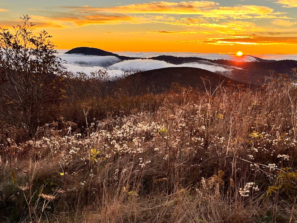
If hiking through wildflowers on a grassy mountain balds surrounded by panoramic views sounds like your thing (and what hikers' thing wouldn't that be), get on this trail ASAP. Another incredible hike to tack on to a trip to Asheville, North Carolina, and one of my very favorites within driving distance of my home: this pretty hike gives off serious Sound of Music vibes thanks to a trail that is mostly exposed across 6,000-foot mountain balds.
A 45-minute drive south of Asheville, the 1.5-mile trail begins off the Blue Ridge parkway at the Art Loeb Trailhead. You'll begin walking in a cool, heady-scented Balsam fir forest before ascending Black Balsam Knob. After you reach the summit, and you've gotten all your Maria von Trapp-esque twirling in, you can hike back or continue the adventure to Tennent Mountain along the trail's almost-5-mile loop.
Grandfather Trail to Calloway Peak
North Carolina
From Akron: 7 hours, 25 minutes
From Columbus: 7 hours, 12 minutes
From Cincinnati: 6 hours, 20 minutes
It's an ascent that inspired the father of the National Parks, John Muir, to "jump about and sing and glory in it all," and exclaim that he was standing "in the face of all Heaven come to earth."
But the Grandfather Trail, while incredible, is not for the faint of heart (or those with a fear of heights): the 4.1 out-and-back Grandfather Trail is for experienced hikers only. If you like to hike with your young children and pets, this is not the trail to bring them along.
It's challenging, strenuous and obstacle-filled. Hikers on this trail face ladders for scaling huge cliff faces, and cable hand rails for ascending super steep sections. There's rock scrambles and treks along exposed rock-strewn summits, and an elevation gain of almost 2,000 feet. It's dangerous, it will get your heart thumping and your legs burning. But it's one of the most spectacular hikes in North Carolina.
The payoff is gorgeous sweeping vistas not just at the pinnacle, but all along the trail, a few of which are 360-degree panoramas.
It is possible to bypass the ladders on MacRae Peak by taking the Underwood Trail about .5 miles in. This trail is also a great option for the return hike.
Bring plenty of water. Bring food. And plan on a full day for this hike, despite the mileage.
There is an admission fee of $24 for adults, $22 for seniors and $9 for children to hike this trail.
It's also under an hour's drive from Linville Gorge Wilderness, making it a perfect addition to a trip to the area.
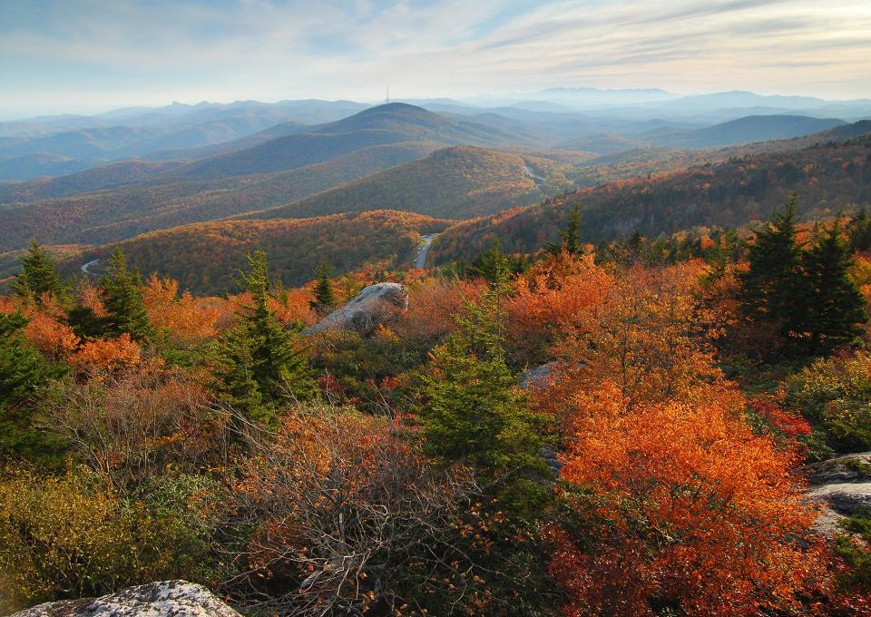
Red River Gorge Geological Area
Kentucky
From Akron: 5 hours, 30 minutes
From Columbus: 3 hours, 45 minutes
From Cincinnati: 2 hours
It seems like a lot of people have their secrets about this place: hidden trails and their own secret spots. While those places are probably worth checking out, many are not on marked trails, and some of them are pretty dangerous. It's worth my acknowledging they exist, but I'll keep the recommendations to the official trails.
Like the Cloudsplitter via Sheltowee Connector Trail, a 4-miler which packs as much fun as you can possibly have in this area of the world on a hiking trail.
There's a nice rope bridge on this one, and for those who dare, Jump Rock, a boulder sticking out of the Red River. There's a swimming hole there, and like the name suggests, folks like to jump from the rock into the water below (at their own risk).
Some bouldering is required at the end of the trail, too, but a rope is usually secured in the section where it's needed.
Double Arch, Courthouse Rock and Auxier Ridge Loop is a classic. It was the first trail I experienced in the Gorge, and it's still one of my favorites in the area. The 6-mile loop is packed with exposed trail, a natural bridge and lovely lookouts of the gorge and the many outcroppings carved by the Red River.
If you're looking for a shorter hike, there are several that lead to natural bridges (think Arches National Park in Utah but surrounded by the forest). Natural Bridge and Laurel Ridge Trail is an easy 3 miler, or Princess Arch and Little Princess Arch, only a third of a mile.
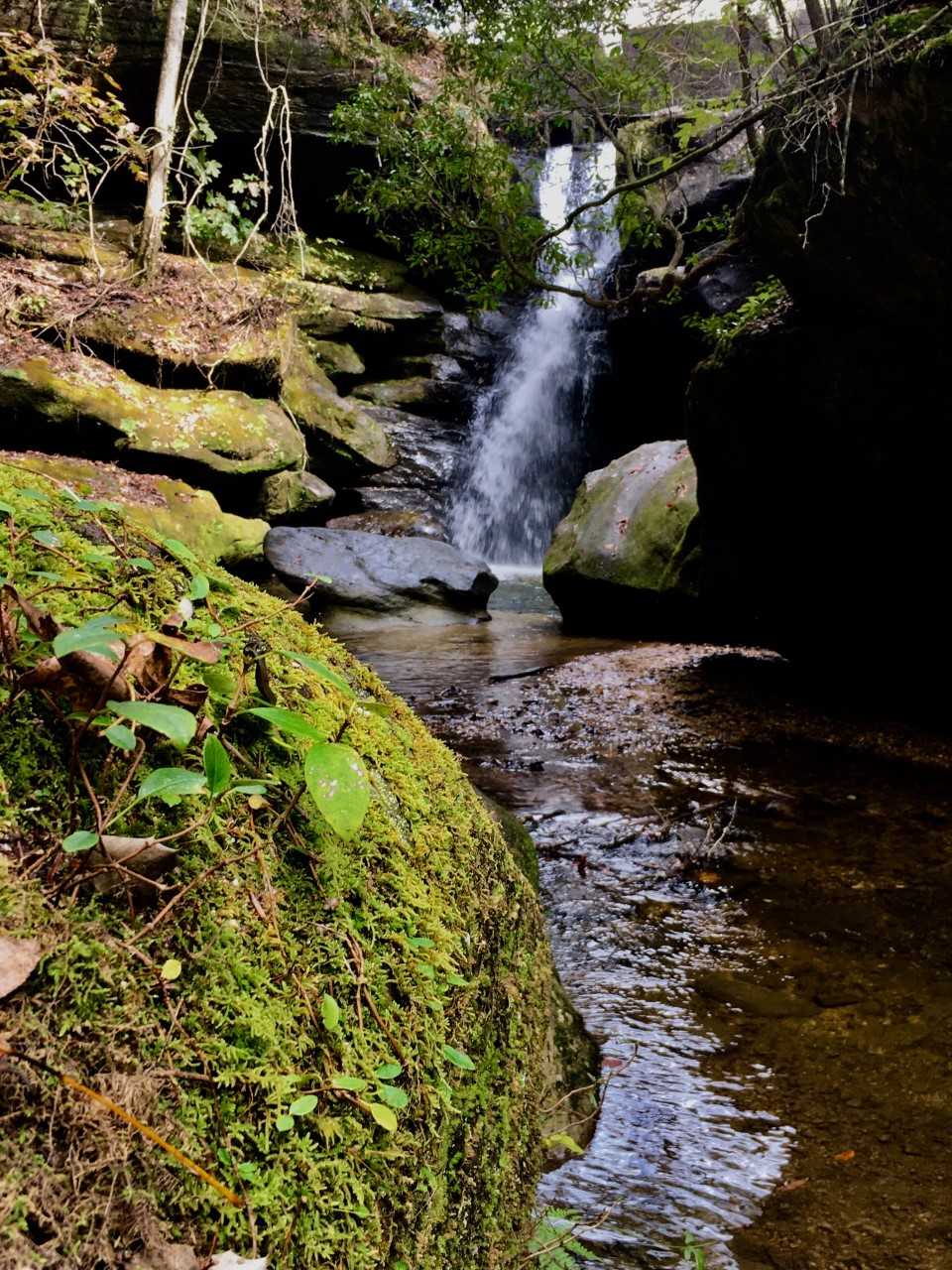
Carpenter Trail, Falling Sink Trail, Mill Trail loop, Bethel Spring Nature Preserve, Alabama
Alabama
From Akron: 9 hours, 55 minutes
From Columbus: 8 hours, 10 minutes
From Cincinnati: 6 hours, 30 minutes
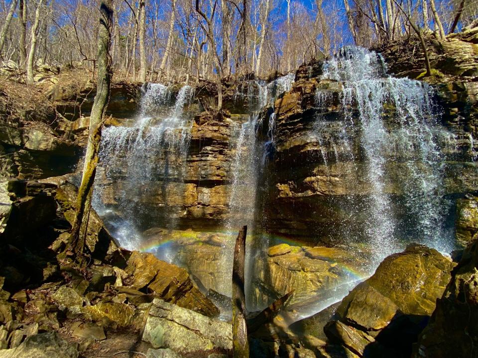
This absolute hidden gem of a waterfall was on land owned privately by a family for generations until 2020, when the land was donated as a nature preserve. The falls was not well known until the preserve opened. A friend of mine who has lived in the area for about 20 years had no idea this was right just down the street from her home until recently.
The hike is a moderate 1.3-mile loop, and winds up Keel Mountain, along a forested trail strewn with the ruins of old water mills and boulders to a spectacular waterfall that plunges into a cavern below (in other words, a big hole in the ground). I do not exaggerate when I say that this is one of the coolest waterfalls I've ever seen. The cave underneath the falls, Paul’s Cave, 1,338 feet in length and 334 feet in depth, according to the Alabama Cave Survey and the Land Trust of North Alabama. Two other caves are also located on the preserve.
Combine it with other hikes for a long weekend trip to Alabama, including this next one.
Dismals Canyon
Alabama
From Akron: 10 hours, 24 minutes
From Columbus: 8 hours, 40 minutes
From Cincinnati: 6 hours, 57 minutes
On a good night, this canyon tucked away in northwest Alabama lights up like the starry night sky. While this place is already beautiful on its own, and totally worth a daytime hike, it's made extra special at night thanks to glow worms.
It's one of the few places in the world that provides a microclimate suitable for bioluminescent critters called Dismalites to thrive, and peak season only occurs a few times during the year - from late April through May and the end of September through the first of October.
Night tours are very limited, and times change throughout the year. Reservations can be made here.
Hiking is beautiful during the day too in this biodiverse National Natural Landmark. A 1.5-mile trail follows the deep canyon along a stream, where massive boulders and tumbling waterfalls can be discovered.
What to know if you visit:
Admission is charged, and varies depending on activity.
A country store and soda fountain and grill are also available to explore.
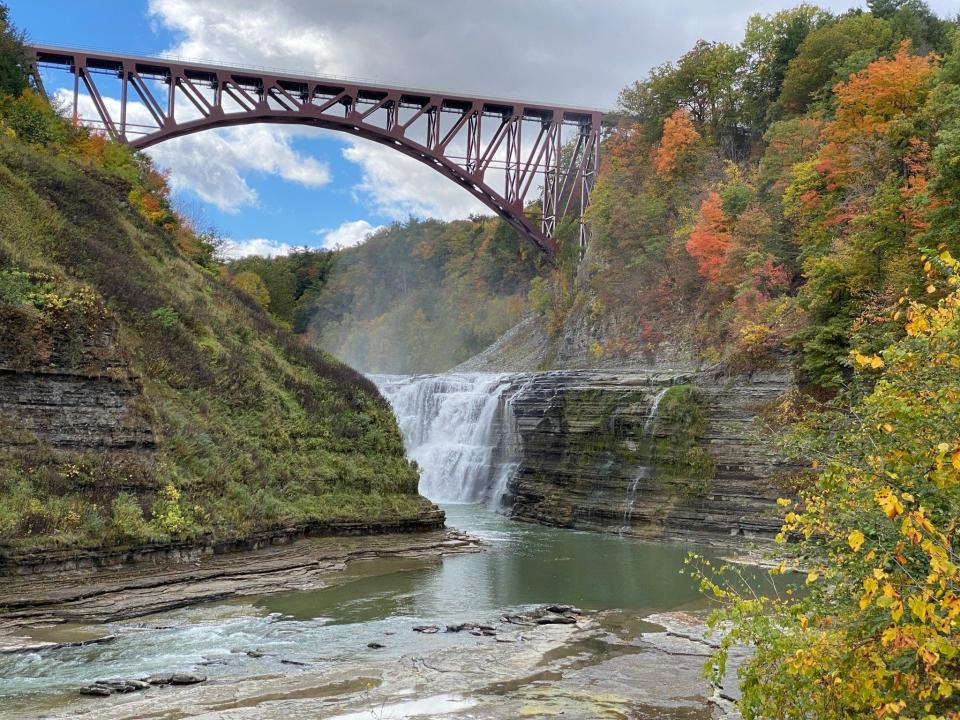
Letchworth State Park
New York
From Akron: 4 hours, 15 minutes
From Columbus: 5 hours, 40 minutes
From Cincinnati: 7 hours, 25 minutes
I think it's safe to say that if a park is compared to the Grand Canyon, it's probably worth your time. Just like Linville Gorge Wilderness, Letchworth State Park has also earned itself the nickname of "The Grand Canyon of the East," and it's easy to see why.
The Genessee River has cut deep gorges here, and flows with three impressive waterfalls. Autumn, of course adds a special touch to any view, but the scenery here is especially stunning in the fall, when the colors lend extra depth to the vistas.
Hikers have 66 miles of trail to choose from,
Overlooks are something you don't want to miss here, either. Inspiration Point offers views straight down the gorge, Middle Falls and Upper Falls and the railroad bridge. View a a horseshoe bend on the river at the Great Bend Overlook
North Fork Mountain Trail to Chimney Top
West Virginia
From Akron: 5 hours
From Columbus: 5 hours
From Cincinnati: 6 hours, 25 minutes
An unrelenting uphill hike leads to some of the best views in the state on this challenging trail up North Fork Mountain in Monongahela National Forest, which clocks in at 5.3 miles out and back.
Even the steep last stretch of the ascent, which will set your legs on fire, is worth the views of the mountaintop ridgeline reaching out for ages one way, and the mountains unfolding in every other direction. Take it all in while you perch (precariously, but carefully) atop the chimney top. Many call this a bucket list hike, and they're not exaggerating.
This trail isn't clearly marked in areas. The turnoff to the final ascent is marked with small rocks in the shape of an arrow. I'd advise using an app like AllTrails and downloading the route in advance to ensure you stay on the trail.
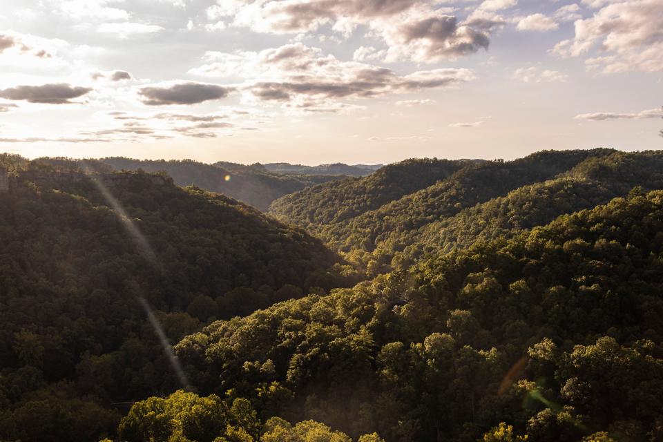
New River Gorge National Park and Preserve
West Virginia
From Akron: 4 hours, 53 minutes
From Columbus: 4 hours, 20 minutes
From Cincinnati: 5 hours, 3 minutes
With its newly minted status as a National Park, highlighter ink has been drawn over this gorgeous region of steeply sloping canyons descending into river. According to WV Public Broadcasting, the park saw a record number of visitors in 2021 at 1.7 million, a 600,000 increase from 2020.
Possibly the park's most famous landmark is the New River Gorge Bridge, the longest steel bridge in the Western Hemisphere. If you head to the park the third October for Bridge Day, the bridge is open for a big party. Pedestrians, vendors, BASE jumpers and rappelers line the bridge for a day of festivities.
Another dramatic site: Grandview, which looks over a horseshoe bend in the New River from 1,400 feet. It makes for a spectacular picnic spot, and with five trailheads, a perfect jump-off point for a day of hiking the Grandview Area Trails, which offer 6 miles of hiking and the best views in the park.
The Fayetteville Area Trails have some beautiful views, or take an easy .2 miles stroll to the cascading Sandstone Falls on the New River.
The region is also widely known for its excellent whitewater rafting opportunities on New River and Gauley River. There's plenty of rafting companies to choose from right near the park.
Bonus: If your trip takes you through the state capitol of Charleston, just under two hours northwest of the park, it's a pretty little town worth exploring. Nestled on the banks of the Kanawha River, impressive historic homes line the water, and Historic Capitol Street has boutiques, restaurants and tree-lined streets.
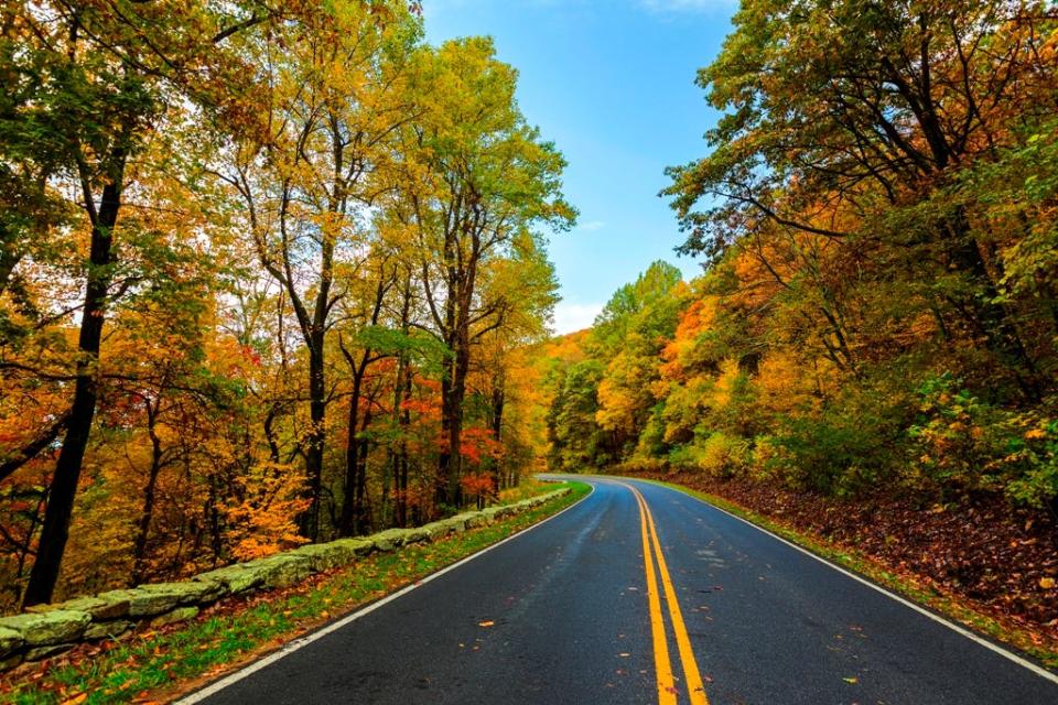
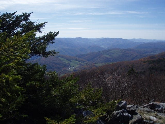
Shenandoah National Park
Virginia
From Akron: 5 hours, 23 minutes
From Columbus: 6 hours, 5 minutes
From Cincinnati: 6 hours, 51 minutes
Ohio adventurers looking for mountains within driving distance and to who want to skip the manic, touristy atmosphere surrounding the Great Smoky Mountains might want to consider Shenandoah National Park.
This patch of the Blue Ridge Mountains is also flowing with waterfalls and stunning views. The Skyline Drive alone is a full day adventure at 105 miles long and with 75 overlooks as it winds along on the peaks of the range. The drive gets especially showy in the fall, when the mountains come alive in autumn color.
And hikers rejoice: there's more than 500 miles of trails in this park to choose from.
For a challenge: the 9.5-mile Old Rag Mountain Loop Trail, touted repeatedly on AllTrails as worth the hype and "brutally awesome," get ready to scramble rocks, but bask in 360-degree views.
Blackrock Summit is much milder, with a 1-mile circuit and more gorgeous views. Or try Bearfence Rock Scramble, still a rock scramble but much shorter that ends in more 260 degree views. noticing a pattern with this park and the number 360?
If waterfalls are more your speed, there are many trails that lead to some beautiful cascades, ranging from the 6.5 mile hike to Browns Gap to the 1.3 mile walk to Lands Run Falls.
Great Smoky Mountains National Park
Tennessee/North Carolina
From Akron: 7 hours, 52 minutes
From Columbus: 6 hours, 15 minutes
From Cincinnati: 4 hours, 30 minutes
Yes it's extremely popular and sometimes way overcrowded, especially in the fall. Chances are you've been there countless times. But that doesn't make it any less beautiful.
Probably the most popular, touristy and most crowded park on the list, the Great Smoky Mountains, this is a highly customizable trip. Make it a foodie trip, with the myriad of restaurants in the area (the Pancake Pantry is my go-to. It hasn't changed since I was a kid). Go moonshine and wine sampling at the many stops along the Gatlinburg strip. Play at arcades and go kart tracks, aquariums and silly museums in Pigeon Forge and Gatlinburg. Or get away from the crowds as quickly as possible and into the peaceful mountains that seem worlds away from the touristy stuff.
There are countless great trails in the area. For the more adventurous, the hike to the top of Mount Le Conte is iconic, and you can stay in the highest lodge in the eastern US on the peak. You'll be seeing by kerosene lantern at dark, bathing in bucket and basin, and dining on family-style meals. Six trails lead to the top, ranging from the steep 5-mile Alum Cave Trail to the 9.1-mile Brushy Mountain Trail.
For the views: Hike the Appalachian trail for a bit on the 8-mile round trip trek of Newfound Gap to Charlie's Bunyon, one of the park's most stunning viewpoints. the 14.5-mile out-and-back Mount Cammerer Trail, which ends in a lookout tower with 360-degree views.
The less ruggedly-outdoorsy among us can check out Clingman's Dome, the highest point in the park and third highest east of the Missisippi River at 6,643, and features a paved path to an impressive view. Countless smaller, easy paths can be found throughout the park, too, featuring waterfalls (Laurel Falls and Grotto Falls among them).
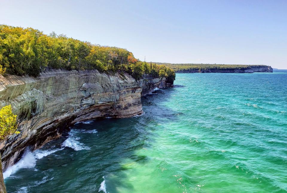
Pictured Rocks National Lakeshore
Upper Peninsula of Michigan
From Akron: 8 hours, 31 minutes
From Columbus: 8 hours, 39 minutes
From Cincinnati: 9 hours, 22 minutes
Sure, not everyone will be up for this lengthy road trip, but if long drives are your thing, there are not many destinations as remote, peaceful and laid back as Upper Peninsula Michigan (the U.P. for those who know) the swath of Michigan that lies next to Lake Superior, and is separated completely by the rest of mainland Michigan by Lake Michigan and Lake Huron. It's perfect for unplugging. Pro tip: break up the trip and stop at Sleeping Bear Dunes along the way.
Pictured Rocks National Lakeshore looks like something transplanted either from the Pacific Northwest or the Caribbean, with its cliffs towering above turquoise water and shipwrecks scattered about. The dramatic Bridalveil Falls and Spray Falls plunge from the cliffs into the lake. The more adventurous can book a kayak tour of the cliffs. Looking to relax? Charter a lunch cruise.
On the shore, there is more to see than the cliffs, including about 100 miles of trails to explore, and even more waterfalls, including the 75-foot Sable Falls, accessible via an easy .6 mile trail. The impressive Grand Sable Dunes also lie within the lakeshore, and are totally hikeable. There's nothing quite like ascending a sandy trail among groves of pine trees to a massive sand dune peak overlooking a sea of massive sand dunes and a great lake.
A half dozen beaches line the shores in Pictured Rocks. Some require a little hiking, others are easy access from a parking lot. Beware: there are no lifeguards at these beaches, there are rip currents on the lake, and water temps rarely surpass the 60s.
While the area near Munising and the Pictured Rocks can get a little busy, there are plenty of quiet, lightly-trafficked trails and areas of the Lakeshore region to be explored. We spent a hushed, dreamy day relaxing in the meadows surrounding Au Sable Lighthouse, a picturesque light perched atop a cliff and situated in a meadow. It can be reached by an easy 1.5 (one way) hike. Exposed shipwrecks can be seen on the shore below, and the light can be climbed.
What should I bring on a fall hike?
First of all, dress in layers. Avoid cotton, as it holds in moisture and sweat. If the temperature drops, that moisture can cause your body to lose heat, or worse − hypothermia. I like to like with a lightweight tank top as my base layer. I'll layer a lightweight thermal over that, and bring a lightweight and/or heavyweight fleece, depending on the weather forecast. Wool socks like ones from Smartwool are wonderful and temperature-regulating in all temps. Bring an extra pair in case your feet get soggy. And don't forget a good, packable rain jacket in case the weather calls for rain. A packable sunhat or ball cap and bandana are great for sun protection. Last but not least, water. Hydration is just as important in chilly weather as it is on warm days.
If you invest in any gear please, consider investing in a small backpack, proper shoes, a water bottle or bladder and first aid kit.
I've seen so many people on treacherous trails in slippery converse or worse, flip flops struggling to avoid a fall. Affordable, gently used shoes with nice grippy soles that ensure you stay sure-footed can be found at places such as REI.com Re/Supply or geartrade.com for a fraction of the price.
Equally important is a good first aid kit, which comes in handy for everything from blisters and bee stings to heavy bleeding.
I'm a sucker for fun hiking gear. From shoes to packs, hiking packs and rain jackets, I have amassed a nice little collection of goods for my outdoor adventures. And I'm always looking for top-quality, expertly-tested gear at the best possible price.
One of my favorite ways to do that is to read up on tried and tested gear on websites like Outdoor Gear Lab and Gear Junkie. Websites like this are dedicated to testing the gear for days and picking out the best of the best.
To save money, I don't just stick to the current year's reviews. I'll look up the past couple years' top gear (most of which is equal in quality as the current year) before scouring sources such as Poshmark, eBay and Google for markdowns (just be wary of fakes, especially with more popular brands like North Face). I've always been quite happy with the gear I've found: a fabulous windbreaker which kept me quite comfy on a boat in the San Francisco Bay; a rain jacket that kept me bone dry in Scotland's heavy rain. Several breathable yet toasty fleece jackets that have kept me warm and comfortable on many hikes through crazy sleet-one-minute-sunshine-the next weather in the Colorado mountains and late winter runs through my local park. The toastiest socks for skiing for my popsicle-prone toes.
REI is also an excellent source for gear, and their $20 for life membership is well worth the price. It literally pays dividends from the past year's purchases, and includes a one year return policy. Their house brand is top-notch too.
This article originally appeared on Cincinnati Enquirer: Where to go hiking near Ohio for the best fall foliage

