Eugene's best kept waterfall secret: Upper Trestle Creek Falls Trail
Waterfalls are like Subarus in western Oregon: They’re everywhere. Despite their abundance, it's still hard not to be thrilled when you see one for the first time.
In an hour’s drive southeast of Eugene — and 30 miles from Cottage Grove — you can find one you won’t soon forget. In 3 miles out and back, or 5 miles if you’ve got time for a full loop, you’ll find your way to the two-tier, 65-foot, Upper Trestle Creek Falls, nestled between old growth forest and a towering, moss-covered grotto.
Trestle Creek Falls Trail is open year-round and offers access to both the upper and lower falls if you complete the entire 5-mile loop, which connects with the Brice Creek Trail to bring you back to the parking area. The trailhead is located on Forest Road 22, which is a continuation of Brice Creek Road east of Dorena Lake.
The hike
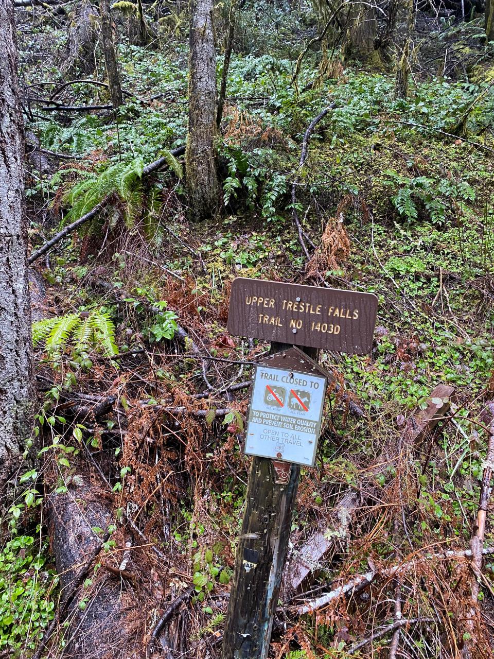
For the sake of timing, I elected to take the out and back option to the upper falls. You can start this hike at the trailhead about 50 feet east of the Brice Creek Road bridge on NF-22. There are numerous gravel parking pull-offs in the area and a wooden sign next to the trail to let you know you’re in the right spot.
A map of the area can be found at bit.ly/3niAFG9
The moderately-difficult Upper Trestle Creek Falls Trail ascends 1,000 feet in elevation through a dense forested ravine before meeting the base of the upper waterfall. The trail is comprised of two steep, long switchbacks which make up the route to the upper falls. The trail can be slippery, so be sure to wear adequate footwear.
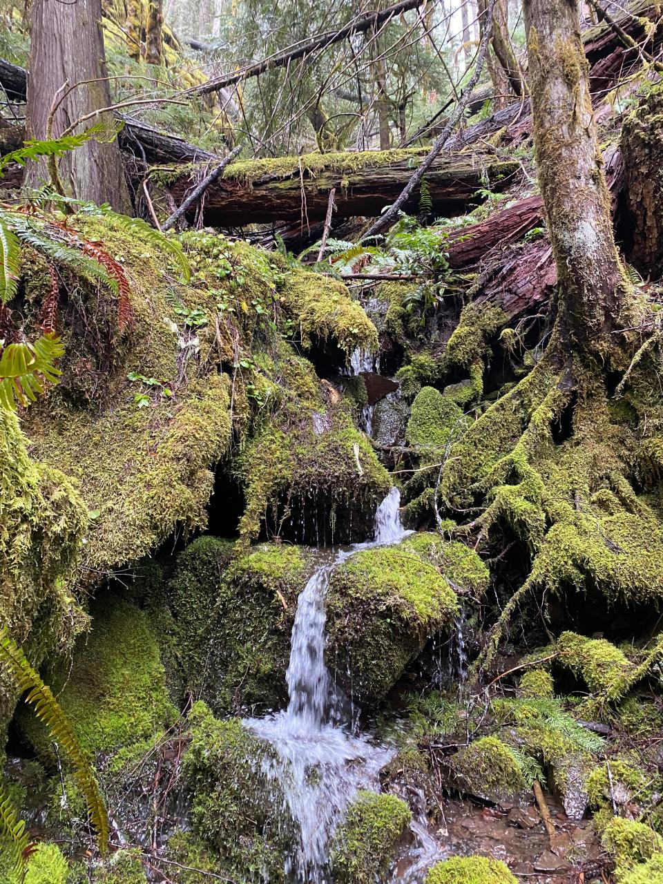
On the way up to the falls, the path crosses several flowing springs that create shallow, muddy pools on the trail, so be prepared with a trusted pair of waterproof hiking boots.
If you’re expecting weather, dress warm and rain-repellent, as hail and mixed precipitation can be common in the area during the winter and early spring.
For the first half mile, you’ll follow a steady incline directly east. You’ll be able to see crystal-clear Brice Creek rippling below to your right.
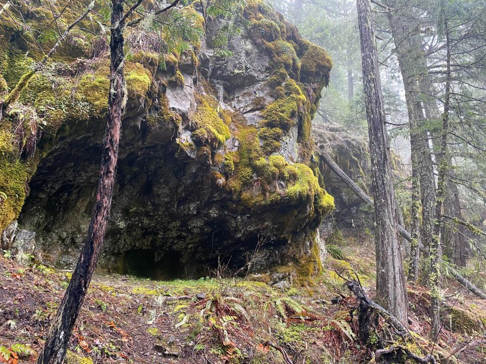
At the end of the first long switchback, about a half-mile in, the trail turns and parallels a steep cliff. Numerous deep caves obscured by dense vegetation and moss can be spotted alongside the trail, some of which have small paths to view them. The Forest Service warns guests of poison oak in this area.
Soon thereafter, the path turns slightly north, and becomes more gradual for the remainder of the ascent to the upper falls. You’ll lose sight of Brice Creek on this section of the trail, but it won’t be long before you spot the rippling Trestle Creek at the bottom of the steep ravine to your left.
Continuing up the trail, you’ll parallel the stream below. Rounding a corner, you’ll enter a rocky enclave, which at its deepest point houses the upper falls. At this point, you’ll be in striking distance of the falls, but the views and sounds only get better. In the fall and spring, the waterfall will be at its fullest, and its consistent roar is as deafening as it is striking.
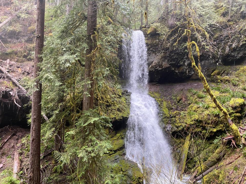
At mile 1.5, the trail winds under and behind the waterfall, marking the top of the loop if you choose to continue. I turned around here and went back the way I came, but set aside 30 minutes to snap some photos, hydrate and relax by the roaring waterfall.
For those wishing to continue, simply follow the trail as it winds beneath the falls. The way down the west side of the loop will be a near-precise mirror of the east, while also providing access to the lower falls on your way back.
A shorter trip
Hikers seeking an abbreviated experience can go directly to the lower falls by starting up the Brice Creek Trail, which begins adjacent the Upper Trestle Creek Falls Trail and is only 0.7 miles to complete. After taking the Brice Creek Trail, hikers will continue straight until crossing a wooden bridge and coming to the Trestle Creek Junction, where a right turn takes them directly to the lower falls.
Information for the shorter, lower falls trail can be found at bit.ly/3oFPT8w
Upper Trestle Creek Falls Trail
In a nutshell: A gradually steep trail through dense, mossy old growth forest with views of a 65-foot, tiered waterfall.
Trip: Three miles out and back, or a 5-mile loop.
Location: 30 miles southeast of Cottage Grove on National Forest Road 22, a continuation of Brice Creek Road east of Disston.
Trailhead: Upper Trestle Creek Trail #1403D.
Weather: The trail is largely covered by thick vegetation, so this hike is doable year-round. However, winter and early spring can be unpredictable so be sure to check the weather before heading up.
When to go: There is medium to low traffic on this trail, but if you want the place to yourself, head up on a weekday.
Fee: No fee.
Map: A map and further information can be found on page 50 at bit.ly/41Loh0y
Directions: Follow signs for Dorena Lake from Cottage Grove, following Row River Road. Going through the town of Disston, the road becomes Brice Creek Road. Continue following the road another 7.5 miles and after crossing the Brice Creek bridge, the trailhead will be on your left.
Charles Gearing is an outdoors journalism intern for the Statesman Journal. He can be reached at cgearing@gannett.com.
This article originally appeared on Salem Statesman Journal: Hike the Upper Trestle Creek Falls Trail near Eugene, Oregon

