Exact location of the fire on the Air Force Academy
(COLORADO SPRINGS) – Using a photo shared by the Colorado Springs Fire Department and some analysis with Google Earth, it’s possible to accurately pinpoint the location of the fire burning on the United States Air Force Academy (USAFA) as of Sunday evening.
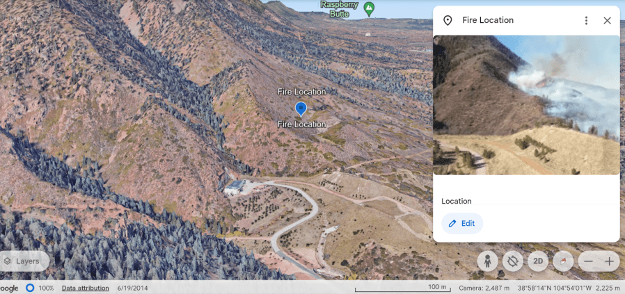
In the image above (CSFD drone photo on right side of image) note the paved and dirt roads, and the shape of the clump of trees paralleling the road. These markers in the photo help us determine the fire location on the map in Google Earth. The fire is near the mouth of the West Monument Creek canyon.
NEW COVERAGE: Crews battle West Monument Creek Fire by air and ground resources
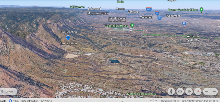
The photo below looking due north shows several important landmarks in relation to the fire location, including the Cadet area at the USAFA (field house, chapel), and the northern fringes of the Peregrine neighborhood in northern Colorado Springs just to the west of the labeled Marshall Sprague Park.
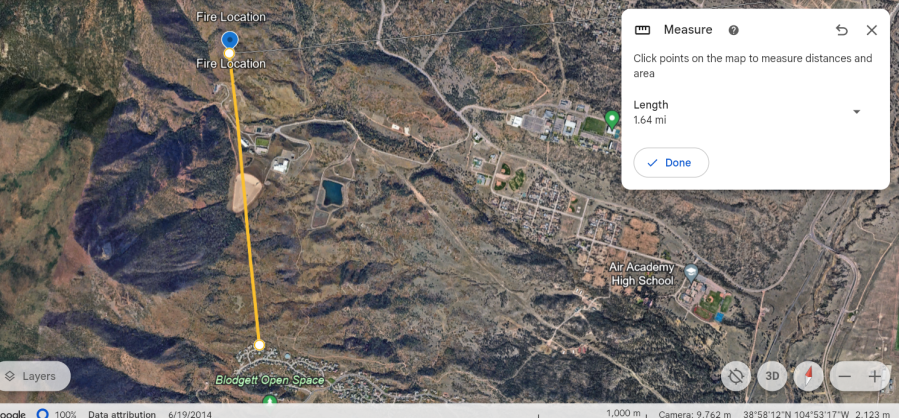
Mapping tools within the online program allow us to measure the approximate distance from the northern most homes of Peregrine to the fires location: approximately 1.64 miles.
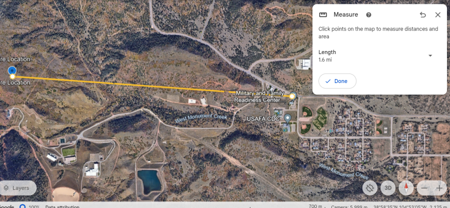
The mapping tools also allow us to measure the distance from the fire to the Military Family and Readiness Center on the Academy: approximately 1.6 miles. Air Academy High School is located underneath the “measure info box” and is located just northeast of the Military and Family Readiness Center. These buildings and the ball fields are on the western edge of the Pine Valley neighborhood on the Academy.
Wind gusts have been out of the west through Sunday afternoon on the Air Force Academy between 35 and 45 mph using several weather sensors in the area. One is located east of the fire at the USAFA airfield and one is above the fire to the southwest on the Rampart Range.
For the latest news, weather, sports, and streaming video, head to FOX21 News Colorado.

