Expect travel delays Sunday as sneaky snow threatens Toronto, Hamilton
Prepare for likely travel delays and rapidly changing conditions as a sharp snowfall gradient develops across southern Ontario on Sunday.
The northern edge of a moisture-packed system grazing the region will allow steady snow to spill into the Greater Toronto and Hamilton Area (GTHA) during the day Sunday.
A sharp cutoff on the north side of the system will divide the region between a blanket of snow and conversational flakes at best. Unfortunately, that cutoff will slice right through the densely populated GTHA—a tough setup for millions of people.
DON’T MISS: El Niño is hanging strong—but a big change is on the way
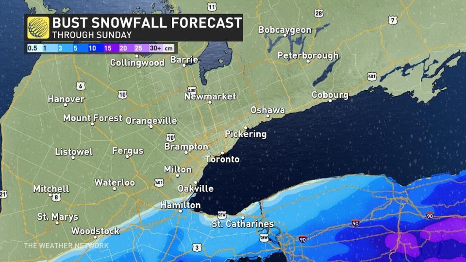
Sharp cutoff in snow totals expected on Sunday
A soggy low-pressure system developing over the central United States on Saturday will push toward the eastern Great Lakes during the day Sunday.
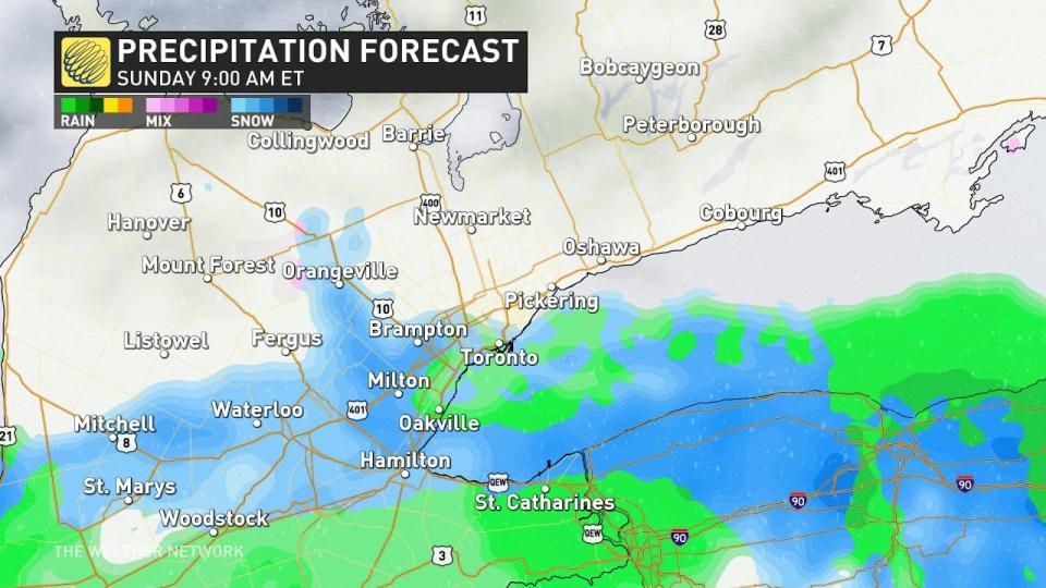
We’ll start to feel this moisture-packed system’s influence as its precipitation begins pushing into southern Ontario early Sunday. Light snow will reach the Golden Horseshoe—the western end of Lake Ontario—through the early morning hours.
Snowfall rates will increase around noon on Sunday with accumulating snow likely around Burlington, Hamilton, and east along the QEW toward St. Catharines and the length of the Niagara Peninsula. The steady snowfall should be able to accumulate despite temperatures hovering around the freezing mark.
This snow will continue for several hours Sunday afternoon before slowly waning from west to east. Snow will finally taper off on the Niagara Peninsula around sunset on Sunday.
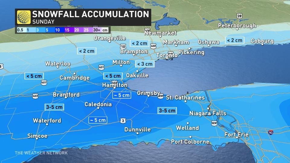
Our best chance for accumulating snow will fall along and south of the 403, with widespread totals of about 5 cm by Sunday evening.
Things start to get tricky closer to the city of Toronto, which will fall on the very northern extent of the snowfall.
“Boom” and “bust” scenarios
The edge of the snowfall moving a dozen kilometres in either direction would have a significant impact on accumulations across Toronto proper and communities like Oakville, Mississauga, and Burlington.
If the storm moves a little too far south, these areas may see a dusting at best. But a tiny nudge toward the north and Torontonians may have to dust off the snow shovels.
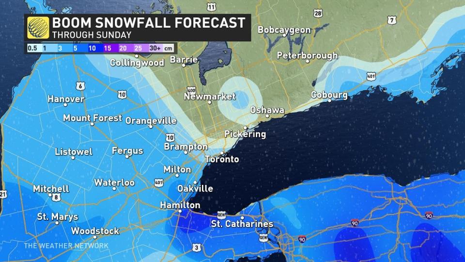
We can see this range of potential outcomes in the models. A northward jog would bring accumulations closer to the city itself, resulting in a “boom” scenario that could bring a few centimetres of snow to the Greater Toronto Area with a potential for 10 cm for pockets of the Niagara area.
However, if the precipitation struggles to push north, we could see a “bust” scenario in which Toronto and Oakville miss out on any snow at all, with only a few centimetres of snow falling on Hamilton and the Niagara Peninsula.
STAY SAFE: Snow paradox: Why 2 cm of snow can actually be worse than 25 cm
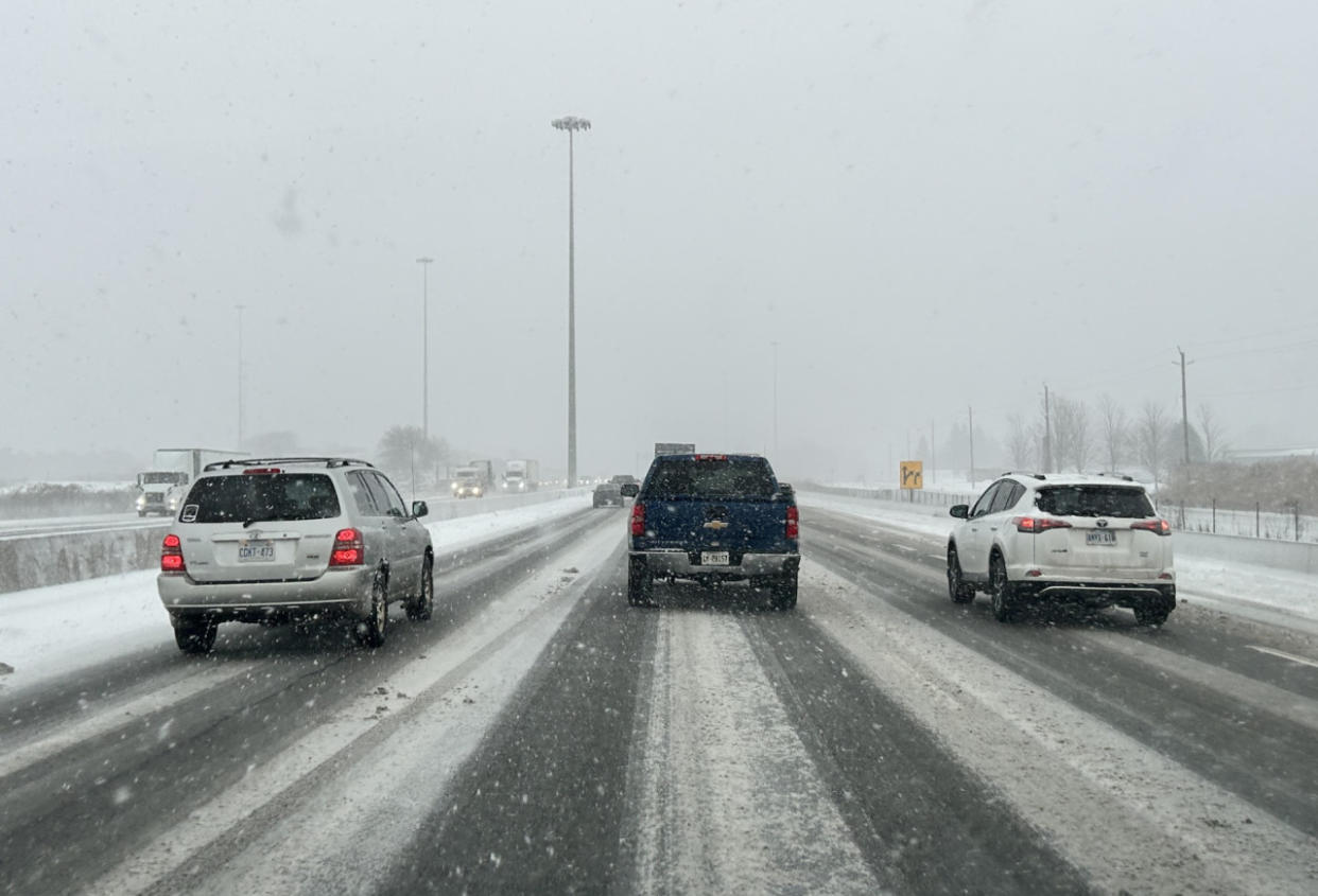
Given the real potential for wet snow falling on the roads, prepare for travel issues throughout the GTHA beginning Sunday morning and lasting through the evening hours. A thin coating of wet snow on the roads increases the danger of slipping and sliding.
Conditions should improve a bit for travellers and commuters hoping for a smooth Monday. Daytime temperatures across the region will rise above the freezing mark Monday afternoon, allowing most—if not all—of Sunday’s snow to melt.
Looking ahead, above-seasonal temperatures will persist across the region next week and into the beginning of February. A few clippers may affect the region with minor impacts next week.
Despite the relentless above-seasonal conditions we’ve seen this season, winter’s still got some gas left in the tank. Forecasters are watching the potential for a pattern flip by the middle of February to bring a return to classic winter cold.
Stay with The Weather Network for your latest forecast across Ontario.

