How to explore California's wild East Bay, its wildflowers, scenic sites and hikes
Exploring backroads: I inherited my love of exploration from my parents.
On weekend drives in Ohio, my dad would find a lonely road he’d never seen and announce, “let’s see where this takes us.” Off we would go. My mom packed my two brothers and me in the back of a Ford station wagon in 1962 towing a tiny tent trailer, and set off from Ohio across the United States, following Route 66 to Texas and the Grand Canyon and on to California, where my dad flew in to join us. As we continued on to Yellowstone, the Black Hills and home, we explored seemingly every back road in the west on that trip. I was hooked for life on the Western states.
Follow along on an exploration of the lovely East Bay parks just 40-60 miles west of San Joaquin County. Our route follows favorite backroads, heading west of Stockton on Highway 4, south on the Byron Highway to Byron, then west on the backroads of Camino Diablo and Marsh Creek Roads to Round Valley Regional Preserve. If you’re seeking a place for food headed to Round Valley, try Wild Idol Saloon on Main Street, an historic biker bar and grill in what remains of historic downtown Byron, or, Union Point Marina, Bar and Grill, on Delta on Highway 4. Both offer good food in unique surroundings.
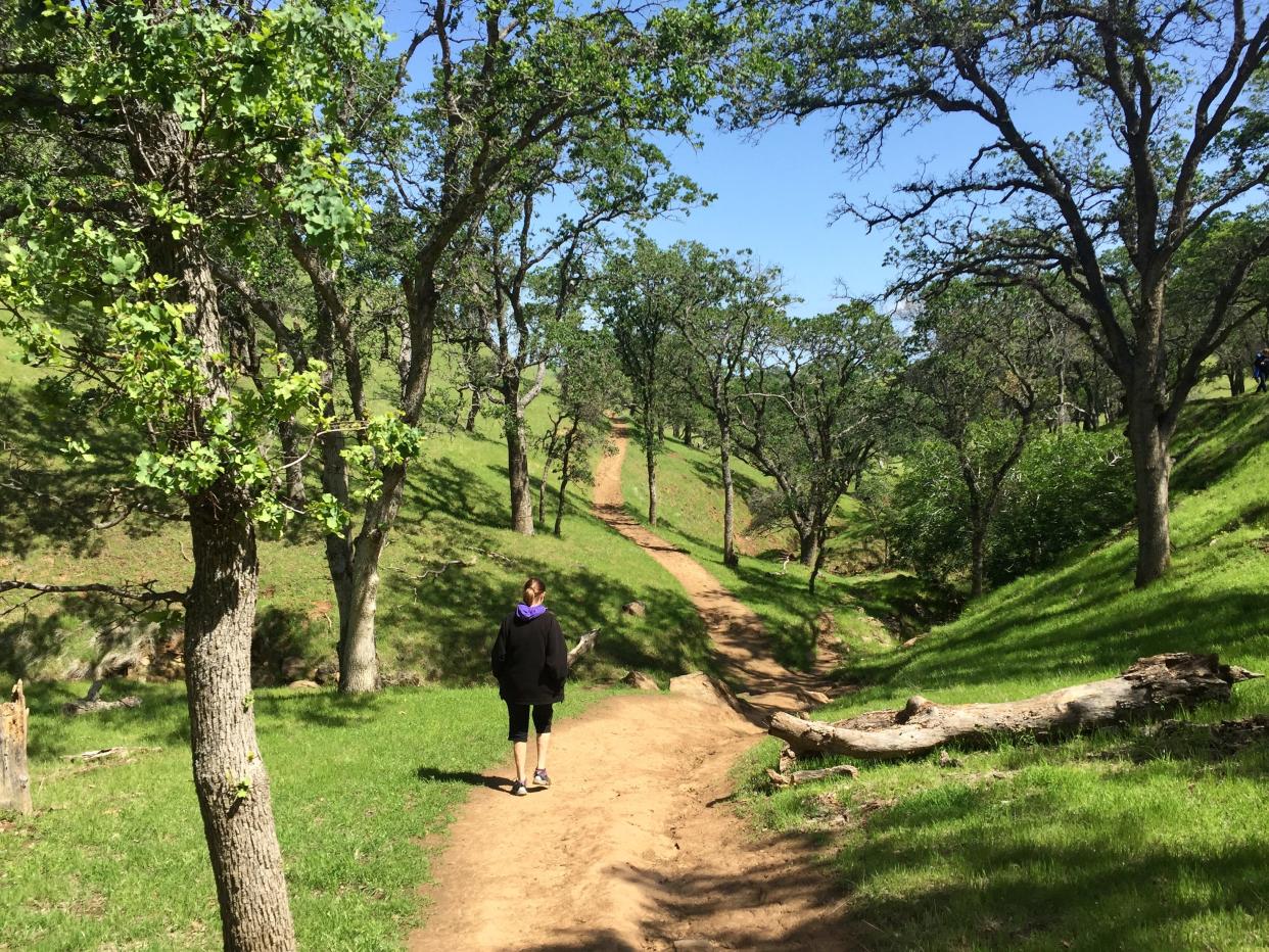
Located east of Mount Diablo’s dual peaks, Round Valley Preserve is a lovely foothills park in the coastal range, with hills and canyons ablaze in emerald green after recent rains. It offers over 30 miles of hiking trails through old oaks: live, blue, valley and black oak along with California bay laurel and buckeye trees, and wildflowers aplenty. The park is open for hiking, horseback riding and bicycling (with some restrictions); no dogs allowed.
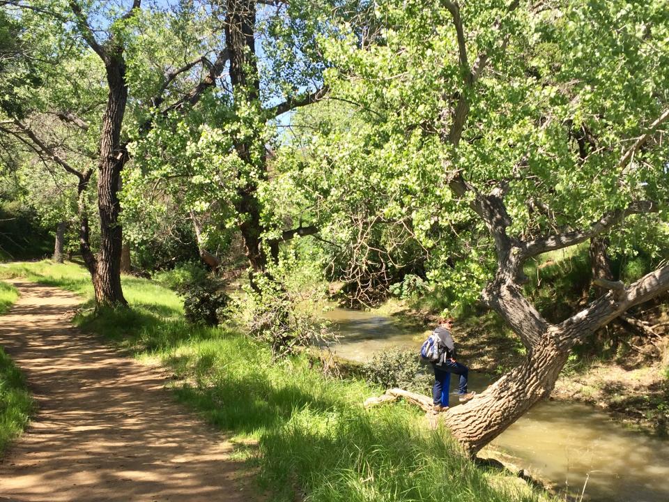
From the parking lot, cross the foot bridge over Marsh Creek, lively with runoff from recent rains, cross a field with grazing cattle and ascend the Hardy Canyon Trail into the foothills beside High Creek. Along the creek watch for signs of deer, pawprints of bobcats (or cougars), and hawks lazily circling on high. Take time and you may spot San Joaquin pocket mice, Audubon‘s cottontail rabbits, red fox, coyotes and endangered San Joaquin kit fox. Golden eagles also patrol the reserve.
Those with high energy can connect with the Miwok Trail and tour all the way into the adjoining Los Vaqueros Reservoir/Watershed to the south. That longer trek, alas, is still on our target list. Nearby Round Valley Preserve are other favorite destinations, including the Los Vaqueros Reservoir with marvelous fishing, Morgan Territory Regional Preserve, Mount Diablo State Park and Black Diamond Mines Regional Preserve.
Los Vaqueros Reservoir parkland is a few miles off Camino Diablo Road; a few years back the lake was increased in capacity to 160,000 acre-feet by raising the dam 35 feet, storing water pumped from the Mokelumne River for East Bay residents. The impoundment is regularly stocked with rainbow trout, largemouth and striped bass, catfish and more (a daily fee and California fishing license is required). The park is also a hiking and bicycling Mecca with a variety of trails and roads surrounding the reservoir.
To reach Mt. Diablo, continue west on Marsh Creek Road to Concord, turn left on Ygnacio Valley Road, then left on Oak Grove Road to the park’s North Gate Road entrance. North Gate Road into Mount Diablo State Park yields a scenic drive with some of the best views in all of Northern California. Plan your visit on a clear winter day – smog will detract from the experience.
Ascend North Gate Road, offering fine views from every turn to reach Mt. Diablo’s 3,849 foot summit, where the Summit Visitor Center offers insight. The North Peak is about a mile distant, reaching 3,557 feet into the sky. The park offers three campgrounds (Juniper, at 3,000 feet, offers spectacular vistas and star gazing), beautiful picnic areas and over 150 miles of hiking trails. Of course, the views from the twin Diablo peaks are stunning.
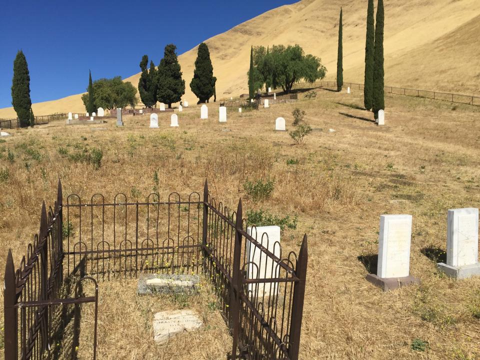
Just 10 miles northeast (as the crow flies) lies Black Diamond Mines Regional Preserve, preserving the history of California’s lively coal mining district, active from the 1850s to early 1900s. By the late 19th century, several towns within the current preserve were the center of Contra Costa population, with several thousand miners and their families mining deep veins of coal, shipping the black diamonds to Pittsburg where the coal powered steamboats, railroads and heated homes. Hike to Rose Hill Cemetery above the parking area, to tour the final resting place of over 100 miners and their families, where the voices of the past seem all too real (see my feature on Black Diamond Mines that ran two weeks ago).
On your East Bay tour you’ll spot plenty of additional back roads …”Let’s see where that road takes us."
For more information: For Round Valley and Black Diamond Mines, go to East Bay Regional Park District’s website, ebparks.org; for Los Vaqueros Watershed, ccwater.com/losvaqueros; for Mt. Diablo State Park, parks.ca.gov. Both Los Vaqueros and Mt. Diablo State Park charge an auto admission charge. For camping in Mt. Diablo State Park, www.reserveamerican.com.
Contact Tim, tviall@msn.com. Happy travels in the West!
This article originally appeared on The Record: Explore the wild East Bay in California, its scenic sites and hikes

