Exploring Donner Summit, California’s most historically important square mile
I have long been an aficionado of old US highways, which accelerated the westward movement of the country’s population. We have avidly explored Route 66 from Chicago to Los Angeles, Highway 50 across the US, and in recent years have been exploring sections of the Lincoln Highway.
When I heard that the Lincoln Highway Association of California was holding a meeting at Donner Summit with tours of segments of the old road following, we decided to attend and join the tour.
The meeting was held at Donner Ski Ranch, and Norm Sayler, who built and operated the Ski Ranch, 19320 Donner Pass Road, Norden, was introduced and said, “the square mile around Donner Summit is the most historic square mile in the state of California.
"Donner Summit is famous because the Emigrant Trail crossed the pass, and the transcontinental telegraph, the transcontinental railroad and the transcontinental cable would all cross the pass near one-another (the short-lived Pony Express took a route across Echo Pass, 40 miles south).”
The Lincoln Highway Association opened the presentation on “the Father Road," with Joel Windmiller and Trey Pitsenberger sharing details on the highway’s evolution. The Lincoln Highway debuted in 1913 as a unified series of roads of brick, pavement, gravel roads and dirt trails; it began in Times Square, New York City and wended westward, ending 13 states and 3,389 miles later in San Francisco’s Lincoln Park.
Steadily improved year-by-year, it was the first transcontinental highway, launching with nationwide fanfare just as Ford Motor Company, with the vaunted and inexpensive Model T and its new assembly line was able to turn-out 1,000 cars in a single day’s production. Americans were eagerly getting mobile and were anxious to see other parts of the country.
The presentation noted that as Lincoln Highway crossed Nevada on some pretty wild and rough roads, it then followed the Donner Lake Wagon Road up and across the pass and then onto the Dutch Fat Wagon Road, which tracked the old Immigrant Trail.
By 1927, the nation chose to number all the key highways, Highway 40 became the noted route in this area and references to Lincoln Highway became less pronounced — even though the contiguous transcontinental highway route continued to lure millions of Americans westward, touring the country as autos caught on in the 1920s and 1930s.
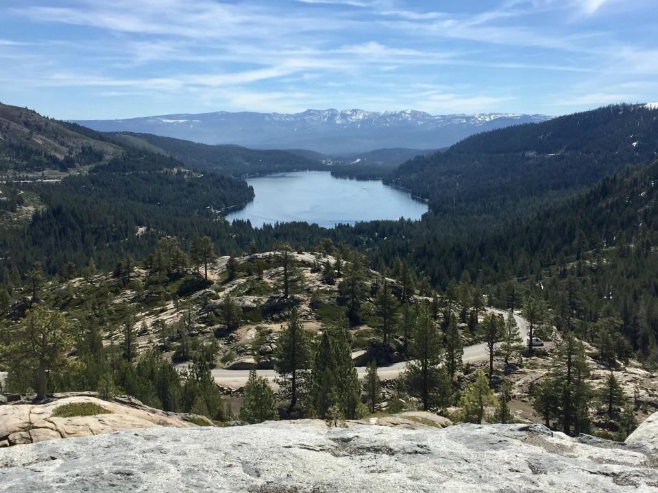
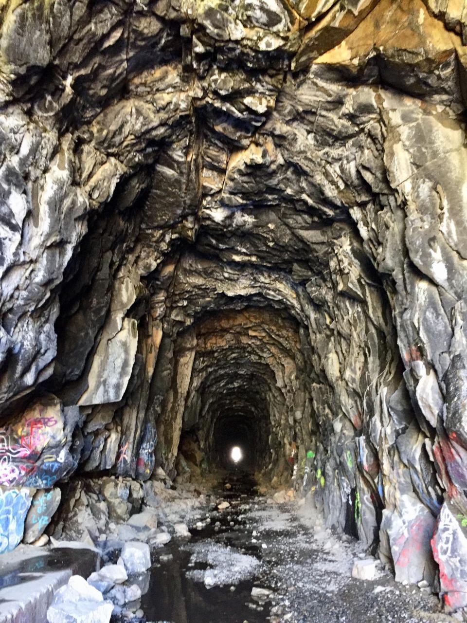
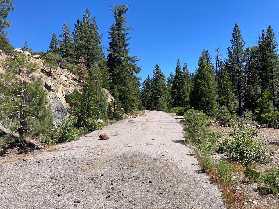
In the square mile around the Donner Ski Ranch and Sugar Bowl ski areas, one can both see and explore old pieces of both the Lincoln Highway and the transcontinental railroad. From Donner Ski Ranch parking, walk just 300 yards south to find an old 1,600 foot-long, eerie but walkable, transcontinental railway tunnel, which was abandoned when the railroad was rerouted a few miles to the south.
We hiked a few sections of the old highway visible from the Ski Ranch, and the old quarry used to provide rock and gravel for building the road near Donner summit. A suggested driving option is to follow the old highway east, over the beautiful, curved Rainbow Bridge (with marvelous Sierra vistas and views of the old railroad and highway right of way), down to Donner Lake with a stop at the Donner Memorial State Museum, which documents the emigrant experience, the Donner Party, the Chinese construction of the railroad and the ancient Washoe peoples who lived there for thousands of years.
Then, retrace your steps back up the pass and follow Highway 40 west, which parallels Interstate 80 to find old portions of the still existing Lincoln Highway. Make a point of visiting the Donner Summit Historical Society’s info-packed museum, 21501 Donner Pass Road, Soda Springs. With luck, you’ll find Norm Sayler minding the museum, offering wonderful insights.
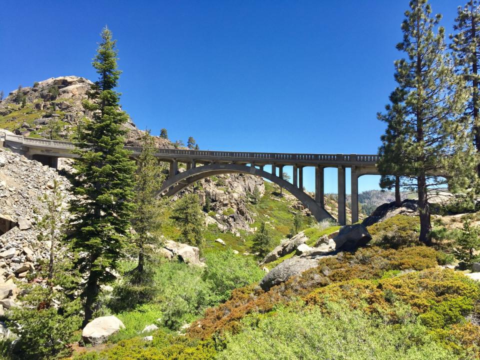
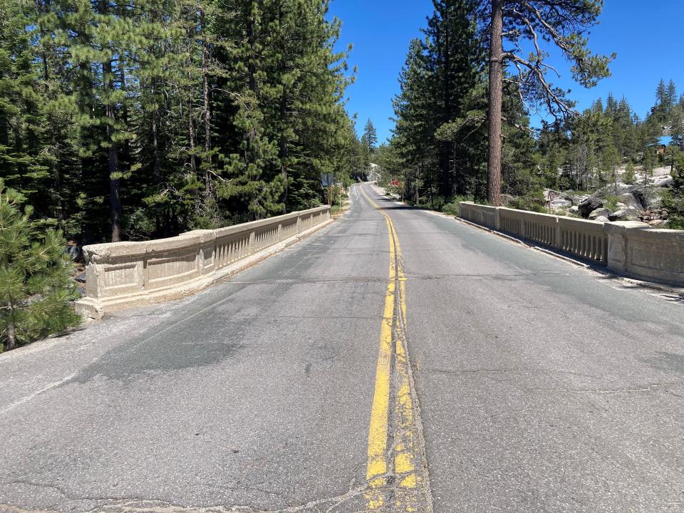
At places like the Rainbow Lodge on Highway 40, the road remains a paved expansion over the top of the old Lincoln Highway, and bridges dating to the 1920s are still used. You will also find other sections of the historic road, abandoned, some sections drivable or walkable, and a few closed due to being on private property.
Learn to use the Lincoln Highway Association online map (lincolnhighwayassoc.org/map), which can be synced to the location of your cellphone, to allow you to follow both accessible stretches of the old Highway and find pieces of the old road that may lie just a few blocks off the current roadway.
We used this wayfinding gem to track the old highway through Soda Springs, Kingvale, finding the delightful Rainbow Lodge reopened on a section of the highway, and marveling at old bridges, railroad under-crossings and abandoned sections of the old Father Road paralleling Highway 40.
As you wend your way westward, stop in Old Town Auburn, where the route follows Lincoln Way, lined with old buildings dating to the heyday of the vaunted Lincoln Highway. You’ll find shops and restaurants celebrating their connection to the historic road. From Auburn, the highway follows a winding route through Newcastle, Penryn, Loomis, Rocklin, Roseville, Citrus Heights and into Sacramento.
Road trip: Lincoln Highway’s historic route runs through San Joaquin County
From Sacramento the route turned south, reaching Galt, Woodbridge, Lodi, Stockton, French Camp, Lathrop, Banta and Tracy before heading over the Altamont Pass to Oakland and onto San Francisco. For my feature on the San Joaquin County portion of the old highway, go to: https://bit.ly/3aIUKPF.
Pack a picnic lunch (or purchase lunch at Donner Ski Ranch, with plenty of tasty options), fire up the old Tin Lizzie and go explore California’s old Lincoln Highway!
For more information: Donner Ski Ranch, donnerskiranch.com; Donner Summit Historical Society, donnersummithistoricalsociety.org; Lincoln Highway Association, (lincolnhighwayassoc.org); Lincoln Highway Association of California, lincolnhighwayassoc.org/ca/; the state association also has a photo-packed Facebook page.
Contact Tim at tviall@msn.com; enjoy your travels in California!
This article originally appeared on The Record: Donner Summit, California’s most historically important area

