Extreme heat that has been roasting Texas forecast to shift into Southeast
The core of a large heat dome that pushed temperatures well past 100 degrees Fahrenheit in Texas for the past two weeks and claimed multiple lives will begin to ease up in the coming days. However, AccuWeather meteorologists caution that no refreshing change to cool air is forecast, and the core of the extreme heat is likely to setup up farther to the east over the southern United States into Monday.
There is no question that Texas is a hot place from late June through early August. Highs in the mid- to upper 90s are commonplace during this time of year. Yet, as the temperature consistently reaches past 100 degrees, as has been the case lately, even heat-savvy individuals, cooling systems and electrical grids can be taxed.
 |
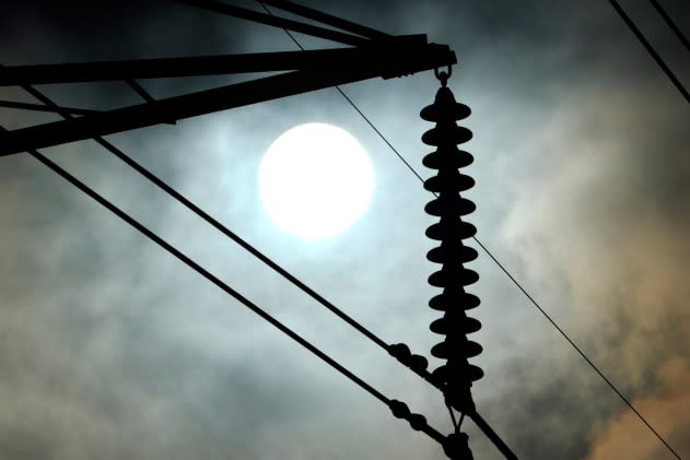
The sun rises over power lines Tuesday, June 27, 2023, in Houston. Meteorologists say scorching temperatures brought on by a heat dome have taxed the Texas power grid and threaten to bring record highs to the state. (AP Photo/David J. Phillip) |
The heat has been accompanied by high humidity levels as well in the central and eastern parts of Texas and the southern Plains. The combination of heat, humidity, light winds and other conditions have pushed AccuWeather RealFeel® Sun temperatures to near 120 F at times.
On Saturday afternoon, the AccuWeather RealFeel® Sun temperature reached 121 degrees in Pell City, Alabama, located 30 miles east of Birmingham, Alabama.
Eleven fatalities have been attributed to the heat in Webb County, Texas, in recent days, according to CNN. The buildup of heat in urban areas and in homes without air conditioners can put a deadly strain on certain individuals, experts say.
 |
McAllen, Texas, has endured 19 days in a row of high temperatures at or above 100 through Saturday. There have been more than a dozen days with highs at or above 100 in San Antonio since mid-June, including five days with highs of 104 or greater. Dallas recently jumped on the 100-degree bandwagon with five straight days of triple-digit temperatures from Sunday through Thursday. The historical average high in McAllen is 98, while a high in the low to mid-90s is common for San Antonio and Dallas for this time of year.
Farther to the east, the Houston metro area has flirted with 100-degree temperatures for several days, but high humidity levels have made it feel much hotter than the slightly lower temperatures near the Gulf Coast. A high in the low 90s is typical in Houston for late June and much of July.
Even though the heat will decline by a few degrees, temperatures are forecast to remain near or above historical averages indefinitely for central and eastern parts of Texas.
"The high-pressure system that has been responsible for the extreme heat over the past couple of weeks has exited Texas to the east," AccuWeather Senior Meteorologist Bill Deger said.
High temperatures near or above 100 will be swapped with highs mainly in the 90s over much of central and northern Texas. Highs over the lower Rio Grande Valley will be trimmed back to more seasonable temperatures near 100.
 |
"Also helping the heat to ease a bit in Texas and the southern Plains will be waves of atmospheric energy that dip southeastward from the Rockies and central Plains," Deger said. "Each of these disturbances will produce more cloudiness and raise chances of downpours and locally severe thunderstorms from the weekend [this] week."
As the heat eases slightly over much of Texas and the southern Plains, it will ramp up farther to the east.
"As the high-pressure area slides to the east, it will now pump up the heat over the Southeast into the early part of the weekend," Deger said.
Temperatures are forecast to remain in the middle to upper 90s in portions of Louisiana, Arkansas, western Tennessee, Mississippi, Alabama and Georgia into Sunday. Cities such as Shreveport, Louisiana; Little Rock, Arkansas; Memphis, Tennessee; Jackson, Mississippi; Birmingham, Alabama; and Macon, Georgia; are among the major towns and cities that will have sweltering conditions.
High humidity levels with dewpoint temperatures well into the 70s to near 80 will combine with actual temperatures, light winds and sunshine to drive AccuWeather RealFeel® Sun temperatures into the 110s or higher in the Southeast. These are the same dangerously hot conditions that people in Texas have been experiencing recently.
 |
Experts urge people to avoid strenuous activity, drink plenty of fluids and seek an air-conditioned environment where and when possible to reduce the risk of heat-related illness.
As a storm system pushes across the Midwest and Northeast early this week, a trailing cool front may dip far enough south to reverse the temperature trend over the interior Southeast.
However, it may be difficult for that front to reach much of the Gulf Coast and locations farther south along the Eastern Seaboard. Instead, much of the Southeast may trend wetter with numerous and frequent drenching showers and locally severe thunderstorms possible through July Fourth.
Want next-level safety, ad-free? Unlock advanced, hyperlocal severe weather alerts when you subscribe to Premium+ on the AccuWeather app. AccuWeather Alerts™ are prompted by our expert meteorologists who monitor and analyze dangerous weather risks 24/7 to keep you and your family safer.


