Reed Timmer details the heart-pounding moments from 5 of his most extreme storm chases in 2018

AccuWeather Extreme Meteorologist Reed Timmer was nothing short of busy in 2018. With major hurricanes, tornadoes, flash floods, and even hailstorms, whenever there was an extreme weather event happening, that's where Reed was going to be.
"[It was a] very interesting year, a multifaceted year in terms of the natural disasters," said Timmer. "A very sad year as well with the areas impacted along the Gulf coast by Hurricane Michael but also a very fulfilling year too by warning the people in the path of these storms."
Timmer put himself on the front line of almost every major storm and natural disaster that hit the country. He lends his scientific expertise to advise people on how to prepare, but he also witnesses the aftermath and lends a hand to those hurting communities.
As 2018 comes to a close, Reed Timmer joined the AccuWeather podcast team to discuss some of the year's most interesting and exciting chases and shares some of the most unusual and heart-pounding moments from the eye of the storms.
Hurricane Michael
Going down as one of the most intense hurricanes to make landfall in U.S. history, Hurricane Michael was the top choice for Reed Timmer as he recounted the storms he chased this year. Michael came in as the third most powerful hurricane to make landfall in the U.S and the most powerful on record to strike the Florida Panhandle.
Mexico Beach and Panama City took the greatest hit from the storm, as most people along the coast lost their homes completely. Others came back to severely damaged homes and deserted neighborhoods.
INTENSE eye wall east side of Panama City beach with Hurricane #Michael @accuweather @breakingweather pic.twitter.com/4exA2CD6xO
— Reed Timmer (@ReedTimmerAccu) October 10, 2018
Timmer found himself riding out the eye of the storm in a Subaru, experiencing firsthand the mere 30 minutes of raw power and disaster that unfolded as the hurricane made landfall.
"The damage was just something that was devastating to see," said Timmer. "They still have a such a long road of recovery ahead down there. We certainly don't want to forget what happened in the Florida Panhandle."
Tornado in Federal, Wyoming
Tornado chasing is not new for Reed.
Catching a tornado as it develops and makes landfall is just another day on the job, and not even a flat tire would get in the way of that. That's right, on May 27 he chased a tornado on a flat tire for about 10 miles. He knew that if he had stopped to fix it, he would have missed the storm completely.
The EF2 twister was around 2 to 3 miles in length, according to the National Weather Service. Estimated peak winds were approximately 111-135 mph.
"Sadly, it hit some farmhouse there and I saw cows flying through the air," said Timmer. "That's the first time that I have seen with my own eyes livestock flying through the air inside a tornado."
INTENSE damaging #tornado touches down 20 miles northwest of Cheyenne, WY and retrogrades back west as it widens into massive cone. Had to punch through hook with horizontal softballs to get to this vantage point. Thankfully everyone is okay here@breakingweather @accuweather pic.twitter.com/h2lQUdFGq9
— Reed Timmer (@ReedTimmerAccu) May 28, 2018
The residents of Federal suffered great damage, including one man who hid under his staircase with his dogs as his house was simultaneously disintegrating around him.
"I allowed him to take shelter in my rental car," said Timmer. "That is definitely one of the good sides of storm chasing when you get to help out with recovery efforts like that."
Sundance, Wyoming, hailstorm
The end of June 2018 brought about severe storms that pounded the northwestern U.S. One storm in particular for Reed Timmer was a rarity.
On June 29, a major hail storm brought hail noticeably larger in diameter than what a typical hailstorm would produced.
"I was in a rental car and decide to sample that hail core," said Timmer. "So I drove into it and [they were the size of] baseballs and softballs and blew all my windows out."
NEW: destructive baseball hail, 70-80 mph winds busting out windows, damaging structures from Sundance, WY through Lead, Deadwood, SD. Largest hail ever seen in Deadwood the locals tell me. Here is just as #tornado warning issued east of Sundance @breakingweather #sdwx #hail pic.twitter.com/26rYSZc6Ax
— Reed Timmer (@ReedTimmerAccu) June 30, 2018
The storm was about 2 to 3 miles wide, and the area was put on a tornado warning. Wind gusts were about 70 to 80 mph.
Reed wasn't the only one on Interstate 90 with shattered windows and this certainly wasn't the first rental car he was bringing back dinged up.
"I think I went through about six rental cars this year, mostly in terms of hail and some flash floods as well," said Timmer. "I brought that one back and returned it and the employees at the rental car company are actually clapping because they had 165 claims I think due to hail at that point."
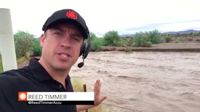
Johnson Canyon, Utah, flash flood
The North American monsoon in July brought flash flooding to parts of the southwestern U.S.
A monsoon is a change in wind direction that can trigger long-duration rainfall or dry weather. The monsoon is well known in southeast Asia, but it occurs in other parts of the world as well.
"This was a relatively new experience," said Timmer. "I have chased flash floods before but I didn't realize the debris plug that some of these floods can have on the front side."
INSANE flash flood with big-time debris plug, massive trees in flow in Johnson Canyon just east of Kanab, UT! First solo flood intercept with @Rankinstudio currently in a different position waiting for another monster flash flood
Monsoon coverage continues for @breakingweather pic.twitter.com/aw9LA69UxY— Reed Timmer (@ReedTimmerAccu) July 17, 2018
Timmer found himself at the Grand Staircase of Johnson Canyon as the water flowed through the dry riverbed and debris came right along with it.
"When they come down these creek beds that haven't flooded in a while, they can have a massive plug of debris and the way that it happens is that the debris plug moves slower than the rest of the flood because of the friction with the earth," said Timmer.
Tescott, Kansas, tornado
On May 1, a tornado ripped through Tescott, Kansas, spanning 14.5 miles long according to National Weather Service. Most buildings received EF2 like damage, but some had "low-end EF3 damage" toward the end of the 30-minute storm.
"Sadly it did cause quite a bit of damage there across north-central Kansas," said Timmer. "Anytime we intercept a storm in our armored vehicles and record data inside it's always a great experience."
The storm took its time developing, undergoing several cell mergers before it produced a tornado by the evening.
Video: HUGE wedge tornado just south of Tescott, Kansas and Dominator 3 intercept early in its lifecycle! Thankfully tornado remained over mostly rural terrain. Measured peak wind gust of ~125 mph #tornado @breakingweather @SeanSchofer @curtisbrooks80 @MikeTheiss @BraydonMoreSo pic.twitter.com/dzTg5wmcIY
— Reed Timmer (@ReedTimmerAccu) May 2, 2018
Timmer and his team had to remain patient in order to properly catch and track the tornado. They stayed inside an armored vehicle prepared to handle the winds and equipped with all the technology needed to track and record the storm.
When it came time to stable the vehicle and brace for impact, however, they had a very tight window of time.
"In that case we only had about 10, 15 seconds before the tornadic winds arrived," said Timmer. "[It] can deploy in a matter of seconds and it is very important to prevent that wind from getting underneath the armored shell or else the vehicle could be easily lifted off the ground."
