Eyes on a Colorado low in southern Ontario next week as Arctic air settles in
Much of Ontario has been graced with an above average November, with temperatures sitting in double-digit territory for at least a couple of weeks.
The city of Windsor in particular has seen 15 days with daytime highs above 10°C, and only two days when temperatures have reached the single digits.
Friday however, will be the last of this mild spell, with a more typical November forecast shaping up into next week. In fact, a winter-like pattern is going to start to emerge even sooner than you may think.
DON'T MISS: Clock ticking towards Greater Toronto and Hamilton Area's first major snowfall
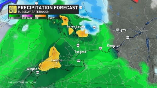
A weak clipper will track across the region Saturday night and into Sunday, with rain and snow showers expected. Blustery and chilly conditions will funnel in behind the system, with a brief period of lake-effect snow showers southeast of Lake Huron and Georgian Bay.
Single-digit highs are in the forecast this weekend, including in Toronto, Hamilton, and London, so anyone heading out to enjoy the Santa parades or the Grey Cup should plan to sport extra layers.
Colorado low takes aim next week
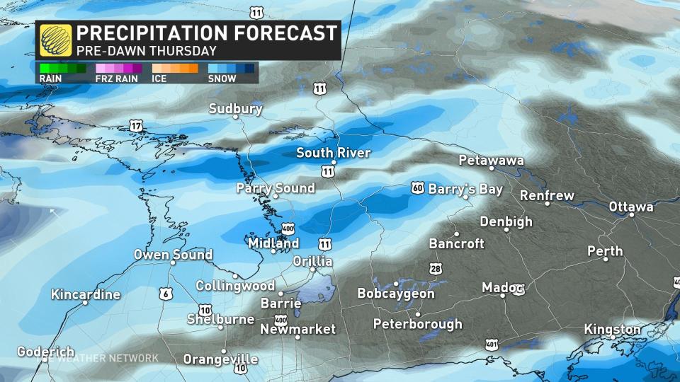
It's a Colorado low early next week that has forecaster's attention. This will be a significant system, but the track and impacts are still highly uncertain depending on how (or if) the system merges with another system diving south from northern Canada.
The most likely scenario looks to feature a fall storm tracking into the Great Lakes region, and then a second low forming near the coast of the northeast U.S. This scenario would bring a snowstorm to parts of northeastern and central Ontario and rain to the south, but there's also the potential for some snow and ice before a changeover to the rain. That risk looks to be primarily north and northeast of Toronto. This will be something to keep a close eye on.
On the heels of that system, a blast of colder air will move in from the Arctic, making its first stop over the Prairies.
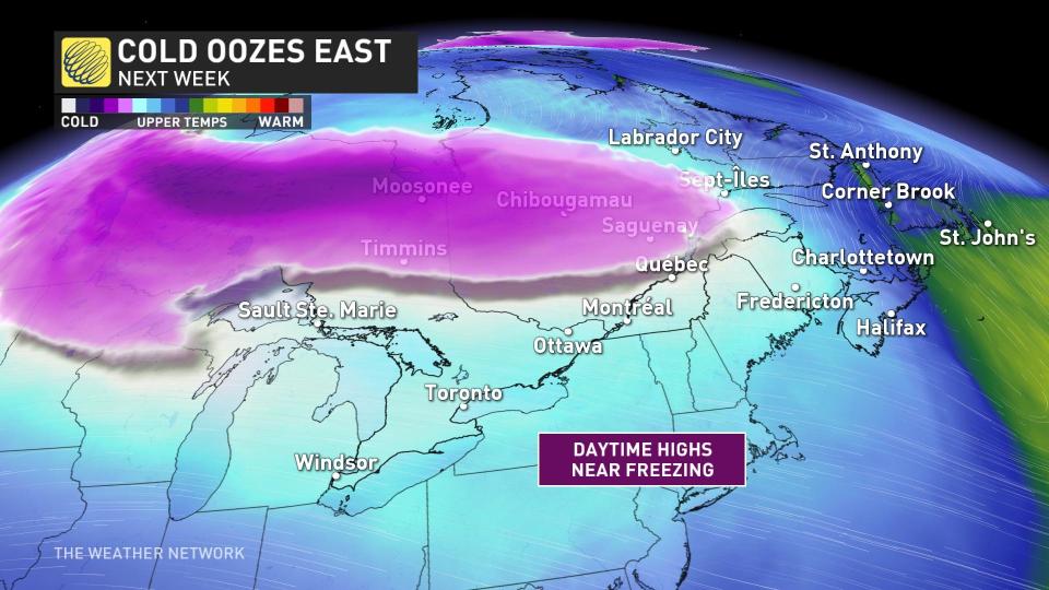
The trough that brings in the colder air will sit in place for several days.
MUST SEE: Brace for chill: Arctic air oozing into Canada for next week
With the Arctic air settling in over the region, and winds sweeping in from the northwest for a couple days, a multi-day lake-effect snow event is not out of the question. This will impact regions close to Lake Huron and Georgian Bay.
Next week will certainly be a good reminder that winter is on its way.
WATCH BELOW: Never scrape your windshield again with this sandwich bag hack
Stay tuned for the latest forecast updates for southern Ontario.

