All eyes are on a tropical wave in the Caribbean. Why is it called Invest 98L?
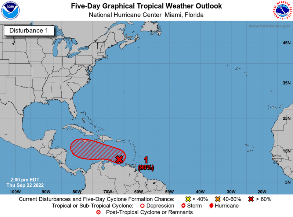
All eyes are on Invest 98L, a storm system in the Caribbean Sea that’s being closely monitored by the National Hurricane Center in Miami.
The system is expected to strengthen into a tropical depression in the next day or so, then it will likely get stronger.
“The low is forecast to move west-northwestward and be over the central Caribbean Sea this weekend where conditions are expected to be conducive for additional development,” the NHC said in an update.
The National Weather Service and local meteorologists say the Mississippi Coast, Louisiana, Alabama and Florida should keep an eye on Invest 98L over the weekend as the storm moves closer toward the Gulf.
It’s likely the system could be a tropical storm or hurricane by Sunday, Weather Channel Meteorologist Scot Pilié said.
But why is the tropical wave called Invest 98L, and what does that mean?
The term “invest” is used for “a weather system for which a tropical cyclone forecast center (like the National Hurricane Center) is interested in collecting data sets or running model guidance,” the NHC said on its website.
The invest terminology is what’s used before waves become tropical depressions, tropical storms or hurricanes, but not all invests strengthen or form into a larger system.
“The designation of a system as an invest does not correspond to any particular likelihood of development of the system into a tropical cyclone,” the NHC said.
The next named storm will be Hermine.

