Fairview Fire now 40% contained as rain helps firefighters halt its advance

The battle against the Fairview Fire burning on the west side of the San Jacinto Mountains was aided as the weekend began with the rainfall from Tropical Storm Kay.
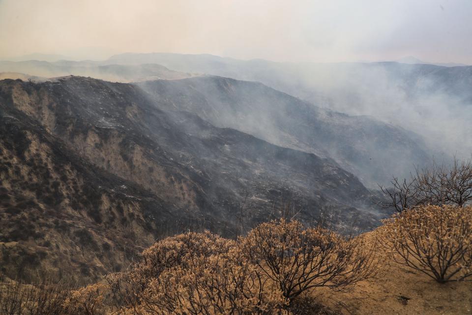
As of late Saturday morning, the fire was 40% contained, up from the 5% where it had stalled most of the week. Cal Fire had not given another update by The Desert Sun's print deadline.
The fire, which started southeast of Hemet Monday afternoon, had burned 28,307 acres.
The National Weather Service issued flood watches through Riverside County from Friday morning through Saturday night. The heaviest rain was expected on the eastern slopes of the mountains and in their neighboring deserts. In addition, high wind warnings are in effect for all of the fire area.
A warning covering the San Jacinto Mountains called for winds of 45 to 55 mph and gusts of as much of 100 mph. Another warning said winds could be 35 to 45 mph, with gusts of up to 65 mph, in valley areas west of the mountains, including Temecula, Sage and Cahuilla.
James Brotherton of the National Weather Service told The Desert Sun on Saturday the fire area had received 0.25 inches of rain so far, with a 60% chance of rain and isolated thunderstorms throughout the day and 30% chance in the evening. Winds from the southeast are expected to be between 5 mph to 10 mph.
Cal Fire updated its incident dashboard Saturday to show 13 structures have been destroyed and four damaged.
Evacuation orders in some parts of the Sage and Temecula areas were reduced to warnings around 5:30 p.m. Friday amid rainy weather conditions that CalFire said were helping firefighters slow the spread.
As of 4 p.m. Saturday, the following areas were reduced to evacuation warnings:
West of the U.S. Forest Service boundary
North of Wilson Valley Road/Reed Valley Road
East of Sage Road
South of Stanley Road
West of Sage Road
North of East Benton Road
East of De Portola Road
South of Cactus Valley Road
Larking Lane
These areas are no longer under evacuation warnings:
South of Diamond Valley Lake
East of Washington Street
North of Borel Road
East of Rancho California Road
East of Anza Road
North of Temecula Parkway/Highway 79
Northwest of Highway 371
West of Highway 74
South of the U.S. Forest Service boundary, including Ramona Indian Reservation and Olivet University
The agency said Thursday that it expected full containment of the fire by Monday, although officials cautioned that is subject to changing conditions. Capt. Richard Cordova said Friday the agency was still shooting for that day, but changes could make meeting that target impossible.
Officials have not said more about the cause of the fire since saying it is under investigation. In a document filed with the California Public Utilities Commission, Southern California Edison reported “circuit activity” in the area close to the time the fire erupted.
Previous reporting by Desert Sun staff writer Paul Albani-Burgio was used for this report.
Desert Sun reporter Brian Blueskye covers arts and entertainment. He can be reached at brian.blueskye@desertsun.com or on Twitter at @bblueskye.
This article originally appeared on Palm Springs Desert Sun: Fairview Fire now 40% contained; rain helps firefighters

