Is it faster to bike or drive during the Washington Bridge closure? We held a race.
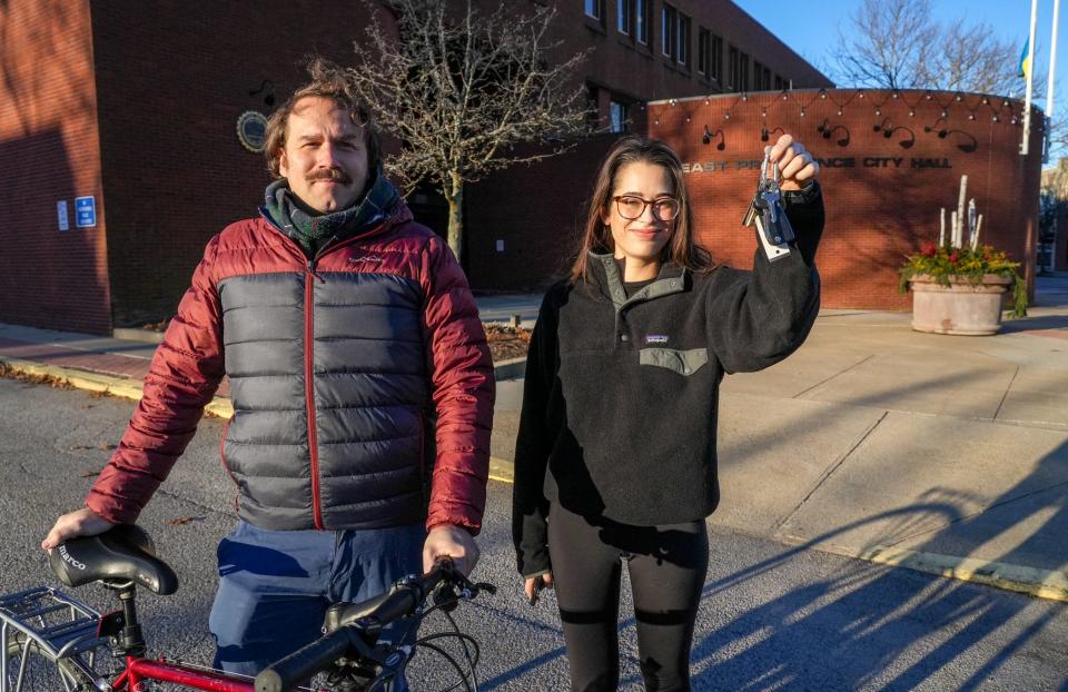
EAST PROVIDENCE — My colleague Wheeler Cowperthwaite put on a balaclava that covered everything but his eyes, wrapped a warm plaid scarf around that, slid on the thickest gloves I’ve ever seen, put on yet another scarf, and only then prepared to bike over the Seekonk River Thursday morning in 29 degree weather.
I climbed into my station wagon, cranked up the radio, and turned on the seat heaters.
But as we both peeled out of the parking lot at East Providence City Hall around 8:15 a.m., I was pretty sure that he had the better end of the bargain.
Sure enough, it took Wheeler only 30 minutes to get to The Providence Journal’s downtown office. Making that same trip by car took me 52 minutes — and it would have been longer if I hadn't been lucky enough to find a parking spot right in front of the building when I arrived.
Neither Wheeler nor I normally commute on the Washington Bridge (thank god). But with the westbound lanes closed and snarling traffic in the East Bay, we decided to set out from East Providence City Hall and race to downtown Providence to test out a hunch that biking may now be a more efficient way to commute than driving.
What is it like biking to downtown Providence from East Providence?
Cowperthwaite: Once I learned the race to downtown Providence was on, I went digging through the pile of cold-weather clothes. Long underwear? Long gone. Ski jacket? Too bulky. Spandex? Never owned it. Snow pants? Not to bike in. Rain (or wind) pants? Santa, please!
I reached out to Liza Burkin of the Providence Streets Coalition, after seeing a post of hers about compiling a list of cold-weather clothes for bike commuters. Her biggest tip was handlebar mittens, essentially cold-weather covering that goes over the handlebars. While I ordered some for future commutes, I knew I'd have to make do with the gloves.
Faux ski gloves from Ocean State Job Lot? Check. Balaclava? Check. With two scarves, a vest and a puffy jacket, I was ready to commute.
Unlike the last reporter race between Patrick Anderson and Paul Edward Parker to see if public transportation or car would get someone to Newport faster, there was little sense of urgency.I was headed for a nice winter ride, bundled up and I was pretty sure I'd win, after covering the terrible traffic troubles. Still, I felt a little guilty about subjecting a colleague to the pain of stop and go traffic.
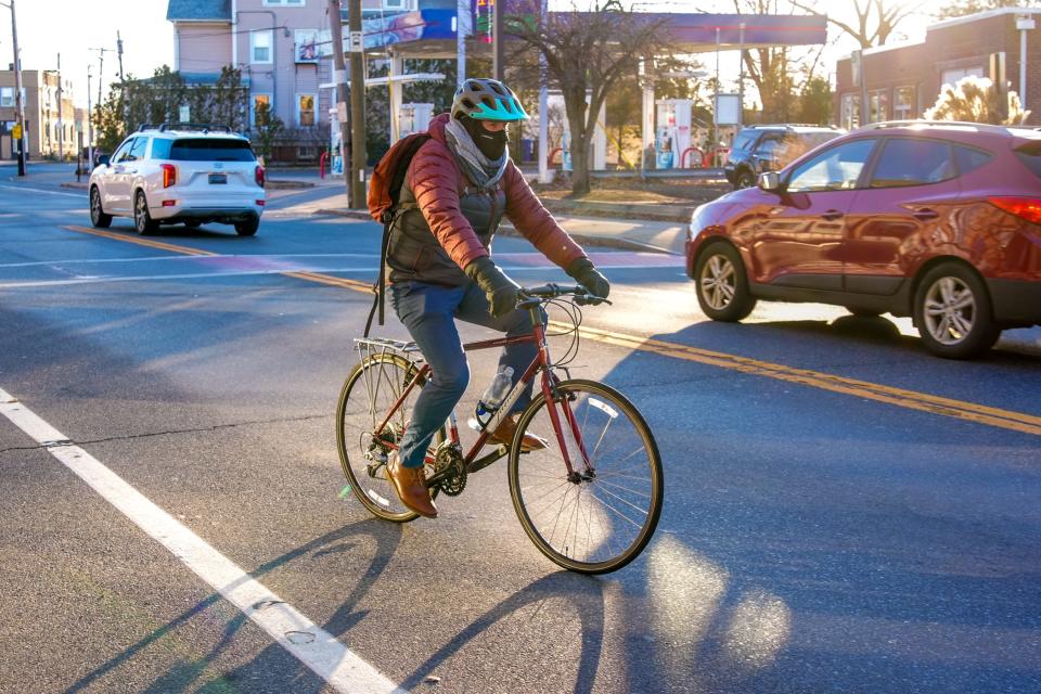
Once we started from the parking lot of East Providence City Hall (8:17 a.m.), I crossed the street, with photographer David DelPoio running a little ahead of me. I strained to see the traffic behind me, the balaclava obstructing my view, but with so few cars, I chanced it and headed down Taunton Avenue, hoping to find the bike path entrance.
Google Maps said the trip should take about 20 minutes: Down Taunton Avenue to Valley Street, across the mixed-use path over the bridge, down South Water and into downtown. Riding down Taunton Avenue, with resident-only barriers at the entrance to most side streets, I thought, even if we started deeper in East Providence, this would have been a breeze.
After nearly getting hit by a driver shortly after starting, who never once thought to look left as he tried to turn left, I thought it was pretty smooth biking, until I had to pull over because I missed the left onto Valley Street, the preferred access point to the bike path.
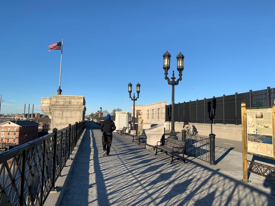
Looking to the left, I figured out the problem. Valley Street, as it goes under the interstate, is entirely torn up and closed. Seeing no construction workers, I walked under, listening to the diffused sounds of the cars above. Once I got on the bike path and climbed up to the bridge, it was smooth riding, with a whole separate lane for walkers parallel to the bike path.
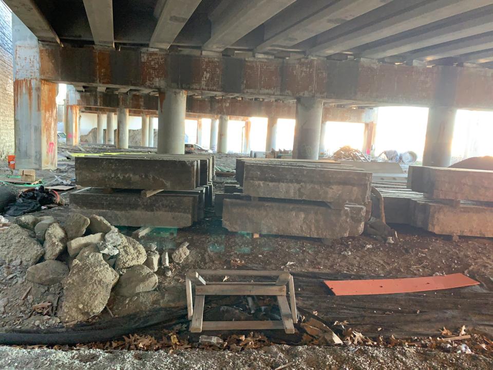
I was passed once (I'm slow) and waved at one other biker coming the opposite direction. In all, I saw six other riders on the Washington Bridge and another three between India Point Park and downtown. I stopped to take a picture of the river and then again of work crews on the interstate before riding down into India Point Park.
The navigation system would have sent me over the India Point Park pedestrian bridge and onto George M. Cohan Boulevard, but I decided to skip the climb, bike through a nearly deserted park, through the hurricane barrier, past Hot Club and picked up the bike path on South Water Street before deciding to head over the pedestrian bridge. By 8:37 a.m., I hit South Water Street. (The Google Maps routing is never consistent, as subsequent searches alternate between going over the interstate and going through the park.)
While I deviated from the all-knowing navigator in the sky (it would have sent me down South Water to Weybosset to Dorrance to Fountain), I knew I could take the pedestrian road past the CIC building to Richmond Street, even if most of the bike lane is being occupied by construction on the new state health lab.
While there are no bike lanes, traffic is light or non-existent, so I biked up past the Providence Performing Arts Center, then down Mathewson Street until I hit the office at 75 Fountain St. at 8:47 a.m.
Despite all the stops to take pictures and video, check directions a few times and walk under the interstate, I arrived in 30 minutes, 10 minutes later than the navigation estimate.I chalk up most of the difference in time to being a slow rider, and maybe choosing a path I was more familiar with that might have added a couple of minutes.
In all, it was a great way to spend the morning and a surprisingly easy commute.
What driving to Providence at rush hour was like
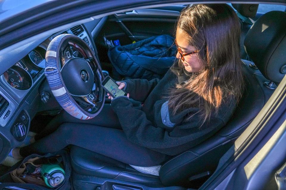
Farzan: After hearing horror stories about people who were trapped in traffic for four hours on Tuesday, I figured that things wouldn’t be nearly as bad by Thursday. Cops would have figured out how to deal with all the traffic, commuters would have found alternate routes to work, and, hopefully, some companies would be letting their employees work from home.
That was all true — but the drive still sucked.
Shortly after I left East Providence City Hall, my GPS told me to take a left on James Street to get to the Henderson Bridge. But the road was blocked with a sign saying, “Do Not Enter: Resident Traffic Only” — as were most of the other side streets that I passed.
Instead, I continued on Taunton Avenue as far as Broadway, then turned onto Waterman Avenue. To my dismay, I discovered that the line of cars waiting to get onto the Henderson Bridge stretched as far as the eye could see, and was at a complete standstill. I’d need to hover awkwardly in the left lane, waiting for another driver to let me in.
A few minutes ticked by before the driver of a navy blue Toyota Prius took pity on me (thank you.) We sat and watched as an East Providence police cruiser, lights flashing, escorted two empty school buses down a closed street.
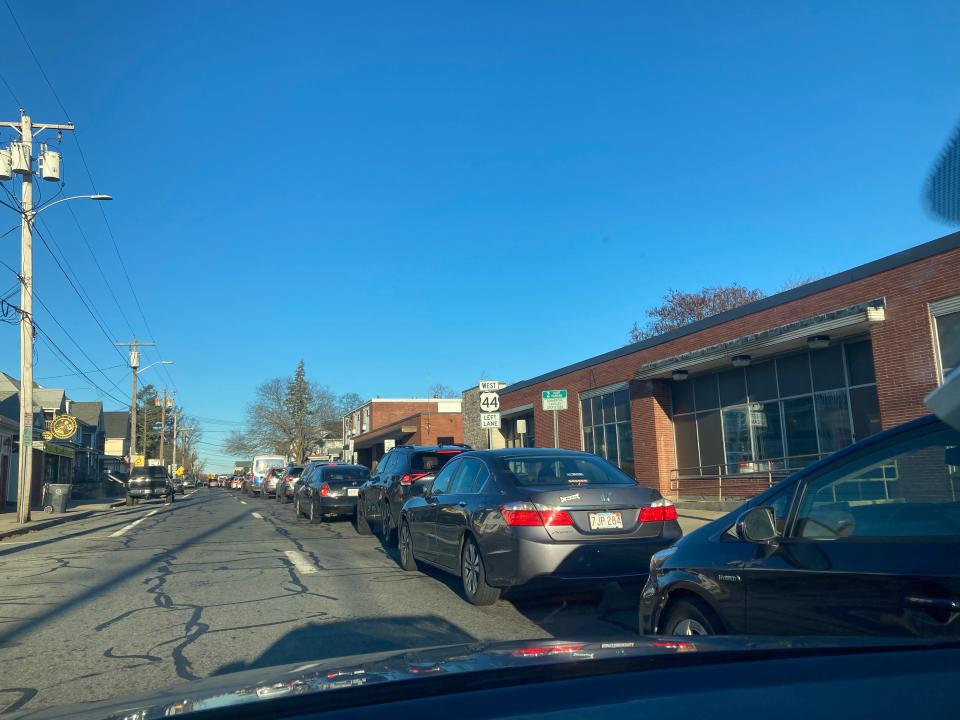
It took 26 minutes just to travel a little over half a mile down Waterman Avenue and get to Massasoit Avenue. Thirty minutes after leaving City Hall, I finally reached the much-maligned Henderson Bridge roundabout. Driving through it wasn’t as stressful as I’d expected — quite possibly because we were all creeping along at less than 5 miles per hour.
I was just about to get on the bridge when my phone lit up with a text from Wheeler: “Here!” He’d won the race and made it to the office before I’d even left East Providence.
By the time I made it to the East Side, I’d been driving for 35 minutes. It took another 17 minutes to get downtown after exiting the Henderson Bridge. Remarkably, I did not witness any road rage, honking, yelling, or blocked intersections at any point during the journey.
More: The Washington Bridge closure is a nightmare, but the memes are pretty funny
Was it the worst traffic that I’ve ever experienced in my life? No. But spending almost an hour trying to get between East Providence and downtown Providence felt like an incredibly stupid waste of time and gas, and that feeling only intensified when I watched a spandex-clad biker whizz past the bumper-to-bumper traffic on the Henderson Expressway.
How accurate were GPS travel time estimates?
Our experiment also revealed that GPS apps tend to underestimate how much the bridge closure is affecting traffic.
Google Maps predicted that it would take only 25 minutes to get downtown from East Providence City Hall on Thursday morning, while Apple Maps estimated that the trip would take 43 minutes. In reality, the drive took 52 minutes.
One reason for the discrepancy: GPS software is scrambling to keep up with which streets are open, and which ones are closed. The quicker route suggested by Google Maps, for instance, would have involved taking a number of side streets that are actually closed to through traffic.
Thanks to our subscribers, who help make this coverage possible. If you are not a subscriber, please consider supporting quality local journalism with a Providence Journal subscription. Here's our latest offer.
This article originally appeared on The Providence Journal: Washington Bridge closure - is it faster to bike to Providence?

