Fierce gusts flip planes at Merritt Island Airport; more storms forecast for Space Coast
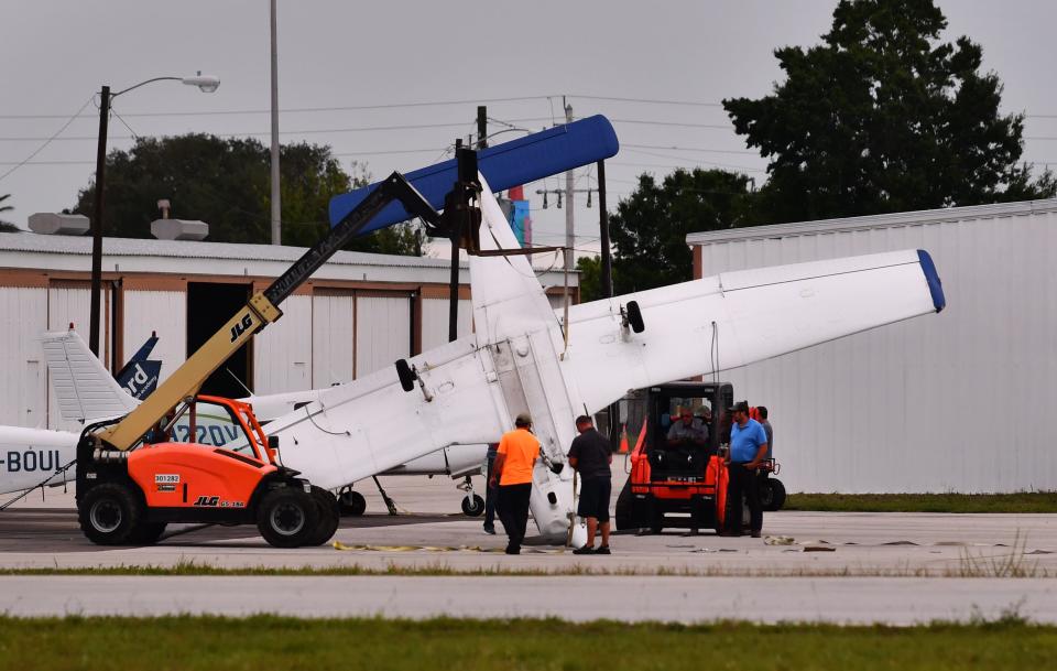
Fierce gusts flipped over three planes in the darkness Thursday night at Merritt Island Airport, continuing a week of wild weather lashing the Space Coast — with more severe storms expected through the weekend.
Thursday's late-night squall line originated along Florida’s Gulf Coast and pushed eastward through Brevard County, flipping the planes about 11:15 p.m., said Matt Volkmer, a meteorologist at the National Weather Service station in Melbourne.
A wind gust was recorded at 58 mph at Melbourne Orlando International Airport, Volkmer said. During an earlier round of storms on Thursday afternoon, a gust hit 60 mph at a Kennedy Space Center wind tower.
More: 'Insane' Florida weather: Best tweets, Instagrams, video, photos of hail in late April
More: Tornado strikes Micco mobile home park, damaging 25 to 30 homes near U.S. 1
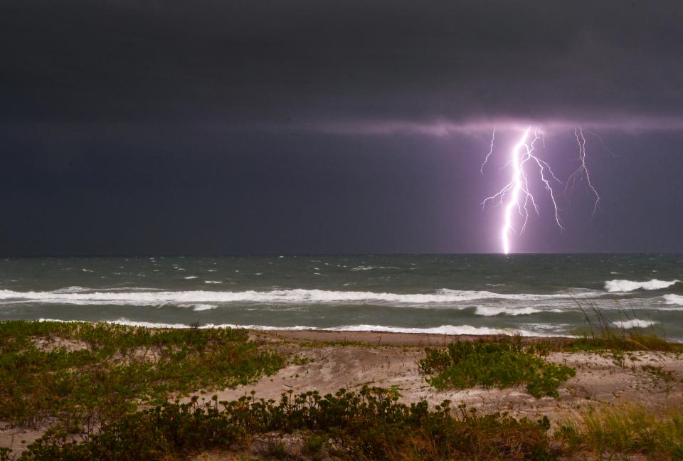
“We saw some funnel cloud reports (and) issued several tornado warnings for the Kennedy Space Center area, parts of Merritt Island, Port Canaveral. One of the reports of a funnel cloud was in the Viera area. Another report of a funnel cloud was on a portion of Merritt Island," Volkmer said.
The squalls swept past on the heels of Wednesday's freak hailstorm that pummeled portions of West Melbourne and Palm Bay with high winds, slush and flooding.
Parts of Florida have been hit with #severe over the last two days, where #thunderstorms have dropped #tornadoes and large #hail. This imagery from @NOAA's #GOESEast shows the severe storms from Wednesday, where golf-ball size hail was reported in locations. pic.twitter.com/D5EpBqVfkH
— NOAA Satellites (@NOAASatellites) April 28, 2023
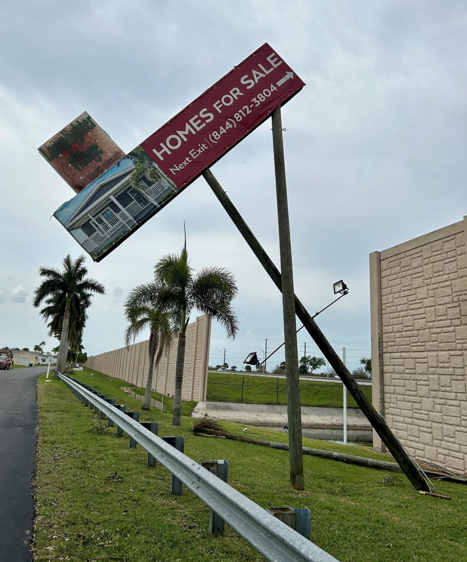
Volkmer said a gust of 71 mph was recorded at 3:23 p.m. Wednesday at a private weather station in the Lamplighter Village manufactured housing community near West Melbourne. On Thursday, Will Ulrich, NWS warning coordination meteorologist, toured the park and surveyed damages from the storm.
"There were at least several homes that either had carports or portions of roofs or siding blown off in that community," Volkmer said.
"And there was a large tree down that fell on a home, too," he said.
This afternoon, forecasters say conditions remain favorable in Brevard County for a few storms to become severe — packing damaging wind gusts near 60 mph, hail up to the size of a quarter, frequent lightning strikes and heavy rain.
“That active pattern continues as we get into Saturday. It looks like another pretty-likely round of showers and thunderstorms in the afternoon ahead of another system in the Gulf,” Volkmer said.
“We could do one more round of severe storms Sunday morning before it looks like we're going get into a quieter weather pattern for next week," he said.
Rick Neale is the South Brevard Watchdog Reporter at FLORIDA TODAY (for more of his stories, click here.) Contact Neale at 321-242-3638 or rneale@floridatoday.com. Twitter: @RickNeale1
Support local journalism. Subscribe today.
This article originally appeared on Florida Today: Planes flip at Merritt Island Airport amid strong storms on Space Coast

