Fighting fire with fire: Behind the massive prescribed burn in San Bernardino National Forest
Standing on a dirt road that runs across a ridgeline off Morris Ranch Road near Mountain Center, a small unincorporated community perched in the mountains that run between the Coachella Valley and Hemet, the perimeters of three fires that have burned in San Bernardino National Forest over the past two decades are all within the panoramic view.
The Mixing Fire burned over 3,000 acres near Mountain Center after starting near a materials mixing plant at the intersection of Highway 74 and Highway 243 in 1999. The Mountain Fire scorched 27,000 acres and destroyed 20 homes east of Mountain Center and Idyllwild in 2013, forcing mountain residents to evacuate and dumping smoke and ash onto Palm Springs. Five years later, in 2018, another large fire impacted the region when an arsonist started the Cranston Fire, which burned more than 13,000 acres, destroyed five homes, and forced more than 7,000 area residents to evacuate. And just out of sight on the other side of Thomas Mountain is the burn scar from the Fairview Fire, which burned over 28,000 acres east of Hemet last fall.
On Friday, June 16, three distinct plumes of smoke stretched into the sky from Thomas Mountain, another fire that would make a mark on the landscape. But this time, the fire was planned months in advance as a prescribed burn intended to reduce the amount of dry and flammable vegetation in the forest that could fuel future wildfires.
Focus on prescribed burns comes after century of fire suppression
Drier and hotter weather across the West driven by climate change has resulted in larger and more intense wildfires in the region, compounded by a long history of aggressive fire suppression. For over a century, fire management has focused on putting out fires as quickly as possible ― from the 1930s through the late 1970s, the Forest Service followed the so-called '10 a.m. policy' of putting out all forest fires by 10 a.m. the next day.
But wildfires play an important role in clearing dead and dry underbrush, which Indigenous peoples recognized and utilized through their own practices of setting fires to clear brush. During the past century of fire suppression, more of this brush was left to burn.
Following increasingly destructive fires in the West in recent years, state and federal officials are now placing a larger emphasis on prescribed burns. The move hasn't been without controversy - last year, two prescribed burns in New Mexico got out of control, becoming the largest recorded fire in the state's history and leading to the Forest Service placing a temporary ban on the practice.
But with millions and millions of acres of forest in need of fuels reduction, and an infusion of cash from the Bipartisan Infrastructure Law and the Inflation Reduction Act, Forest Service officials are now ramping up the practice again at a larger scale.
'We're trying to think bigger and more holistically'
The area near Mountain Center was selected for a prescribed burn because it was at risk of a wildfire burning down the mountain toward the community of Garner Valley. A prescribed burn would clear fuel, making it easier for firefighters to combat any future wildfires in the area. Last year’s Fairview Fire, which moved toward the area, demonstrates that “there is a natural tendency for fire to move towards this community,” said Josh Boehm with San Bernardino National Forest’s Front Country Ranger District, who served as a burn boss trainee on the project.
“We develop these projects by talking about what makes sense for community protection and firefighter safety. If a fire were to come through here, where can we safely engage a fire to protect the community? And how can we reduce those fuels to reduce the severity of firefighter engagement?” Boehm said.
Over the course of two weeks starting on June 15, the Forest Service conducted a prescribed fire operation on Thomas Mountain, located west of Garner Valley and southwest of Idyllwild and Mountain Center. The project’s size ― about 2,500 acres ― made it the largest single prescribed fire project in San Bernardino National Forest in roughly the last 15 years, according to Boehm.
The burn was initially slated for about 250 acres, but the size was increased to 10 times that after the Forest Service selected Southern California in January as one of 11 priority landscape project areas that will receive a combined $490 million to reduce wildfire risks. In Southern California, forest officials responded by “increasing the pace and scale” of wildfire prevention projects, says Boehm.
“We weren’t designing huge projects, which we’re changing now, we’re trying to go with more landscape-level projects. But because we have been so limited on resources and funding and everything else, we’ve had small targeted projects. Now, we’re trying to think bigger and more holistically,” Forest Fuels Management Officer Lauren Blake said.
The Southern California Fireshed Risk Reduction Strategy, which spans 4 million acres of Forest Service lands across Angeles, Cleveland, Los Padres, and San Bernardino National Forests, is home to 25 million people and has the nation’s highest concentration of high-risk firesheds, areas that show where fires ignite and are likely to spread. The region is also home to an increasing number of homes in the wildland-urban interface, where homes overlap with fire-prone landscapes.
Initial projects in Southern California are planned for 2023-26, with $10 million allotted toward a goal of 5,000 treated acres in fiscal year 2023, and a goal of treating a total of 27,500 acres in the next three years. In addition to prescribed burns, other projects include “hardening” homes and utility infrastructure in the wildland-urban interface and creating defensible space around homes.
Four other selected projects span California: Plumas National Forest, Trinity National Forest, the Klamath River Basin, and the Humboldt-Toiyabe National Forest. The 11 new project areas are in addition to an initial 10 landscape projects announced by the Forest Service last year as part of the agency’s broader Wildfire Crisis Strategy, which also received funding through the infrastructure law. Combined, a total of $930 million will be invested in the 21 projects, spanning 45 million acres of the nation’s forests.
The 10-year strategy “calls for treating up to 20 million acres on national forests and grasslands and up to 30 million acres on other federal, state, Tribal, private and family lands to assure our forests are more resilient to wildfire and other effects of climate change, safer for communities, and remain key refuges for plants, fish and wildlife, according to a January press release from the U.S. Department of Agriculture.
Prescribed burns dependent on weather, resources
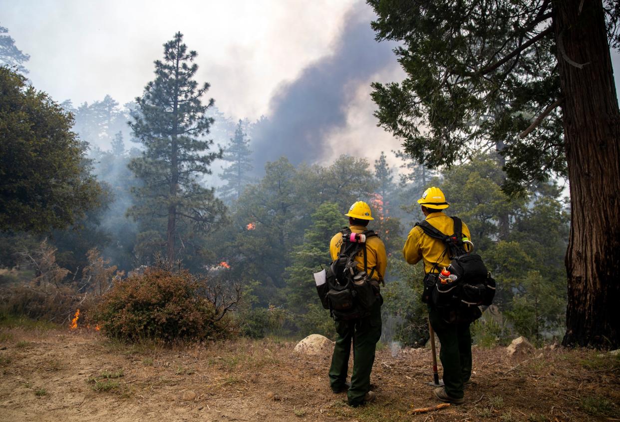
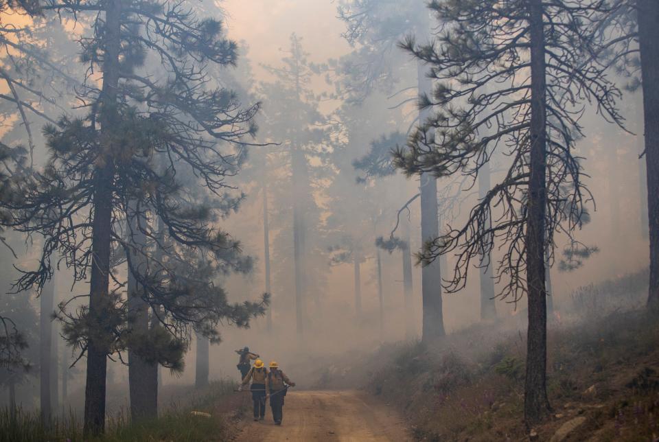
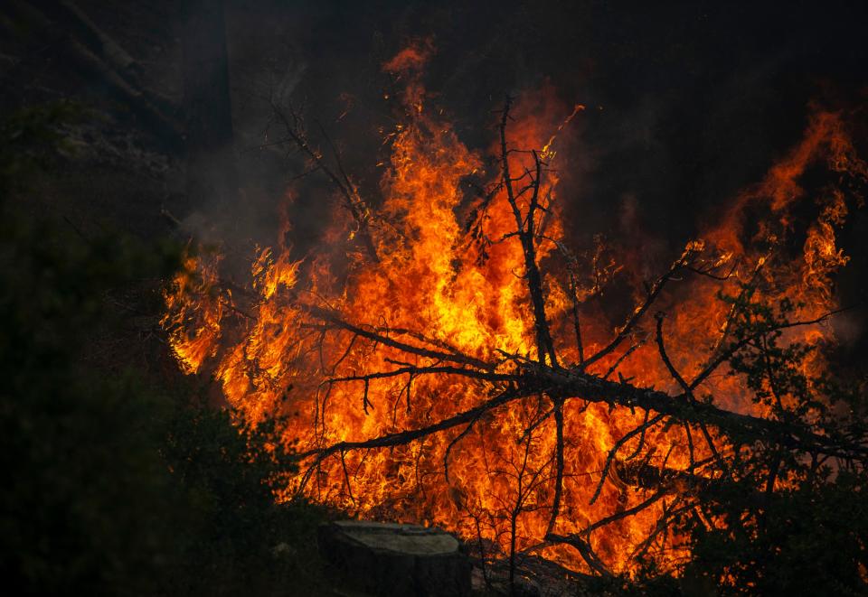
From miles away, the three plumes of smoke rising from Thomas Mountain looked like three separate larger fires. But a drive up the bumpy 4WD Thomas Mountain Road from Highway 74 to the project site revealed that, up close, each plume of smoke came from dozens and dozens of smaller fires lit by firefighters with drip torches. In addition to firefighters lighting fires by hand, helicopters also ignited fires from the air with a helitorch, which is essentially what it sounds like ― a torch hanging down from a helicopter.
In previous years, firefighters have chipped away at dry and dead vegetation by thinning the plant growth or by pile-burning the organic matter. But this burn involved a larger-scaled "broadcast burn" across the landscape, which has been a rarer tool in local forest management, especially at the scale of this month’s project, because of a lack of resources. Prescribed burns are also very weather dependent, and during this month’s fire burn bosses checked the weather every 30 minutes to make sure conditions were appropriate to ignite fires, and when the weather wasn’t just right ignitions were stopped.
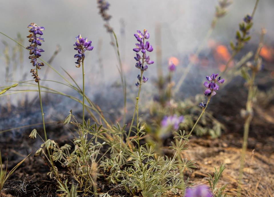
Up on Thomas Mountain, firefighters lit a patchwork of fires that burned through pine needles, dry vegetation on the underside of shrubs, and downed and dead trees, and mostly appeared to leave purple lupines and other wildflowers and plants with high moisture content unscathed. The goal with prescribed burns is to create a “mosaic” pattern, says Blake, leaving patches of blackened landscape without fuels that will hopefully slow down a wildfire’s path, and targeting older and dryer brush while leaving younger growth. Blake says the idea is to mimic the ways that lightning fires historically impacted the landscape, before the past century of fire suppression.
“We haven’t been able to let our lightning fires burn for 100-plus years, so now we’re seeing the end result for it, and we have this wildfire crisis because we haven’t been able to let nature take its course and have focused on suppressing fire for so long, and we haven’t had the infrastructure to be able to go out and treat all of these millions of acres of land and keep it healthy,” said Blake.
Planning for the prescribed fire operation took about eight months, and actually executing a planned burn is heavily dependent on weather conditions. Typically, June would be too late in the season for prescribed burns, but this year’s wet winter shifted the ideal season back. After Thomas Mountain, no other burns are planned for San Bernardino National Forest this season, and the Forest Service plans to resume prescribed burns “as early as the fall if weather and fire conditions allow us the opportunity,” according to Public Information Officer Stephanie Bishop.
Another 1,000 to 2,500 acres of prescribed burns are planned for Thomas Mountain in 2024.
This article originally appeared on Palm Springs Desert Sun: San Bernardino National Forest prescribed burn is largest in years. Why now?

