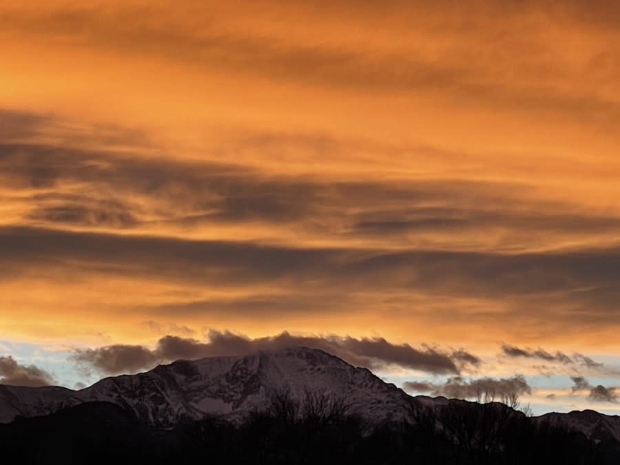
Fire danger, high winds, Spring, and snow all expected next week
(SOUTHERN COLORADO) — A couple of different seasons are likely to impact Colorado over the next several days. These impacts come at a very unique time with Meteorological Spring now less than a week away. The first day of Spring, as meteorologists measure it, starts March 1.

With the arrival of Spring, temperatures for this time of year should generally be in the upper 40s and lower 50s across most of the Eastern Plains. However, Colorado doesn’t typically like to ‘play by the rules’ so to speak.

Highs across the area are expected to vary widely from the lower 30s on into the middle 70s depending on your elevation. One of the main reasons we will see these abnormally warm temperatures is due to strong winds rolling through from the west.
As winds out of the west descend from our mountains, they compress and warm. That warm, sinking air reaches the lower elevations and continues pushing further east. The Arkansas River Valley has even lower elevation and will therefore warm even more.

Winds on Sunday and Monday are expected to be quite breezy. Sunstained winds will be roughly 20 to 30 mph each day, whereas winds may gust up to 50+ mph.

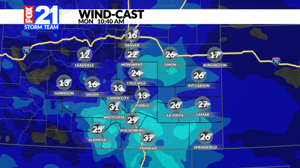
Where is all of the wind coming from? Well, we have a couple of different energy sources that will bring this dynamic weather to the area:
Location 1: a spinning low-pressure system off of the west coast
Location 2: an incoming trough from the pacific northwest

These two sources of energy will meet right over the Rocky Mountains in the coming days. Their expected approach will start to trigger high winds, high fire danger, warm temperatures and eventually snow.

With the warm temperatures, dry conditions and very windy weather on the way, fire danger will significantly increase for your Sunday and Monday.

Red flag warnings are in effect for the good majority of the area this Sunday. Burning of any kind is not advised and can lead to rapid fire spread and growth. You may also notice the winter storm watches now active for much of our higher terrain out west. A strong cold front is expected to move in Tuesday bringing snow chances with it.


Currently, models are hinting at a widespread chance for snow across the area Tuesday. With that being said, lower elevations may not see quite as much this time around. It appears that the high country will likely see the higher totals.
Patterns and data will certainly shift over the coming days so be sure to check back in with the FOX21 Storm Team for future updates.
For the latest news, weather, sports, and streaming video, head to FOX21 News Colorado.

