Fire whirls and pyrocumulus clouds: How fire creates its own weather
Substantial fires can make their own weather – and do it in several ways.
The most common weather phenomena wildfires can create include pyrocumulus clouds, fire tornadoes and smoke clouds that cause significant cooling.
Here’s more about them:
Pyrocumulus clouds
Fire clouds are known as pyrocumulus. In Latin, pyro means “fire” and cumulus means “pile” or “heap.”
They form over heat sources due to the intense, upward vertical motion of air cooling and condensing as it moves higher into the sky.
If fires burn hot enough, they can create clouds that produce lighting and rain, called pyrocumulonimbus.
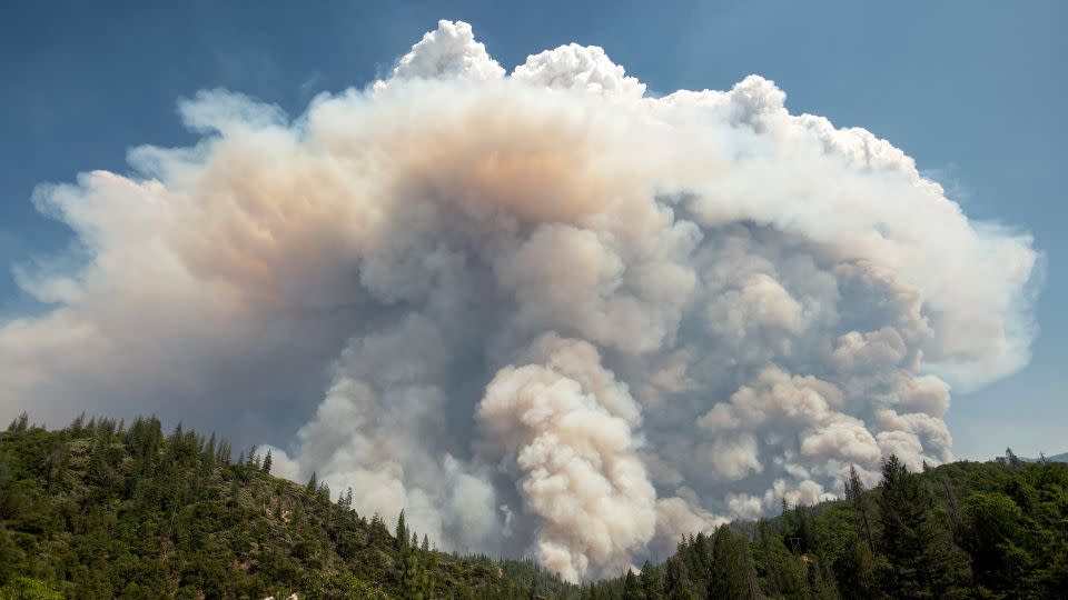
Pyrocumulonimbus clouds look much darker than typical clouds because of their large amounts of smoke and ash.
They can reach heights of 50,000 feet and generate their own systems of thunderstorms.
And sometimes, lightning strikes generated from them even can ignite additional fires.
Fire whirls
Fire whirls occur when superheated air near the surface of a large fire zone rises rapidly in an air mass that also spins, much like a dust devil or whirlwind. But instead of dust, the rapidly rising air above a wildfire can accelerate into a very tightly spinning column of air composed of fire.
Thunderstorms formed by pyrocumulonimbus clouds can spawn large fire whirls – sometimes called firenadoes – if there is enough instability in the atmosphere.
The most extreme example of this happened during the 2018 Carr Fire in California. The wildfire spawned a fire vortex with winds as high as 140 mph and temperatures up to 2,700 degrees Fahrenheit.
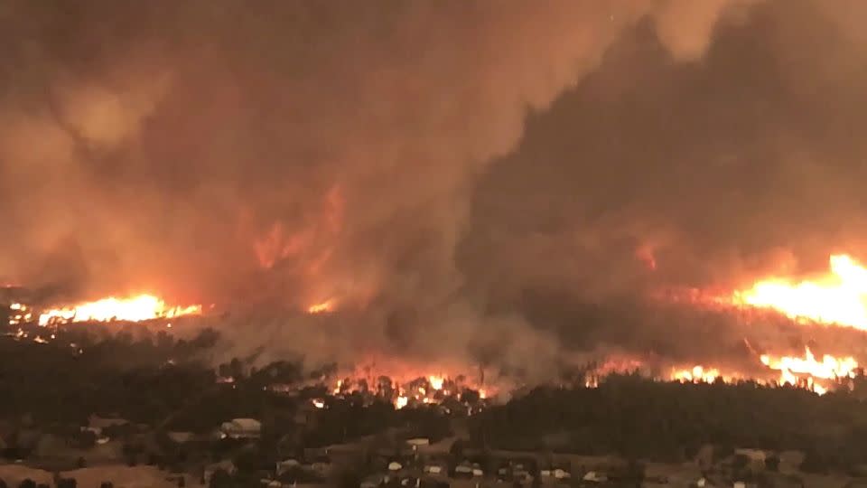
However, typical spin-ups from wildfires have a weaker spin and do not normally meet tornado qualifications.
Smoke clouds
The clouds of smoke that wildfires can produce may also serve to cool the environment in some cases.
Such clouds can be thick enough that sunlight struggles to get through, leaving the surface much cooler than it would have been if warmed by the sun.
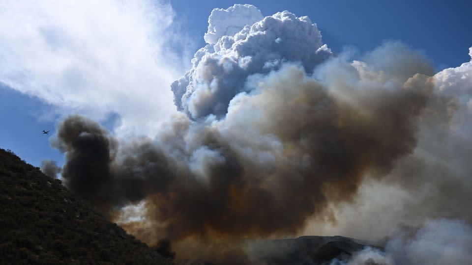
These clouds can sometimes produce rain to help put out a fire, though the rain often evaporates before reaching the ground because of the hot, dry environment.
For more CNN news and newsletters create an account at CNN.com

