UPDATE: McCully Mountain Fire 100% contained
UPDATE at 11:55 a.m. on Tuesday, Sept. 12
The McCully Mountain Fire has been 100% contained, according to the Oregon Department of Forestry. Fire crews are continuing to mop up a blaze that reached 15 acres and brought level 1 evacuations to the area south of Lyons and east of Scio.
"We will have resources on this fire for the next few days, please continue to allow them to their job and stay clear of the area," ODF said in a Tuesday update.
UPDATE at 11:45 a.m. Monday, Sept. 11
The McCully Mountain Fire was calm overnight, which allowed fire crews to get a fire line around 100% of the blaze and start getting it plumbed and mopped up, officials said Monday morning.
The fire is now officially 5% contained. Overnight, the blaze was mapped at 15 acres.
A level 1 evacuation warning that had been issued for the area was lifted by the Linn County Sheriff's Office.
"We have lots of resources on the fire today, please avoid the area to allow the firefighters to work," the Oregon Department of Forestry, North Cascades District said in a morning post.
The fire, located in the upper Thomas Creek Canyon on private timberland, and southwest of McCully Mountain, is being attacked by fire crews from the Oregon Department of Forestry.
———
Original story
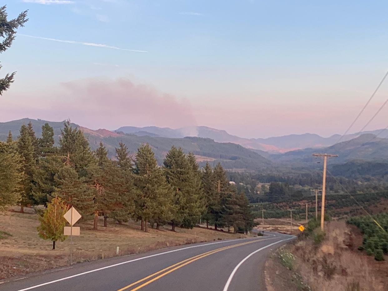
An 18-acre wildfire burning south of Lyons near McCully Mountain has brought level 1 evacuations warnings to a remote part of Linn County.
The fire, located in the upper Thomas Creek Canyon on private timberland, and southwest of McCully Mountain, is being attacked by fire crews from the Oregon Department of Forestry.
The fire is visible from higher elevations in the Stayton-Scio area and in the Santiam Canyon.
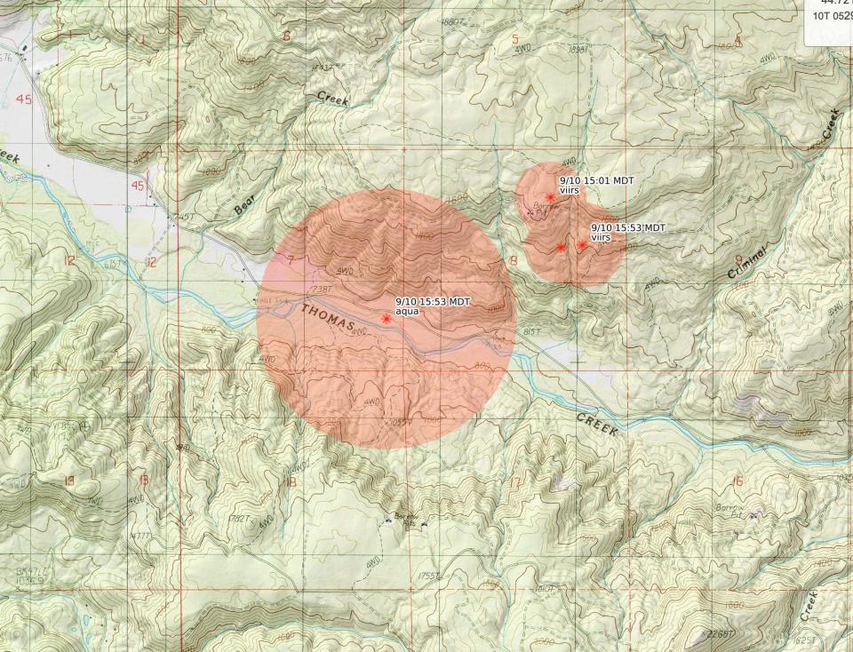
"The fire is past the locked gates of Thomas Creek Drive, and in remote terrain," the Linn County Sheriff's Office said. "As a precaution, LEVEL 1 (BE READY) evacuation preparedness alert for the following area:
"Beginning at the intersection of South Cedar Mill Road and Trask Road, south to Thomas Creek, traversing the creek west to where Bear Creek dumps into Thomas Creek, then north to the intersection of South McCully Mountain Road and East McCully Mountain Road, encompassing all residences on both sides of both South McCully Mountain Road and East McCully Mountain Road."
(Here is a map showing the evacuation area).
There is no evacuation warning, currently, for Lyons or Scio, the two closest towns.
"While the areas within a level 1 area remain open, persons living or visiting the level 1 area should stay alert and prepared, as evacuation levels can change with fire conditions quickly and alerts may not be able to be delivered to cell phones in the area," the Linn County Sheriff's Office added.
Zach Urness has been an outdoors reporter in Oregon for 15 years and is host of the Explore Oregon Podcast. To support his work, subscribe to the Statesman Journal. Urness is the author of “Best Hikes with Kids: Oregon” and “Hiking Southern Oregon.” He can be reached at zurness@StatesmanJournal.com or (503) 399-6801. Find him on Twitter at @ZachsORoutdoors.
This article originally appeared on Salem Statesman Journal: UPDATE: McCully Mountain Fire 100% contained
