First day of hurricane season is the perfect time to learn how to track hurricanes
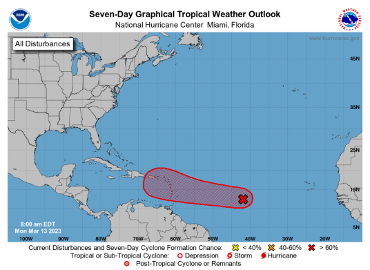
The 2023 Atlantic hurricane season has officially kicked off and the National Hurricane Center already has its eye on a system of low pressure in the eastern Gulf of Mexico, which has been designated as Invest 91L.
That designation means that meteorologists are gathering specialized data and developing forecast models for where the system may go.
Tracking storms and their development is increasingly more important for Floridians as severe weather becomes more frequent, but tracking them — or even understanding where to begin — can be confusing and time-consuming.
Invest 91L expected to impact Florida: National Hurricane Center designates system as Invest 91L. Florida impact expected
Best hurricane tracking apps: Stay prepared for the 2023 hurricane season with one of these five hurricane tracker apps
Here’s a guide that will help you better understand how storms are tracked, how to read weather radar and provide you with easy-to-use resources to stay on top of it all with little effort.
Don’t have a lot of time? Here’s the best way to track storms
Without a doubt, the best way to keep track of severe weather is to find a local news source, download its mobile app and turn on notifications (weather alerts, at the very least).
During hurricane season, most news sources will have someone manning weather coverage across the clock, pushing frequent updates, and providing safety information such as evacuation routes, where to find gas, supplies and other important local details.
This info will be broken down into digestible bits that can help you make quick and informed decisions every step of the way.
Hurricane prep on a budget: On a budget? Here's 5 cheap ways to prepare your home for Florida's hurricane season
Tax free holidays in Florida: Florida's disaster preparedness sales tax holiday started Saturday. What you should buy
What is the best source for hurricane and storm tracking?
The National Oceanic and Atmospheric Administration, National Hurricane Center and National Weather Service are the best sources for weather monitoring.
The NHC’s mission is to help save lives, mitigate property loss and improve economic efficiency by issuing accurate watches, warnings, forecasts and analyses of hazardous tropical weather. It also continuously works to educate the public about severe weather and hazards.
Information from the NHC is typically what is used to inform weather reports from local news sources and weather-related alerts pushed to mobile devices.
During the season, NHC pushes tropics outlooks multiple times a day but increases their frequency as a storm approach.
How accurate are hurricane and storm forecasts?
According to NOAA, seven-day forecasts can accurately predict the weather about 80% of the time, five-day forecasts are accurate about 90% of the time and 10-day forecasts or longer are accurate about 50% of the time.
Weather forecasting is a science often taken for granted. The first telegraph service that began collecting weather data and producing charts began in 1869, according to the NWS. With the radical advancement of technology since, it’s easy to assume that forecasting has become trivial, but it’s not that simple.
WeatherTiger: 2023 hurricane season will be 'once-in-a-generation slugfest' between tropical forces
NOAA's forecast: Hurricane season 2023 has begun in the Atlantic. Here's what to expect and when it ends.
Forecasts tend to rely on weather models, which are extremely complicated math problems that use data collected by weather stations, radars, satellites and other weather instruments together with over 150 external parameters in addition to internal parameters in the model itself.
As you can imagine, that’s a large volume of data and it scales exponentially with the size of the model’s grid. The bigger the grid, the less accurate forecasts become. These models must also be updated frequently to account for new data.
This has led to the creation of local weather models that offer smaller but more detailed forecasts, and it’s the reason so many weather models exist.
How far can you predict a hurricane?
Meteorologists can predict how many hurricanes a season is expected to see before it begins. Hurricane season forecasts and often published in the spring.
Starting on May 15, the NHC will issue tropical weather outlooks four times a day until the end of the season on Nov. 30. Systems can be detected well before they become storms or hurricanes, and these outlooks will indicate the likelihood the system will develop.
Hurricane paths can be predicted between 3 to 5 days in advance, leading to the charts showing the dreaded “cone of uncertainty.”
When are storm and hurricane updates posted?
Starting May 15 through November 30, NHC issues a Tropical Weather Outlook each day at 2 a.m., 8 a.m., 2 p.m. and 8 p.m. EDT.
For every active tropical cyclone, NHC issues a complete advisory package at 5 a.m., 11 a.m., 5 p.m., and 11 p.m. EDT. It includes an updated forecast and graphics with the track and intensity forecast, time of arrival of tropical storm and hurricane-force winds, key messages, a potential storm surge flooding map, and a storm surge watch/warning graphic. NHC also posts the same information on Facebook and Twitter to ensure a wide distribution.
When hurricane watches or warnings are posted for a portion of the U.S. coastline, NHC opens a television media pool to provide live interviews to national news/weather outlets and those local TV stations in the path of the storm.
NWS provides timely forecasts and decision support services to help local officials determine what public safety actions are needed, such as whether to evacuate, close roads and schools, or open shelters.
How to read 'cone of uncertainty' chart
Forecast one graphics are often misinterpreted because many people use them to determine if they will be impacted by an approaching storm and whether or not they should prepare or evacuate.
It is important to remember that this graphic predicts where the center of the storm may go and that hurricanes are likely to affect areas outside of the cone. It can also be used to understand how big the storm is at that moment and to see current coastal wind watches and warnings.
The size of the cone is drawn based on how likely the eye is likely to remain inside the cone and is not an indication of the size of the storm. How accurate − or not − NOAA's predictions have been over the past five years are also factored into the size of the cone, which it says is accurate about 66% of the time.
How to get weather alerts, warnings on your phone
Wireless Emergency Alerts (WEAs) are short emergency messages from authorized federal, state and local authorities that can be broadcast from cell towers to any WEA-enabled mobile device in a locally targeted area.
You don't need to do anything to receive WEA -- most phones come with this feature already enabled on their mobile device.
Here's how to check and see if you have WEAs enabled on your device:
For iOS
Go to settings -> Notifications
Scroll to the bottom of the screen
Under Government Alerts, check and see if the feature is enabled
For Android
Go to settings -> Safety & Emergency
Tap Wireless emergency alerts
From this menu, you can toggle alerts, specific alerts and check alert history
Storm and hurricane tracking resources
Follow USA Today Network Florida newspapers
This article originally appeared on Pensacola News Journal: Is a hurricane coming to Florida? Here's how to track it
