Gloomy weather ends the week in southern Ontario ahead of first frost risk
Rainy and breezy conditions will end the week in Ontario as a clipper system gusts into the region from the west.
While the ongoing stretch of gloomy conditions will finally break behind this clipper, clearer skies and a blissful return of sunshine will only set up in time for Sunday night to bring many communities their first frost of the season.
SNEAK PEAK: What El Niño means for Canada's upcoming winter season
A clipper continues through Friday
It’s never too early in the season to talk about Alberta clippers—but at least we’re not looking at a thump of snow with this particular visitor.
Showers will start our Friday across Ontario as this low-pressure system pushes in from the west. Rain will spread east through the day and persist across portions of eastern Ontario heading into Saturday.
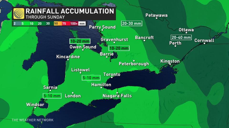
General totals of 5-10 mm of rain are in the forecast for the Greater Toronto Area (GTA), with 10-20 mm possible across higher elevations, near the Huron shores, and up toward cottage country. Folks near Ottawa could see 20-30 mm of rain where the precipitation lingers into Saturday.
SEE ALSO: How to trick you brain into feeling happy on this gloomy day
Breezy conditions will continue as this system treks across the region. Gusts of 30+ km/h are possible into Friday, with lakeshore communities expecting the most blustery winds.
Chilly air brings first frost risk Sunday night
Sunday will feature plenty of weather we haven’t witnessed across southern Ontario in quite a while.
For the first time in weeks, we’ll see significant clearing on Sunday as that departing system clears out of the region. Clouds have been a mainstay in the skies over the GTA lately. Toronto has endured 18 straight days with minimal sunshine.
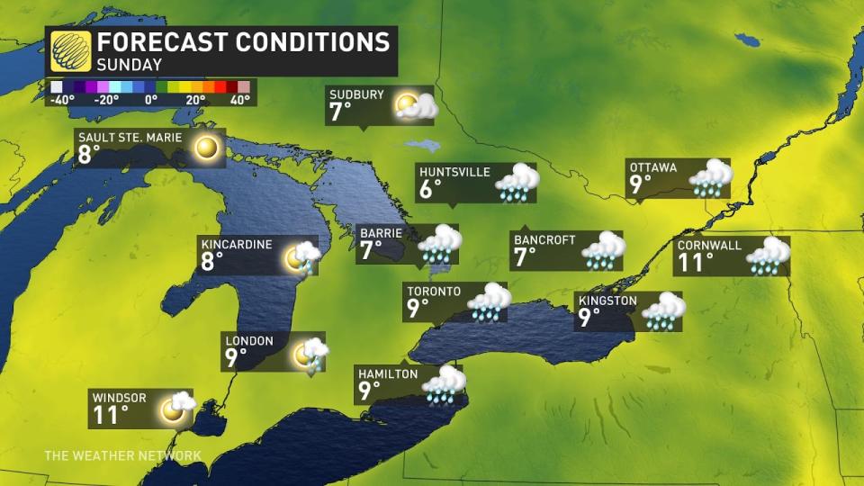
That long-awaited sunshine comes with a downside for warm-weather lovers, unfortunately, as much cooler air pushes into southern Ontario.
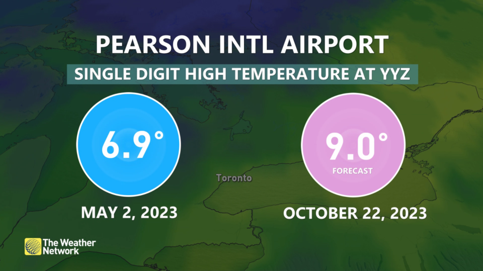
Chilly northwesterly winds will keep daytime high temperatures in the single digits for most of the province. It’s been more than four months since Toronto last saw a high temperature below 10°C.
Brisk daytime temperatures and limited clouds Sunday night will bring about low temperatures dipping awfully close to the freezing mark.
This will lead to a risk for the first frost of the season in many communities, including the City of Toronto, Mississauga, Oakville, Burlington, and Hamilton.
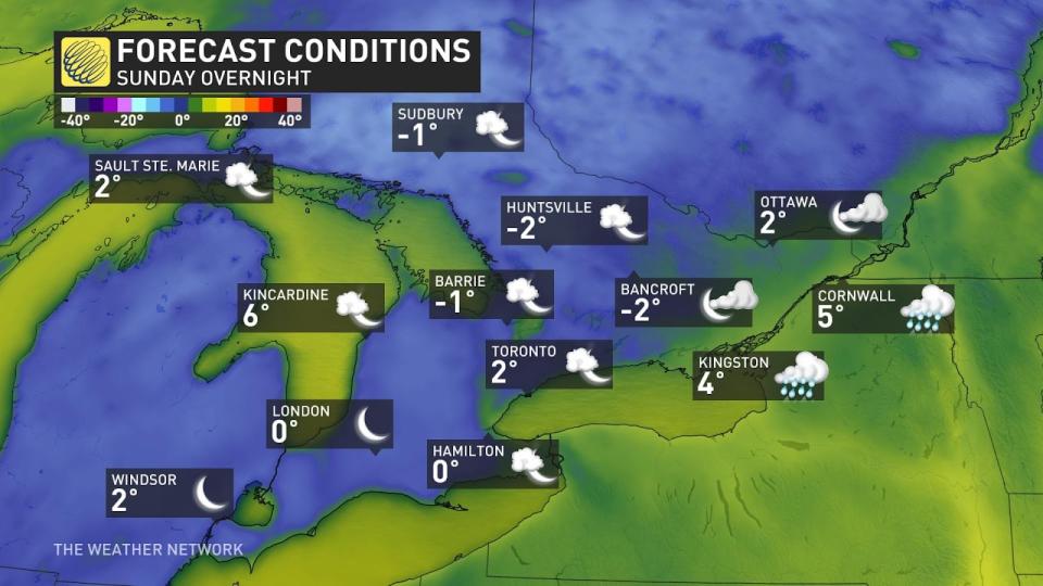
Communities in southwestern and eastern portions of the province may miss out on the frost, as could folks in the GTA right along the lakeshore—but everyone else should take proper precautions, wrapping and protecting any vulnerable crops or plants.
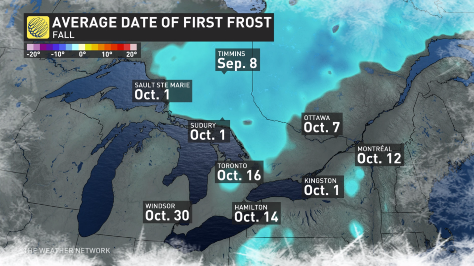
It’s not unusual to get frost this time of year near the city and around the Golden Horseshoe. Many locations are actually a few days behind their average first frost.
WATCH | Don’t let rainy, dreary days get you down; try this instead
Stay tuned to The Weather Network for the latest forecast updates in Ontario.

