First Warning: Wettest weather since October due late this week
AUSTIN (KXAN) — Although we haven’t seen a drop of rain in downtown Austin this month, our luck is about to change with a slow moving storm system moving our way later this week.
In-Depth: we haven’t had more than an inch of rain fall in one day at Camp Mabry since October 26.
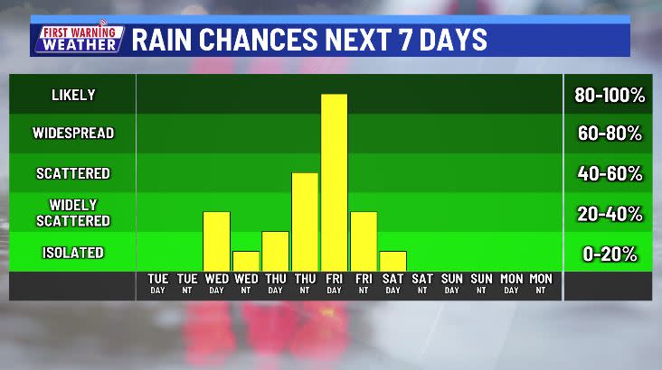
As things stand now, the rain will be slow to progress eastward with rain chances mostly confined to the Hill Country on Wednesday. Rain backs down a touch on Thursday, but by Friday, most of us should be in for a widespread soaking. Saturday should be a drying day with some lingering morning showers wrapping up into the afternoon.
Rainfall amounts
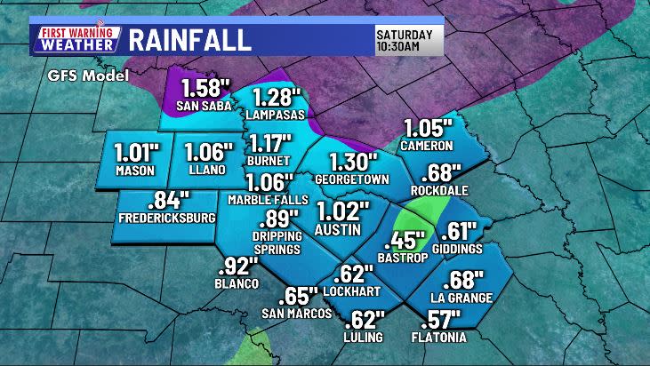
Exactly how much rain we get will depend on a few factors including the eastward motion of the storm system as a whole and whether we can get many thunderstorms to enhance rainfall intensity.
As of now, the forecast points towards most getting 0.5″-1.25″ with pockets of 2″-3″.
Weather threats
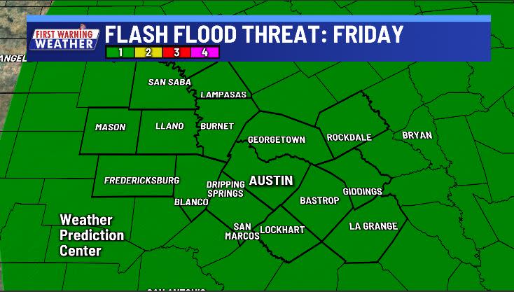
Most of Central Texas is still in severe drought and should be able to handle *most* of this incoming rain, but if it comes too quickly we could see problems.
A marginal risk for flash flooding (city/urban flooding, not river flooding) exists for all counties on Friday.
Stay with the First Warning Weather Team as we track any changes to this storm system.
For the latest news, weather, sports, and streaming video, head to KXAN Austin.

