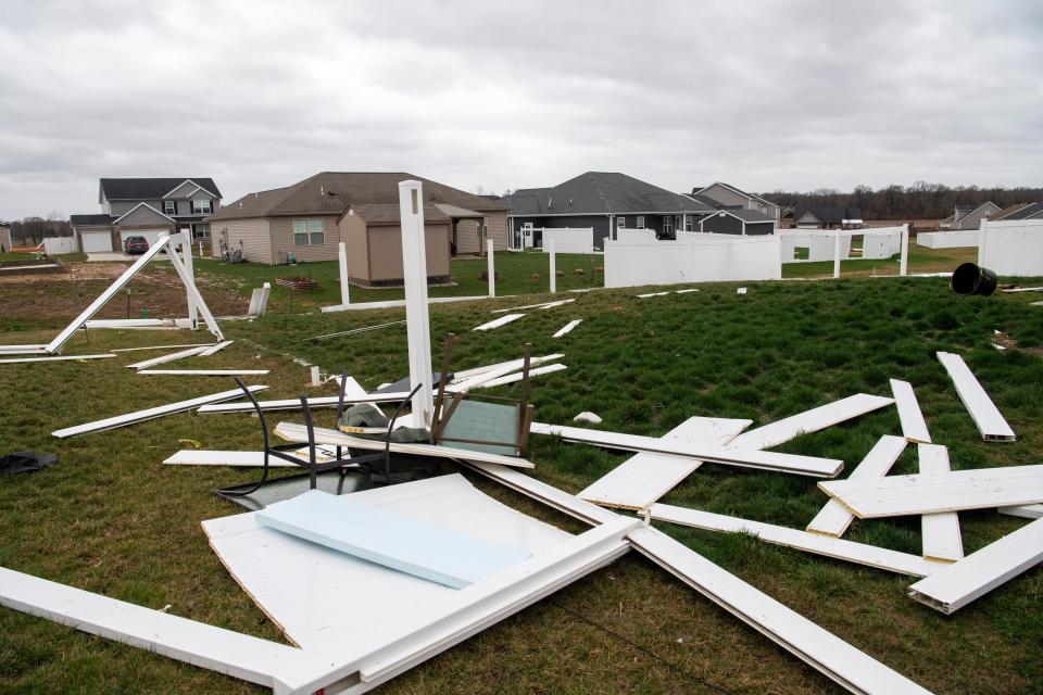
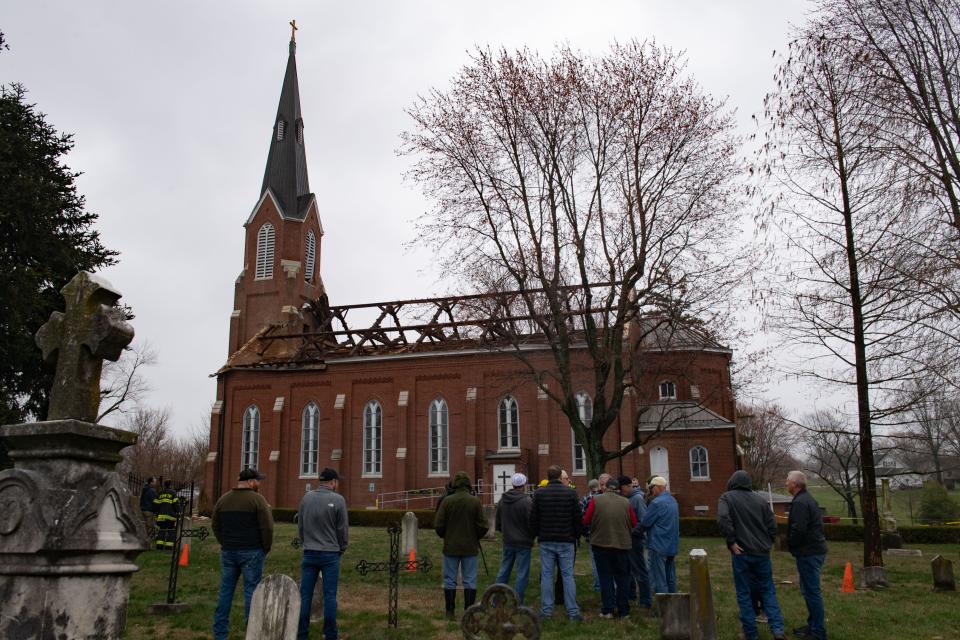
Severe weather rolls through Tri-State area; damage reported
A line of severe thunderstorms rolled through the Tri-State on Friday, spawning tornado warnings and reports of flooding, as well as property damage.
Several tornado warnings were issued as a line of storms rolled in from Western Kentucky into Southwestern Indiana during the lunch hour. While most of the warnings were based off radar returns, one was spotted near the Kasson area, which is between the West Side of Evansville and the Posey County line near Indiana 66.
It was the capper to a 12-hour stretch that saw several inches of rain fall on cities throughout the region. The National Weather Service reported sustained winds of 28 mph Friday afternoon with gusts topping 50 mph. A high-wind warning is expected to remain in effect through Friday evening.
Creeks and streams were swollen by daybreak and some roadways were covered, prompting the National Weather Service to issue a flash flood warning for most of the area.
CenterPoint outages
As of 4:20 p.m. CenterPoint reported more than 18,000 customers had lost power. No restoration times have been listed.
More than 2,000 customers appear to have been affected in the Lorraine Park neighborhood on the East Side of Evansville, according to Center Point.
Another large outage related to the afternoon storm was on the far West Side of Evansville in the University of Southern Indiana area with over 1,000 customers impacted.
Severe weather in our area has resulted in widespread power outages. If you see a downed line, stay at least 35 feet away, call 911 and then us at 800-227-1376.
— CNPAlerts Indiana (@CNPAlerts_IN) March 3, 2023
How much rain has fallen?
The weather service reported 3.73 inches of rain from the storm as of 1 p.m. at Evansville Regional Airport.
Evansville Vanderburgh Central Dispatch had fielded four calls for water rescues as of 9 a.m. A supervisor there couldn't even count the number of calls they'd had for flooding or high water, only saying there were "a lot" − and that they were coming from all over the city.
"Shoot, I had trouble getting to work this morning," he said. "And my area doesn’t flood.”
So what made this storm so strong?
The low-pressure area associated with the storm was unusually powerful. The National Weather Service office in Paducah, Kentucky, recorded a pressure of 980.2 mb around 10:15 a.m. Friday, the lowest it's ever recorded at the site.
It was even lower in Evansville, where the weather service recorded a pressure reading of 976 mb. That level of pressure is what meteorlogists typically see in a Category 2 hurricane. The previous record low pressure for the city, 979.7 mb, was set in February 1926.
What roads are closed in Vanderburgh County?
Old Princeton Road from Baseline Road to Stacer Road
Baseline Road from Korff Road to Old State Road
Wortman Road in Darmstadt
Access to Ascension St. Vincent hospital's Washington Avenue entrace was closed as of 1:25 p.m. Friday due to downed power lines, according to Evansville-Vanderburgh Central Dispatch supervisor Braden Buss.
"People attempting to access the hospital should come in from Bellemeade west of Saint Mary's Drive," Buss said.
More:Weather service: Flooding concerns are growing as rain heads to Tri-State
How does this compare to a month's worth of rain?
The average total precipitation for Evansville in March is 4.6 inches, so it's possible the city will receive that much in just one day.
This article originally appeared on Evansville Courier & Press: Flash flood warning in effect for Evansville, Henderson areas

