Flash flood warning issued for central Larimer County burn scar
A flash flood warning has been issued for a portion of the Cameron Peak Fire burn scar in central Larimer County until 3:30 p.m. Thursday, July 20.
At 12:23 p.m., Thursday the National Weather service said radar and automated rain gauges had recorded a half inch of rain with another half inch possible, resulting in flash flooding taking place or soon to take place.
Those in the warned area are urged to move to higher ground.
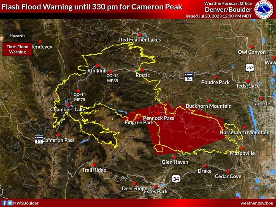
The warned area includes:
Pennock Pass
Pingree Park
Box Prairie
Upper Buckhorn along County Road 44H
Moondance Way
Stringtown Gulch
Big Bear
Lower Buckhorn on County Road 27 above Masonville
Crystal Mountain
Poudre Springs
Upper Pingree Park Road
Sky Ranch
Storm Mountain
Flash Flood Warning for Cameron Peak burn area until 330 pm. #cowx pic.twitter.com/WECwLQ5yfr
— NWS Boulder (@NWSBoulder) July 20, 2023
Second flash flood warning for Cameron Peak Fire burn scar
The National Weather Service has issued a flash flood warning for an area of the northern Cameron Peak Fire burn scar until 4:15 p.m. July 20.
That area includes south of Red Feather Lakes to Rustic and Colorado Highway 14 and west to Kinikinik.
Flash Flood Warning for northern portions of Cameron Peak until 415 pm. #cowx pic.twitter.com/vPln8ft2sG
— NWS Boulder (@NWSBoulder) July 20, 2023
Fort Collins included in large area under severe thunderstorm watch
The National Weather Service has issued a thunderstorm watch for much of the eastern half of Colorado, including Fort Collins, until 9 p.m. July 20.
The weather service said a couple tornadoes, widespread hail and wind gusts to 75 mph are possible in the area.
Vigilancia de Tormenta Severa ha sido emitida para partes de Colorado, Nebraska y Wyoming hasta las 9 PM MDT pic.twitter.com/8QHLpyiR6J
— NWS Boulder (@NWSBoulder) July 20, 2023
This article originally appeared on Fort Collins Coloradoan: Flash flood warning issued for Cameron Peak Fire burn scar

