Flash flood warnings continue into the week after weekend of storms throughout state
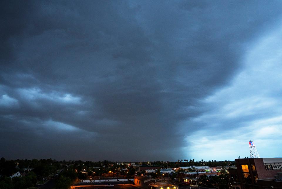
Arizona saw rain, thunder and dust storms and flash flooding this weekend and meteorologists say to expect inclement weather to continue into the week.
Western Maricopa County received heavy rain early Sunday and showers continued moving northwest into La Paz and northeastern Yuma county, according to the National Weather Service in Phoenix. The storms brought winds of 30 to 40 mph, according to Bianca Feldkircher, a meteorologist for the weather service.
Feldkircher said some areas near Casa Grande got up to 2 inches of rain. There was also flooding in some areas of southern Maricopa County.
State Route 238 closed about 10 miles west of State Route 347 between Maricopa and Gila Bend due to flooding, according to the Arizona Department of Transportation. It was still closed as of 3 p.m. on Sunday and there was no estimated time for reopening.
Dust storm activity was seen in south Phoenix, Mesa and Buckeye. In Goodyear, visibility was down to half a mile, according to Feldkircher.
As showers moved through the metro area Sunday morning, the temperature at Phoenix Sky Harbor dropped to 80 degrees and the humidity increased.
Southern Arizona saw strong thunderstorms develop overnight near Vail, over the Sonoita area and in Fort Huachuca, where 0.82 inches of rain were recorded in 11 minutes with wind gusts over 50 mph, according to the National Weather Service in Tucson. West Graham County and west Cochise County received strong thunderstorms overnight as well.
The storms also moved towards the Tucson metro where there were "cloud-to-ground strikes " and light showers.
In Pinal County there was heavy rain, strong winds and blowing dust early Sunday, according to the weather service.
The thunderstorms in southern Arizona caused rockslides north of Bisbee, according to Rob Howlett, a meteorologist at the weather service office in Tucson. That area received heavy rainfall of up to 3 inches as of Sunday afternoon.
Howlett also said they had received reports of 1-2 inches of flooding as well as washes running in that area and in mountain areas, including Madera Canyon.
In Flagstaff there was flooding on Saturday across U.S. 89 and in Doney Park associated with the Pipeline Fire burn scars, according to Cynthia Kobold, a meteorologist with the National Weather Service in Flagstaff.
She said some areas had 1 to 2 feet deep of accumulated water. There were also reports of flooding in some apartments in north Flagstaff.
About 1.7 inches of rainfall fell over the course of two hours on top of the mountains in the burn scar, which contributed to the flooding, according to Kobold.
“So it was coming down pretty hard, pretty fast, which is part of the reason why that flooding ended up occurring,” Kobold said.
What is a monsoon? Here's the definition
Active monsoon pattern continues past the weekend
An active monsoon pattern is expected to last until late Tuesday or early Wednesday in La Paz, Yuma, Maricopa, southern Gila and northern Pinal counties, according to the weather service.
WRO East & West: A very active monsoon pattern expected to last through late Tuesday night/early Wednesday morning. Make sure you have a way of receiving our weather alerts. Stay safe everyone. #azwx #cawx pic.twitter.com/MDPFdAustr
— NWS Phoenix (@NWSPhoenix) July 24, 2022
Scattered storm activity might arrive to the Phoenix area after 7 p.m. on Sunday, so not everyone will see rain, according to Feldkircher. She said the chance of severe thunderstorms is about 10%.
On Tuesday, the low temperature is expected be around the 80s and there might also be scattered showers.
Flooding is going to be a possibility with any storm through at least the middle of the week, according to Feldkircher.
“There's a significant amount of moisture in the air right now. So any storm that develop has the potential to dump about like two inches of rainfall in an hour. So that's why the flood watch is out,” Feldkircher said.
A flash flood watch that was issued for southeast Arizona was extended through Tuesday at 5 p.m.
⚠️The Flash Flood Watch has now been extended through Tuesday for all of southeast Arizona. This means that the atmosphere continues to be favorable for an active monsoon period with thunderstorms producing heavy rainfall. (1/3) pic.twitter.com/NFIogtzrib
— NWS Tucson (@NWSTucson) July 24, 2022
Howlett said in Tucson there is a 70% chance of thunderstorms on Sunday and Monday, and the temperatures are expected to drop below normal to the 90s.
In Flagstaff, there is an 80% chance of precipitation on Sunday afternoon, which is expected to continue overnight, according to Kobold. On Tuesday, those chances will go up to 90% during the day and drop to 70% at night.
“These storms can be so small in nature, but so powerful that it's kind of hard to tell exactly where those are going to set up,” Kobold said. “So there's definitely a threat of flooding. I know we are messaging that for the community to be prepared. So we just have to hope that it doesn't fall on those mountains.”
Reach breaking news reporter Angela Cordoba Perez at Angela.CordobaPerez@Gannett.com or on Twitter @AngelaCordobaP.
Support local journalism. Subscribe to azcentral.com today.
This article originally appeared on Arizona Republic: Flash flood warnings continue into the week for Arizona

