Flood advisories issued in parts of Miami-Dade, Broward after the heat alert extended
If you thought South Florida couldn’t flood while simultaneously being under a scorching heat advisory — think again.
Parts of the region could see flooding Monday afternoon as thunderstorms move through the area with pouring rain and lightning, according to the National Weather Service in Miami.
The weather agency issued flood advisories for parts of Miami-Dade and Broward counties, with the last one expected to expire around 5:15 p.m.
Between 1 and 3 inches of rain have fallen, and additional rainfall amounts of 1 to 3 inches are expected over the area.
The affected areas include low-lying and poor drainage areas in Hialeah, Miramar, Miami Gardens, Doral, North Miami Beach, Miami Lakes, Hialeah Gardens, Opa-Locka, Miami Springs, Medley, West Little River, Miami International Airport, Hard Rock Stadium, Golden Glades, Miami, Kendall, Doral, Sweetwater, West Kendall and Zoo Miami.
Cloud to ground lightning strike looking toward Hialeah! #FLwx pic.twitter.com/n50uVGEVEZ
— Jackson Dill (@Jackson_Dill) July 17, 2023
It’s getting hot in here
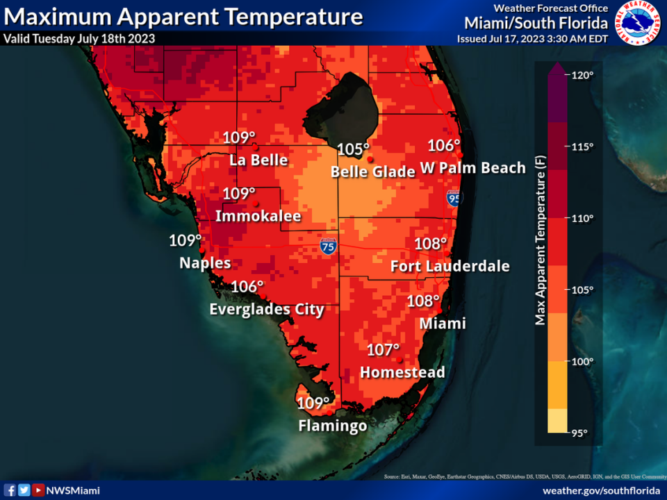
While the potential for flooding increases, the National Weather Service extended a heat advisory for Miami-Dade and Broward through 7 p.m. Tuesday as the heat index, or how the temperature feels, climbs up to 110 degrees.
READ MORE: Heat advisories extended in Miami-Dade, Broward — again. Here’s what you need to know
Heat advisories are issued in the region when a heat index of 105 degrees or higher is registered for at least two hours. Temperatures will continue to peak in the low 90s on Monday and Tuesday afternoons, the weather agency said.