Series of atmospheric rivers target B.C., raises flood and avalanche risk
While we don't need to be concerned for a repeat of the deadly, destructive November 2021 atmospheric river in B.C., there are worries incoming events will still have considerable impacts.
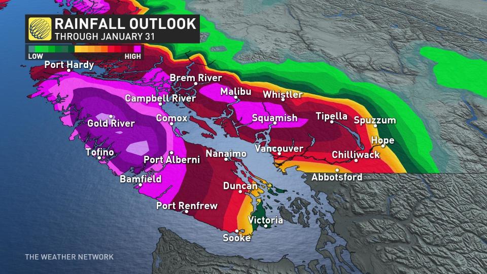
A steady stream of moisture originating from Hawaii is set to flow straight into B.C. through next week, and that means rain. And, lots of it. Some areas are likely to see more than 200 mm of rain through the end of the month.
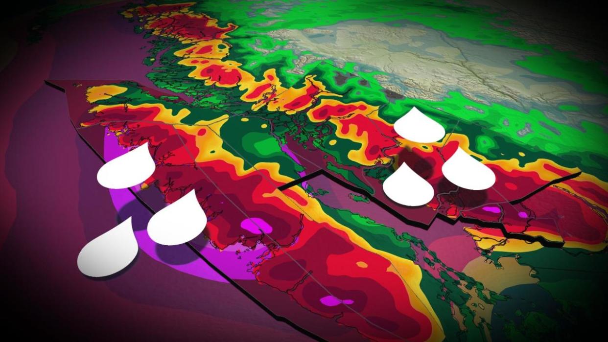
With the extreme amounts of rain in the forecast and an expected snowmelt, the chances of flooding will rise considerably across Vancouver Island and B.C.’s South Coast, including Metro Vancouver.
The pattern is also conducive to an elevated avalanche risk.
DON’T MISS: El Niño is hanging strong—but a big change is on the way
Series of storms threaten the coast with excessive rains
A steady parade of storms rolling through the northeastern Pacific Ocean will train an atmospheric river on coastal B.C. beginning this weekend and lasting into next week.
The tropical moisture aiming for the West Coast is a bit of evaporated paradise heading to the region straight from Hawaii –– a classic pineapple express setup for the region.
Each storm will tap into this vast reserve of atmospheric moisture to produce widespread heavy rainfall across the region. Disruptions begin this weekend as rounds of heavy rainfall arrive both Saturday evening and Sunday evening.
RELATED: Backcountry enthusiasts beware as weather warms, experts cite avalanche risk
Saturday night and beyond
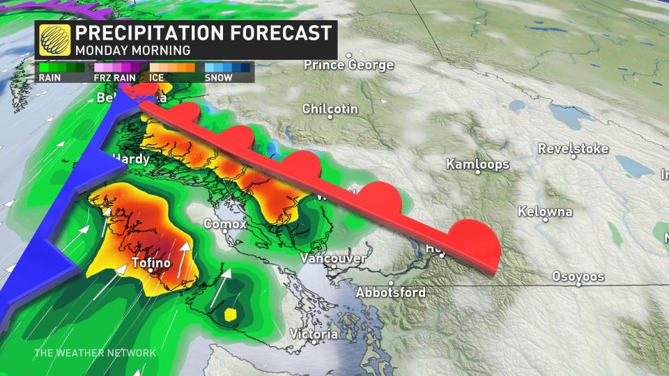
The first wave of torrential rain reaches western Vancouver Island Saturday evening, migrating across Metro Vancouver overnight. The wave will drop a quick 60 mm across the North Vancouver mountains with about 30 mm for downtown Vancouver.
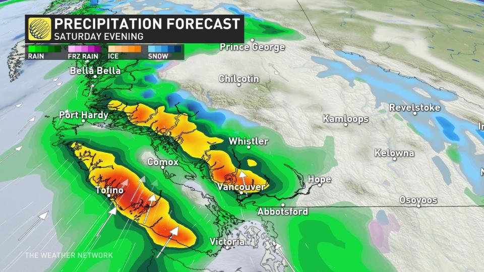
Conditions rapidly improve Sunday morning, but then quickly deteriorate once again Sunday evening. The pineapple express will target more towards central and northern Vancouver Island, and the Sunshine Coast.
Communities most at risk include Tofino, Port Alberni, Powell River, Gibsons, and Sechelt. Close to 200 mm is forecast to fall in 24 hours across western Vancouver Island, which would put the region at threat for flooding and mudslides.
The hazard here is the stalling nature of the atmospheric river, which remains in situ through early Tuesday before slumping southeast.
The arrival of deep tropical moisture will send freezing levels soaring above Whistler, soaring to above 2500 metres into next week. More bad news for ski resorts along the North Shore and Vancouver Island.
The strong and mild southwest flow means temperatures on Monday will be in the low-teens across southern Vancouver Island and Metro Vancouver, up to eight degrees above seasonal –– approaching record-breaking territory.
Combined rainfall and snowmelt will lead to a flooding risk around the mountains, as well as creating an unstable snowpack that will enhance the potential for avalanches in the backcountry.
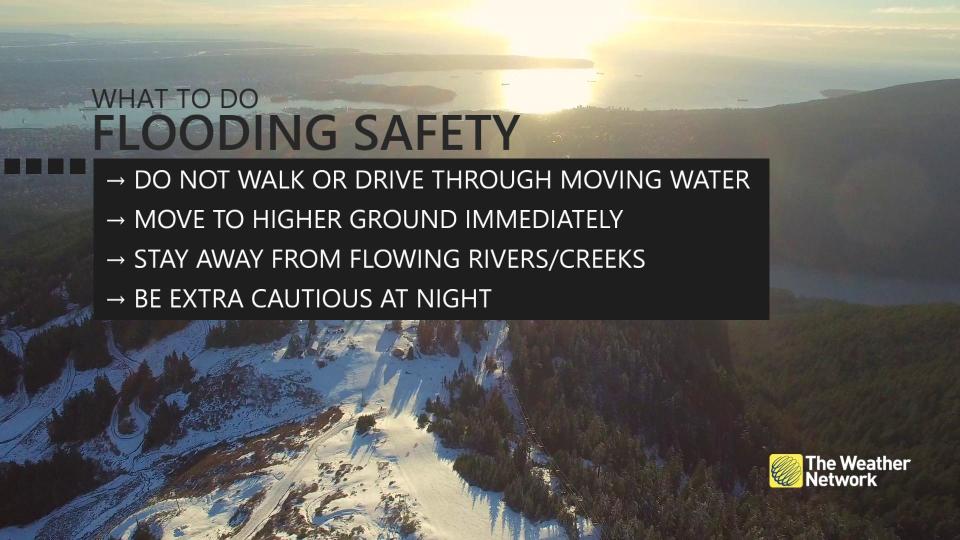
MUST SEE: Get ahead of disaster: Six tips to manage flooding
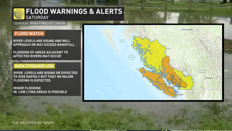
B.C.’s River Forecast Centre issued flood watches for all of Vancouver Island and a large portion of the South Coast, including Howe Sound, Sunshine Coast, Sea-to-Sky, and North Shore Mountains.
High streamflow advisories are in effect for the Lower Fraser River tributaries, the eastern Fraser Valley including Abbotsford and Hope, as well as the Fraser Canyon.
Take some time before the rain starts to clear out debris any storm drains to ensure run-off doesn’t begin pooling up.

