Flood worries rise as more storms bring rain, snow to southwestern Utah
The forecast for the first week of spring in southwestern Utah looks a lot like it did all winter: lots of rain, some snow and the potential for flooding.
Another series of storms moved in from the west on Sunday, bringing widespread mountain snow and valley rain that forecasters said would last for several days.
Temperatures in the St. George area were expected to stay in the 50s during the day and drop into the 40s or high 30s at night through the rest of the week, with a high likelihood of rain each day through at least Thursday.
Higher-elevation areas like Cedar City were expected to get several inches of snow over the course of the week, with periods of rain as temperatures rise during the day. Temperatures in Cedar City were forecasted to reach the low 40s during the day and drop below 30 at night.
The storms represent the latest in a lasting season of wet weather that has hit the entire western U.S.
What had been a relatively quiet weekend on the West Coast transitioned quickly into another period of storms, with continued flooding in California and above-average precipitation from the west coast to the central plains.
"Moisture associated with this storm system will spill into the Great Basin and the Rockies on Monday, resulting in periods of mountain snow and valley rain showers," the National Weather Service said. "Snowfall totals are forecast to surpass a foot in the higher elevations of the Great Basin, the Wasatch and the western Colorado Rockies."
Flooding worries
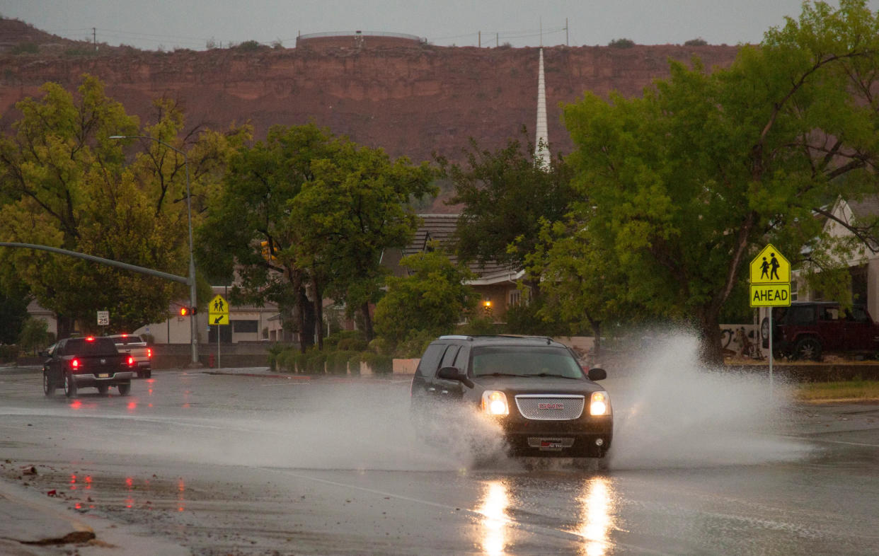
Across southern Utah, swollen rivers and topped-out reservoirs had authorities warning about flood danger.
Two people were found dead last week after being caught in a flash flood in Kane County near the Utah-Arizona border, with several others saved by helicopter.
Forecasters believed the Santa Clara River in St. George could reach its "action phase" of 12.9 feet before the end of the week, potentially flooding some roads and low-lying areas inside the surrounding flood plain.
There was no significant worry about impacts to homes or individuals as long as they exercised caution, though.
Gov. Spencer Cox issued an executive order providing state employees with administrative leave time to help support community flood responses.
"With the weather warming up, flooding is a major disaster concern in Utah. We’re experiencing record-breaking snowpack levels and we want to be prepared for what spring could have in store," Gov. Cox said. "Utah’s state employees are community-minded and we know many will want to support their local emergency response teams for the common good."
Snowpack levels across southwestern Utah were near 200% of normal for the time of year, and while the moisture was expected to help alleviate some of the state's drought conditions, it had already caused flooding and left at least two people dead.
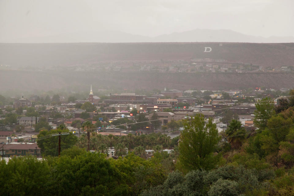
All the moisture made for dramatic scenery across the red-rock region.
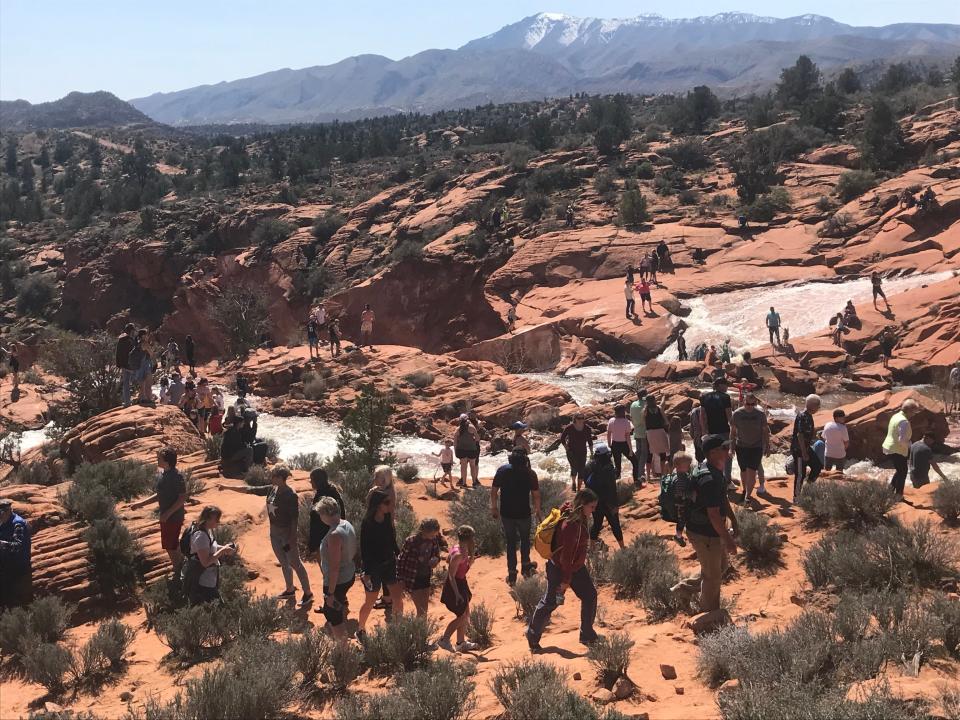
At Gunlock State Park, water topped the reservoir's dam and ran over in waterfalls into the rocks below, creating a rare scene that state park officials said would draw thousands of visitors in the coming weeks.
The visitors were welcome but park officials warned people to "stay safe around the water, watch for flash floods, fast currents and slick rocks."
'We invite visitors to enjoy this wonderful experience, but want to remind the public to exercise vigilance and safety in the area,' Gunlock State Park Manager Jon Allred said. 'There is inherent risk when recreating outdoors, so safety and situational awareness are paramount.'
Floods across the West
It had been a relatively quiet weekend on the West Coast after another atmospheric river storm hit California last week, but by late Sunday, things were taking another turn toward stormy weather.
The Golden State already was hit hard by one storm Sunday, and a second one later in the week could likely have the characteristics of an atmospheric river, AccuWeather meteorologist Mary Gilbert said.
Twin storms were forecast to batter California this week, the second one likely to provide the latest of a dozen atmospheric rivers to deluge the state in recent months.
The National Weather Service forecast periods of heavy rain and snowfall for the Sierra Nevada with wind gusts reaching 50 mph over the next few days.
"After a tranquil Saturday, active weather is expected to overspread much of the West," the weather service warned.
Road Weather Alert:
Another storm will move through the state and bring widespread mountain road snow Sunday night through Tuesday morning.
Note, additional RWAs will be issued over the coming days.
For more info, visit: https://t.co/4P1gO2c9Uo#utwx #utsnow@UtahTrucking pic.twitter.com/mrWAJkVMhP— UDOT Traffic (@UDOTTRAFFIC) March 19, 2023
The first storm had already begun ushering Pacific moisture into California on Sunday and was forecast to spread north quickly up the Pacific Northwest.
Eleven atmospheric river storms, which started in late December, have pounded California with record amounts of rain and snow.
For example, as of March 13, season-to-date snowfall at the Central Sierra Snow Lab at California’s Donner Pass exceeded 650 inches, compared with a normal full-season total of about 360 inches, the Drought Monitor said.
This article originally appeared on St. George Spectrum & Daily News: Rain, snow bring more flood worries to southern Utah

